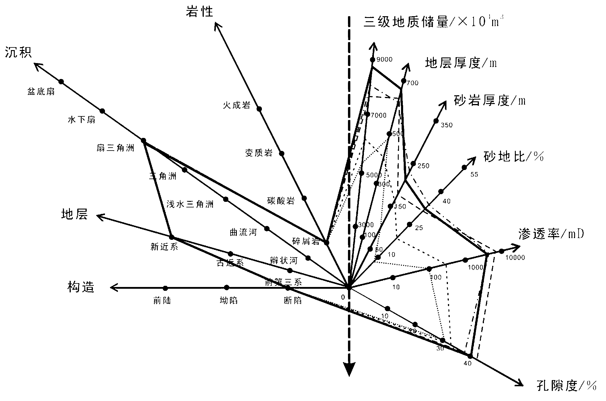
Geology evaluation method for offshore sedimentary rock oil field
A technology for sedimentary rocks and oil fields, applied in instruments, data processing applications, calculations, etc., can solve problems such as strong uncertainty, difficult to standardize, and difficult to quantify, and achieve the effect of clear layers, simple working methods, and rich connotations
- Summary
- Abstract
- Description
- Claims
- Application Information
AI Technical Summary
Problems solved by technology
Method used
Image
Examples
Embodiment Construction
[0008] The present invention will be described in detail below in conjunction with the accompanying drawings and embodiments.
[0009] The offshore sedimentary rock oilfield geological evaluation method of the present invention comprises the following steps:
[0010] 1. According to the geological parameters needed to develop the target oilfield, make a geological analogy map.
[0011] Such as figure 1 As shown, an XOY coordinate system is established. According to the geological parameters required for the development of the target oilfield, several polar coordinate axes are set at intervals from the coordinate origin O. Each polar coordinate axis represents a certain geological parameter. According to each geological parameter Different scales are set on each polar axis, and the meaning of each scale is determined according to the corresponding geological parameter type.
[0012] Embodiments of the present invention make a geological analogy map according to the geological...
PUM
 Abstract
Description
Claims
Application Information
 - R&D
- Intellectual Property
- Life Sciences
- Materials
- Tech Scout
- Unparalleled Data Quality
- Higher Quality Content
- 60% Fewer Hallucinations
Browse by: Latest US Patents, China's latest patents, Technical Efficacy Thesaurus, Application Domain, Technology Topic, Popular Technical Reports.
© 2025 PatSnap. All rights reserved.Legal|Privacy policy|Modern Slavery Act Transparency Statement|Sitemap|About US| Contact US: help@patsnap.com


