Remote sensing evaluation method of lake water reserves based on multispectral images
A multi-spectral image and lake water technology, which is applied in the field of satellite remote sensing and earth observation, can solve the problems of measurement cycle and cost limitations, and cannot be widely promoted and applied.
- Summary
- Abstract
- Description
- Claims
- Application Information
AI Technical Summary
Problems solved by technology
Method used
Image
Examples
Embodiment Construction
[0047] Embodiments of the present invention will be further described in detail below in conjunction with the accompanying drawings and examples. The following examples are used to illustrate the present invention, but should not be used to limit the scope of the present invention.
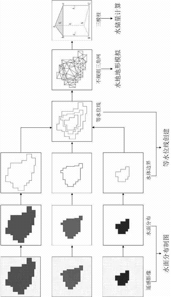
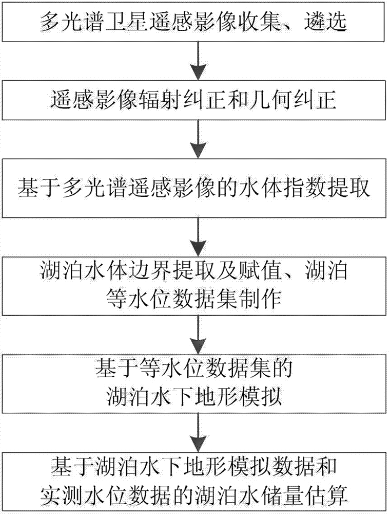
[0048] In order to better grasp the lake water storage and its changes in a wide range, the embodiment of the present invention proposes a remote sensing estimation method for lake water storage based on multispectral images, see figure 1 , the method includes:
[0049] S1. Extract the water body index reflecting the distribution characteristics of the lake water surface according to the spectral response characteristics of the lake water body in different bands of the multispectral remote sensing image;
[0050] S2. Obtain the lake water body boundary according to the extracted water body index, and assign the measured lake water level information to the lake water body boundary, and generate la...
PUM
 Abstract
Description
Claims
Application Information
 - R&D
- Intellectual Property
- Life Sciences
- Materials
- Tech Scout
- Unparalleled Data Quality
- Higher Quality Content
- 60% Fewer Hallucinations
Browse by: Latest US Patents, China's latest patents, Technical Efficacy Thesaurus, Application Domain, Technology Topic, Popular Technical Reports.
© 2025 PatSnap. All rights reserved.Legal|Privacy policy|Modern Slavery Act Transparency Statement|Sitemap|About US| Contact US: help@patsnap.com


