

Lake and reservoir underwater three-dimensional terrain simulation method and device based on digital elevation model
A digital elevation model and three-dimensional terrain technology, applied in 3D modeling, image data processing, complex mathematical operations, etc., can solve the problems of high data acquisition cost, large prior data, and high algorithm complexity, and achieve low monitoring cost, The effect of convenient update and wide space coverage
- Summary
- Abstract
- Description
- Claims
- Application Information
AI Technical Summary
Problems solved by technology
Method used
Image

Examples
Embodiment Construction
[0039] In order to make the purpose, technical solutions and advantages of the present invention clearer, the technical solutions in the present invention will be clearly and completely described below in conjunction with the accompanying drawings in the present invention. Obviously, the described embodiments are part of the embodiments of the present invention , but not all examples. Based on the embodiments of the present invention, all other embodiments obtained by persons of ordinary skill in the art without creative efforts fall within the protection scope of the present invention.
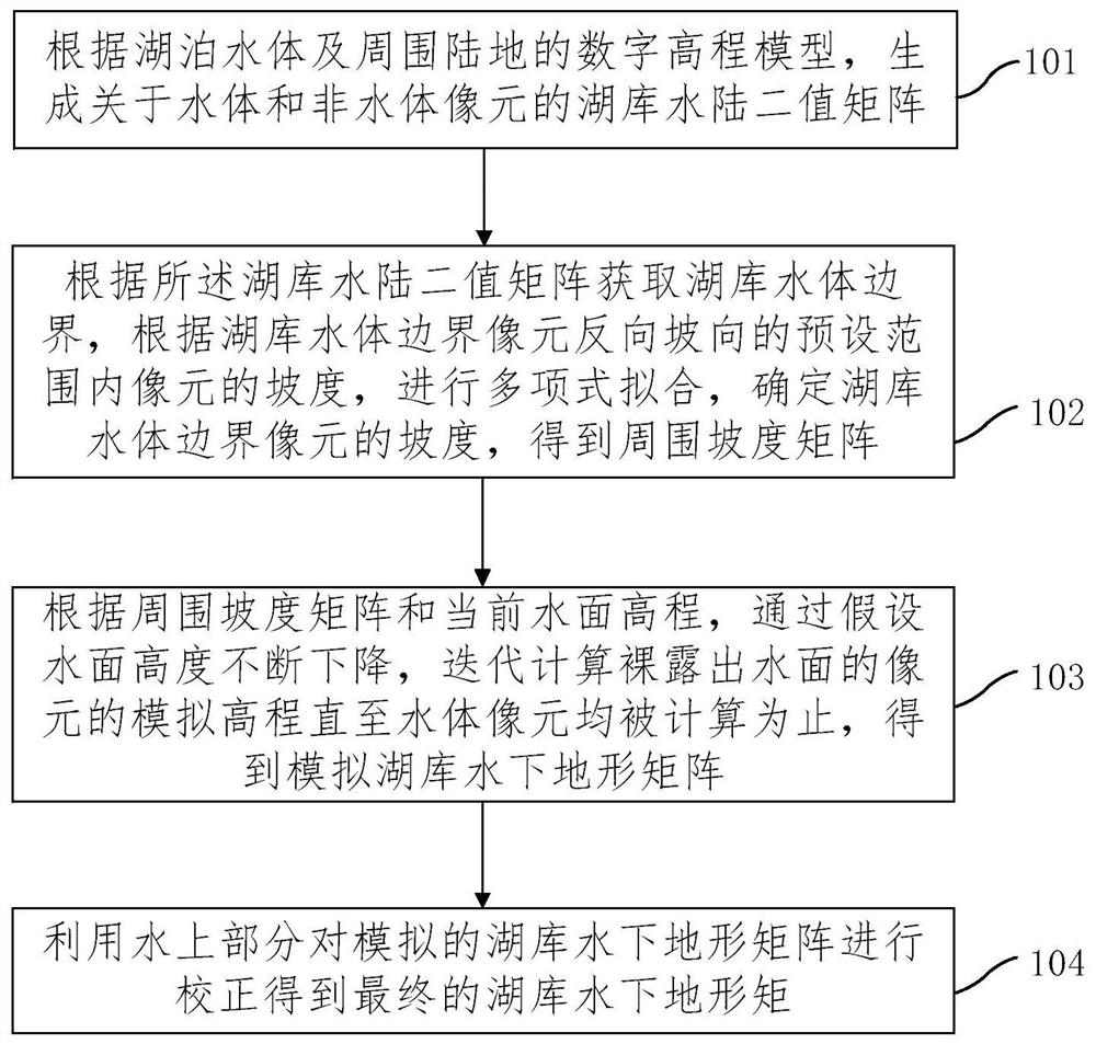
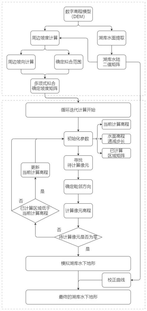
[0040] Combine below Figure 1-Figure 5 The method and device for simulating underwater three-dimensional terrain of lakes and reservoirs based on digital elevation models of the present invention are described. figure 1 It is one of the schematic flow charts of the digital elevation model-based underwater three-dimensional terrain simulation method for lakes and reservoirs provided by the p...
PUM
 Abstract
Description
Claims
Application Information