A Decryption and Restoration Method for Elevation Data

A technology of elevation data and recovery methods, applied in the field of geographic information security, can solve problems such as inaccuracy, inconsistent elevation data, and unfavorable use of geographic information data, and achieve the effect of improving the theory and method system and improving reliability.

Inactive Publication Date: 2016-03-30
NANJING NORMAL UNIVERSITY
View PDF4 Cites 0 Cited by
  • Summary
  • Abstract
  • Description
  • Claims
  • Application Information

AI Technical Summary

Problems solved by technology

However, some elevation data released to the outside world are inconsistent, inaccurate, and even vary greatly

Method used


Image

  • A Decryption and Restoration Method for Elevation Data
  • A Decryption and Restoration Method for Elevation Data
  • A Decryption and Restoration Method for Elevation Data

Examples


Example Embodiment

[0042] The present invention will be further described in detail below in conjunction with the drawings and embodiments.

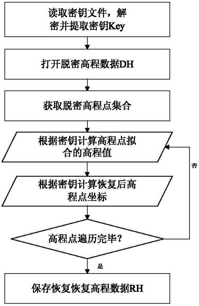
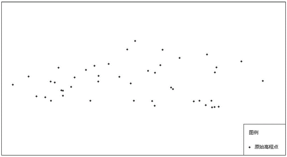
[0043] In this embodiment, the shp format data storing the elevation information is selected, and the elevation data is read, decrypted, and restored to further explain the present invention in detail. This embodiment selects the elevation data of a certain area (such as image 3 ) As the original elevation data, including the following steps:

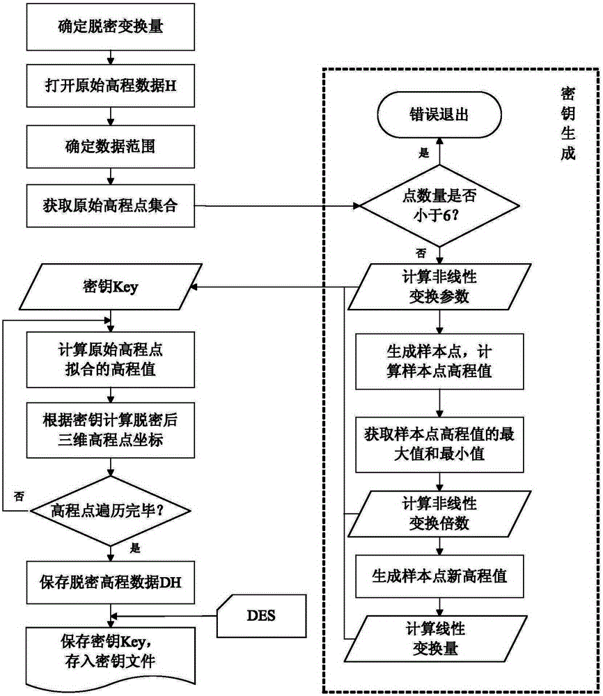
[0044] (1) Declassification process of elevation data

[0045] Step 11: Determine the densification transformation amount, input the total transformation amount of the elevation data sumpara=50, and the nonlinear transformation amount nonlinear=20.

[0046] Step 12: Determine the range of elevation data.

[0047] Open the original elevation data H and obtain the minimum bounding rectangle R. The coordinates of the lower left corner of R are (141577.585, 155000.146), and the coordinates of the upper right corner are (141998....


PUM


Abstract

The invention discloses an altitude data decryption and recovery processing method on the basis of a linear and nonlinear mixed model, which comprises the following process of: (1) decryption processing process for altitude data, which comprises the steps of generating nonlinear transformation parameters, generating linear parameters, storing a key, carrying out decryption processing on original altitude data and the like; and (2) recovery processing process for the decrypted altitude data, which comprises the steps of reading the key, recovering the decrypted altitude data and the like. According to the method disclosed by the invention, safety of the altitude data can be effectively ensured, meanwhile, the relative position relation of the altitude data is kept basically unchanged, and an effective technological means is provided for use of the altitude data in the national economic construction.

Description

Technical field [0001] The invention belongs to the field of geographic information security, and specifically relates to a method for de-densing and recovering elevation data based on a linear and nonlinear mixed model. Background technique [0002] Elevation data is state secret data, which is related to national security. Under the general trend of global informatization, the security protection of elevation data has become more and more prominent. According to relevant national laws and regulations, the location accuracy of the public map is not higher than 50m, the iso-height distance is not less than 50m, and the grid of the digital elevation model is not less than 100m. The relevant literature also mentions the topographic landscape and characteristics, the highest point of the map, and the main Geographical location and elevation of commanding heights such as mountain peaks, high gully ratio, steep cliff ratio, etc., should be deleted; certain local data standards require...

Claims


Application Information

Patent Timeline
IPC IPC(8): G06F21/60
CPCG06F21/602
Inventor 周卫王芙蓉高隆杰高奋生王海荣
Owner NANJING NORMAL UNIVERSITY
Why Eureka
Try Eureka