

Remote sensing image fusion method oriented to water quality quantitative remote sensing application
A technology of remote sensing image and fusion method, which is applied in the field of satellite image processing and can solve problems such as narrow use range
- Summary
- Abstract
- Description
- Claims
- Application Information
AI Technical Summary
Problems solved by technology
Method used
Image

Examples
Embodiment Construction
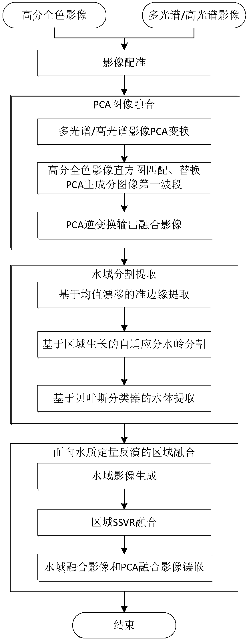
[0047] Attached below figure 1 , figure 2 , image 3 and Figure 4 Specific embodiments of the present invention are further described in detail:
[0048] Such as figure 1 Shown, the present invention is concretely realized as follows:
[0049] 1. Based on high-resolution panchromatic image I 1 Geographic Information for Hyperspectral / Multispectral Remote Sensing Imagery I 2 clipping and registration of the overlapping areas, perform cubic spline interpolation and resampling to the resolution of the high-resolution panchromatic image on the cropped and registered hyperspectral / multispectral remote sensing image, and the resampled hyperspectral / multispectral remote sensing image Has the same width and height as the high-resolution panchromatic image.
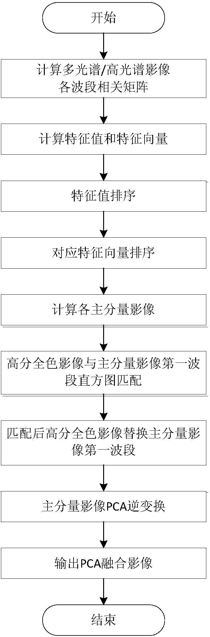
[0050] 2. Calculation of hyperspectral / multispectral image I 2 The band correlation matrix and eigenvectors of the bands are used to perform principal component analysis. At this time, the main spectral information of th...
PUM
 Abstract
Description
Claims
Application Information