

An integrated processing method and system for multi-sensor data of an ultra-low-altitude UAV
A data processing system and multi-sensor technology, applied in the field of aerial surveying and mapping, can solve problems such as geometric post-processing without multi-sensor
- Summary
- Abstract
- Description
- Claims
- Application Information
AI Technical Summary
Problems solved by technology
Method used
Image

Examples
Embodiment Construction
[0031] Specific embodiments of the present invention will be described in detail below in conjunction with the accompanying drawings.
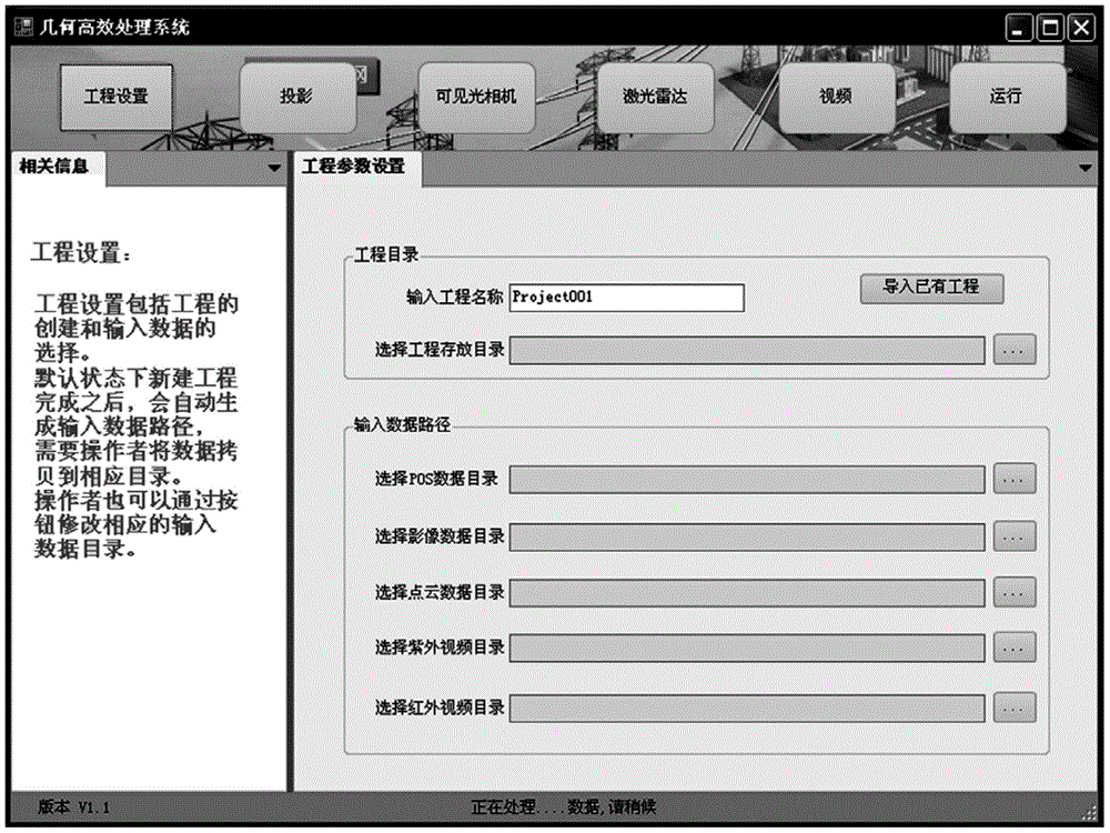
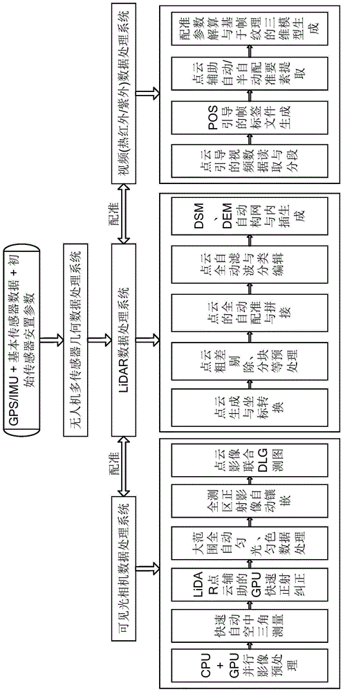
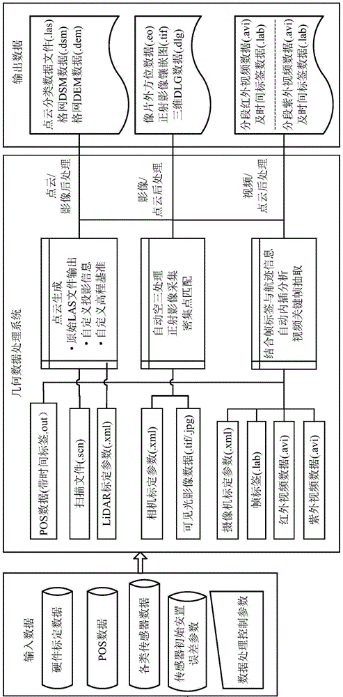
[0032] Figure 4 It is a flow chart of an integrated processing method for multi-sensor data of an ultra-low-altitude UAV in an embodiment of the present invention. Such as Figure 4 As shown, the ultra-low-altitude unmanned aerial vehicle multi-sensor data integrated processing method in the embodiment of the present invention comprises the following steps:
[0033] Step 401: Set initial data including GPS / IMU, basic sensor data and initial sensor placement parameters, and post-process multi-sensor joint data based on the initial data;
[0034] Step 402: Define the data flow process and interface file specification for multi-sensor post-processing;
[0035] Step 403: Taking the GPS / IMU as the reference standard, the joint data processing mode in which multiple sensors are uniformly calculated to the same absolute reference coordinate syste...
PUM
 Abstract
Description
Claims
Application Information