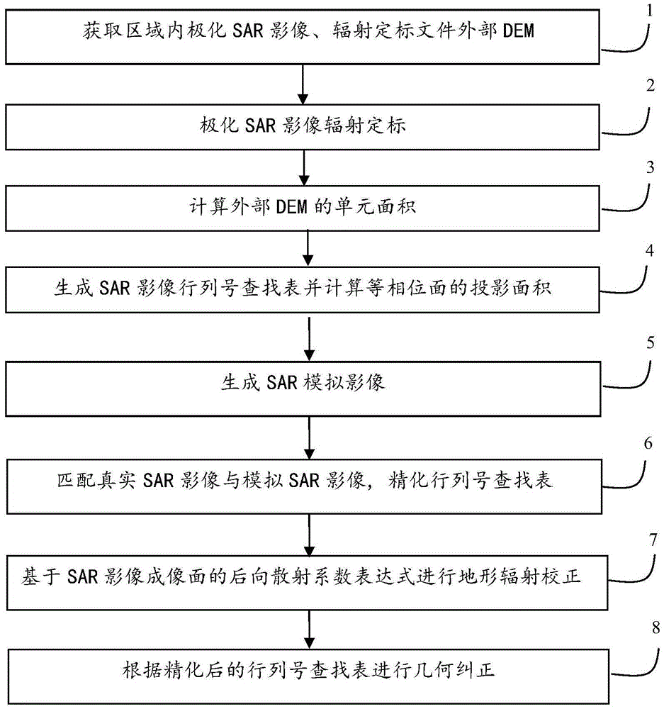
A Polarized SAR Terrain Radiation Correction and Geometry Correction Method Based on Imaging Surface Characterization
A technology for terrain radiation correction and geometric correction, which is applied in the field of remote sensing image processing to achieve the effects of improving geometric correction accuracy, improving terrain radiation correction, and eliminating terrain effects.
- Summary
- Abstract
- Description
- Claims
- Application Information
AI Technical Summary
Problems solved by technology
Method used
Image
Examples
Embodiment Construction
[0033] The present invention will be described in further detail below in conjunction with the accompanying drawings.
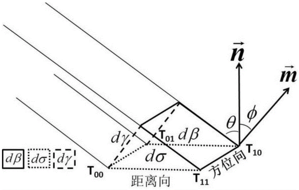
[0034] The backscatter coefficient is defined as the average radar cross-sectional area within a unit scattering area, which can be defined as β according to the difference of scattering units (dβ, dσ, dγ) 0 , σ 0 , γ 0 , dβ is the scattering unit of the imaging surface, indicating the size of the SAR image pixel, and its value is fixed, represented by a solid line box; dσ is the actual ground area corresponding to the SAR image pixel, called the ground scattering unit, and is represented by a solid dotted line box Indicates; dγ is the plane wave isophase surface scattering unit, which is represented by a dashed line frame. figure 2 medium vector is the normal of the imaging surface, the vector is the normal of the ground unit, and the angle (φ) between them is called the projection angle. vector The included angle (θ) with the SAR incident vector i...
PUM
 Abstract
Description
Claims
Application Information
 - R&D
- Intellectual Property
- Life Sciences
- Materials
- Tech Scout
- Unparalleled Data Quality
- Higher Quality Content
- 60% Fewer Hallucinations
Browse by: Latest US Patents, China's latest patents, Technical Efficacy Thesaurus, Application Domain, Technology Topic, Popular Technical Reports.
© 2025 PatSnap. All rights reserved.Legal|Privacy policy|Modern Slavery Act Transparency Statement|Sitemap|About US| Contact US: help@patsnap.com


