Methods and systems for creating maps with radar-optical imaging fusion
A radar system and optical imaging technology, applied in the field of map creation, which can solve the problems of inaccurate spatial measurement, poor angular resolution, etc.
- Summary
- Abstract
- Description
- Claims
- Application Information
AI Technical Summary
Problems solved by technology
Method used
Image

Examples
Embodiment Construction
[0010] Before any embodiment of the invention is explained in detail, it is to be understood that the invention is not limited in its application to the details of construction and arrangement of components set forth in the following description or shown in the drawings. The invention is capable of other embodiments and of being practiced or carried out in various ways.
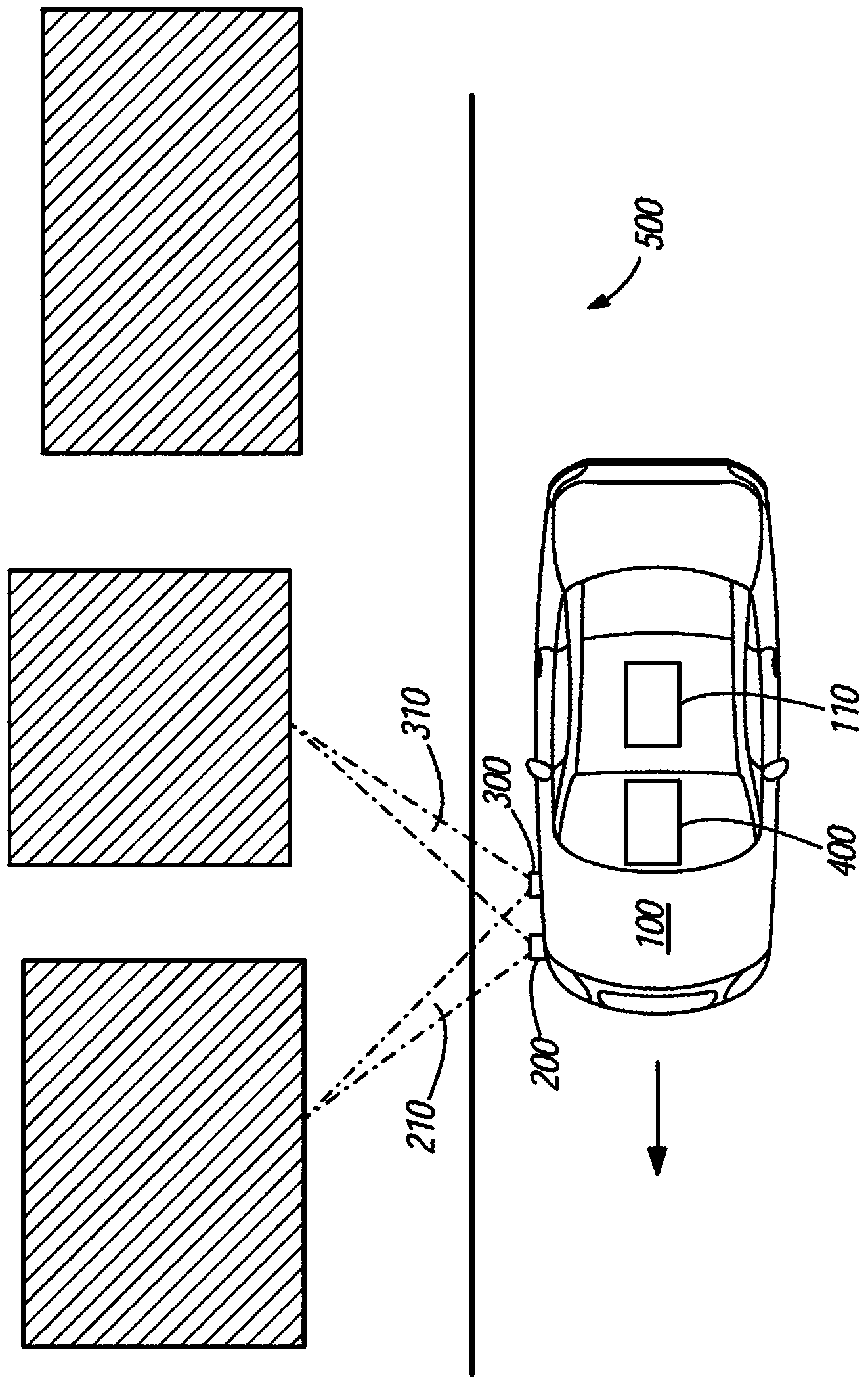
[0011] The present invention includes methods and systems for creating maps by combining information from radar scans and optical image acquisitions. Survey vehicle 100 is maneuvered through the space, collecting one or more radar scans and optical images of the space. The space is any location where a detailed three-dimensional view of an area, such as a building in an urban environment, is desired.
[0012] In various embodiments, measurement vehicle 100 is a conventional vehicle, such as a car, truck, van, or motorcycle. In other embodiments, the measurement vehicle 100 is an autonomous or teleoperated v...
PUM
 Abstract
Description
Claims
Application Information
 - R&D Engineer
- R&D Manager
- IP Professional
- Industry Leading Data Capabilities
- Powerful AI technology
- Patent DNA Extraction
Browse by: Latest US Patents, China's latest patents, Technical Efficacy Thesaurus, Application Domain, Technology Topic.
© 2024 PatSnap. All rights reserved.Legal|Privacy policy|Modern Slavery Act Transparency Statement|Sitemap