A Method for Physical Damage Assessment of Buildings Based on Remote Sensing Multispectral Images
A multi-spectral image and building technology, applied in the field of remote sensing image processing, can solve the problem of heavy workload of visual interpretation
- Summary
- Abstract
- Description
- Claims
- Application Information
AI Technical Summary
Problems solved by technology
Method used
Image
Examples
Embodiment Construction
[0015] The specific embodiments of the present invention will be described in detail below with reference to the accompanying drawings. It should be understood that the specific embodiments described herein are only used to illustrate and explain the present invention, but not to limit the present invention.
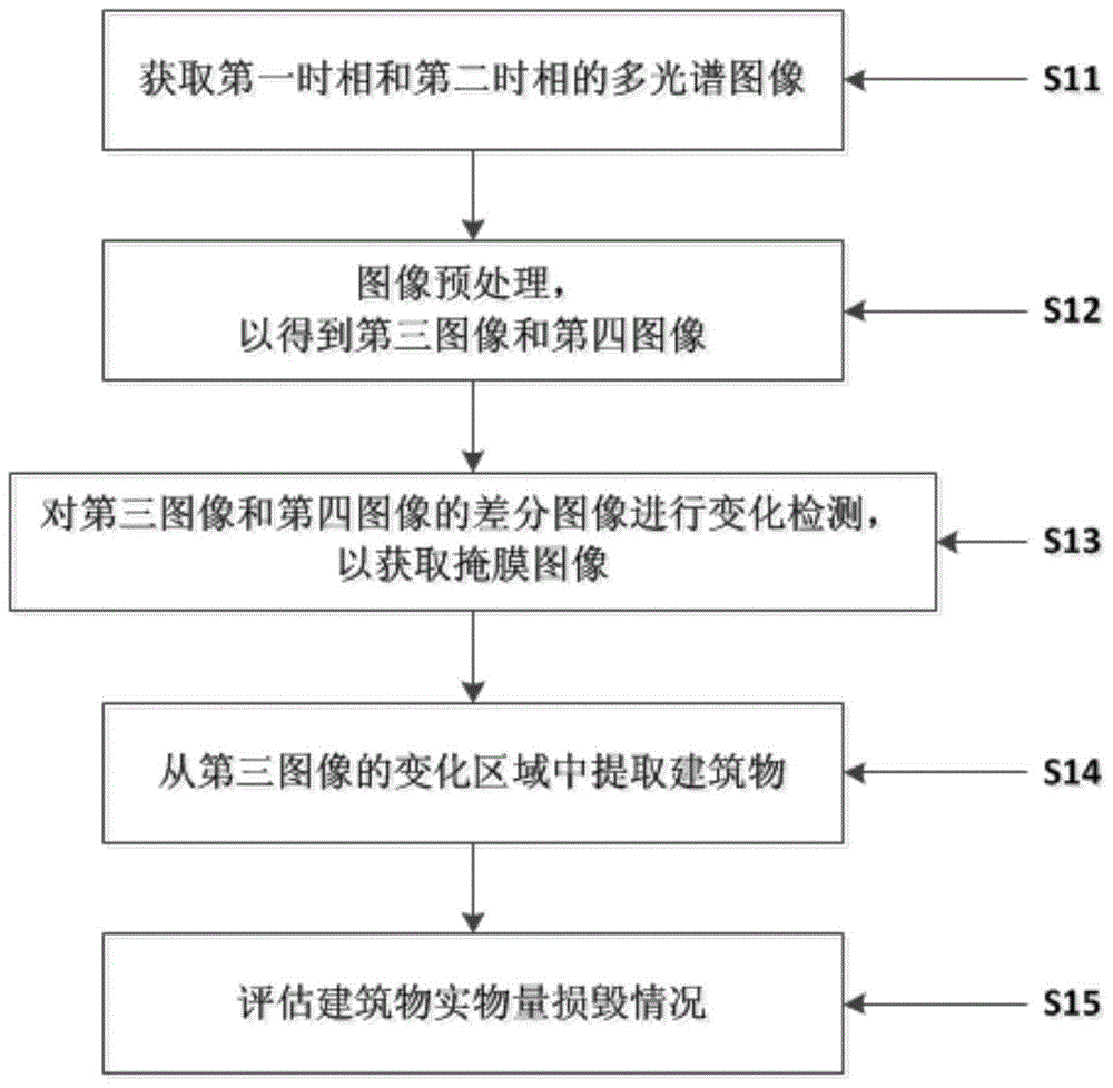
[0016] figure 1 It is a flow chart of evaluating physical damage to buildings based on remote sensing multi-spectral images according to the present invention.
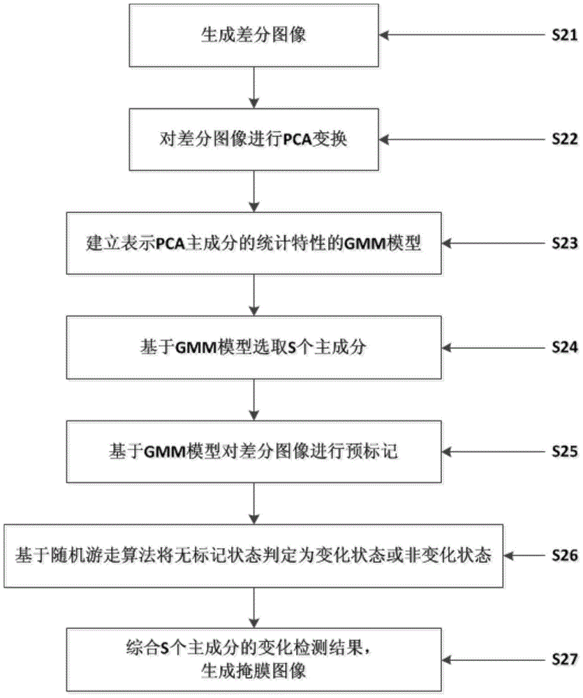
[0017] In step S11, a multi-temporal remote sensing multi-spectral image of the same area can be acquired. Satellite remote sensing images of the same area captured in a first time phase (for example, before an earthquake) and in a second time phase (for example, after an earthquake), such as the ZY-3 satellite, may be used. The images acquired at the first phase and the second phase, respectively, may be referred to as a first multispectral image and a second multispectral image. For subsequent change detect...
PUM
 Abstract
Description
Claims
Application Information
 - R&D
- Intellectual Property
- Life Sciences
- Materials
- Tech Scout
- Unparalleled Data Quality
- Higher Quality Content
- 60% Fewer Hallucinations
Browse by: Latest US Patents, China's latest patents, Technical Efficacy Thesaurus, Application Domain, Technology Topic, Popular Technical Reports.
© 2025 PatSnap. All rights reserved.Legal|Privacy policy|Modern Slavery Act Transparency Statement|Sitemap|About US| Contact US: help@patsnap.com


