Remote sensing image segmentation method adopting region splitting technology
A remote sensing image and region technology, applied in image analysis, image enhancement, image data processing, etc.
- Summary
- Abstract
- Description
- Claims
- Application Information
AI Technical Summary
Problems solved by technology
Method used
Image
Examples
specific Embodiment
[0057] In this embodiment, digital image processing technology is used to accurately segment remote sensing images of complex scenes. Its invention process is as follows:
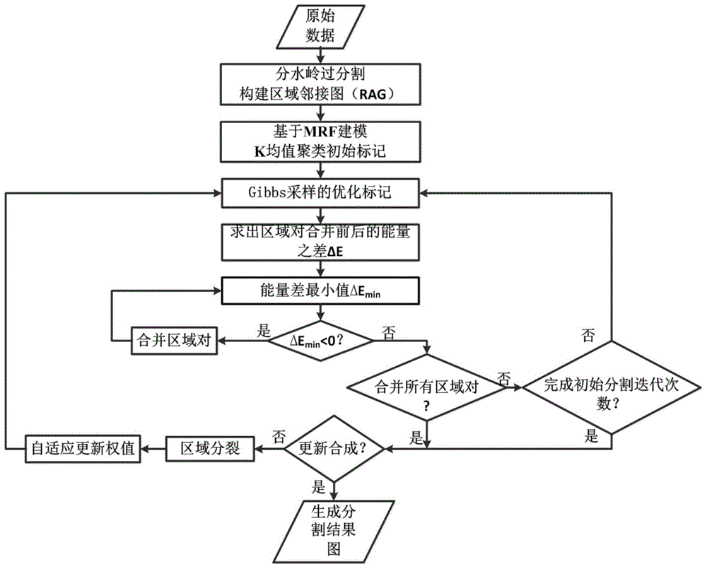
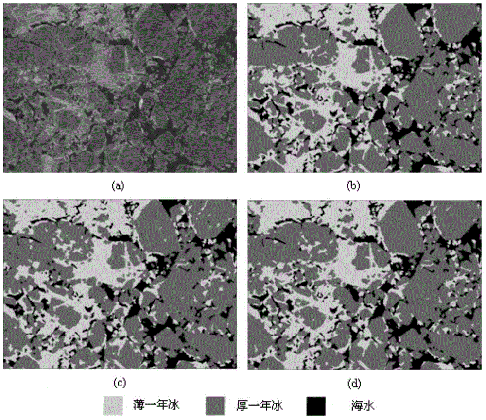
[0058] refer to figure 1 Firstly, remote sensing image over-segmentation and region adjacency graph representation are carried out. refer to figure 2 Watershed over-segmentation is performed on the input remote sensing image, resulting in many small regions, each with relatively consistent backscatter values. Each region R consists of a set of positions S R composition, these locations belong to the region. The feature vector {Y of each position S |s∈S R} averaged to an eigenvector Y R . And use a specific data structure Region Adjacency Graph (RAG) to describe the image. The nodes of the adjacency graph are composed of a group of regions R, and its edges represent the boundary positions between each pair of adjacent regions.
[0059] refer to figure 1 Mark optimization of region adjacency graph ...
PUM
 Abstract
Description
Claims
Application Information
 - R&D
- Intellectual Property
- Life Sciences
- Materials
- Tech Scout
- Unparalleled Data Quality
- Higher Quality Content
- 60% Fewer Hallucinations
Browse by: Latest US Patents, China's latest patents, Technical Efficacy Thesaurus, Application Domain, Technology Topic, Popular Technical Reports.
© 2025 PatSnap. All rights reserved.Legal|Privacy policy|Modern Slavery Act Transparency Statement|Sitemap|About US| Contact US: help@patsnap.com


