GNSS-R-based double-star positioning method for sea-surface targets

A positioning method and target technology, applied in satellite radio beacon positioning systems, positioning, measuring devices and other directions, can solve problems such as cumbersome steps

Active Publication Date: 2015-06-03
BEIHANG UNIV
View PDF9 Cites 8 Cited by
  • Summary
  • Abstract
  • Description
  • Claims
  • Application Information

AI Technical Summary

Problems solved by technology

However, traditional sea surface target positioning require...

Method used


Image

  • GNSS-R-based double-star positioning method for sea-surface targets
  • GNSS-R-based double-star positioning method for sea-surface targets
  • GNSS-R-based double-star positioning method for sea-surface targets

Examples


Embodiment Construction

[0024] The implementation steps of the present invention will be further described below in conjunction with the accompanying drawings:

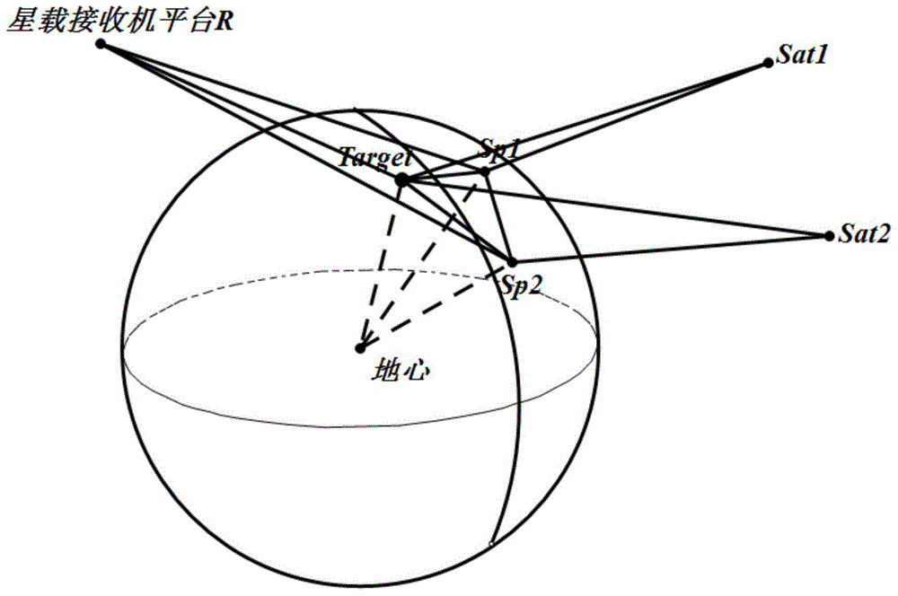
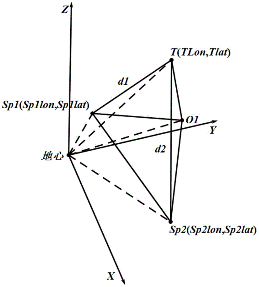
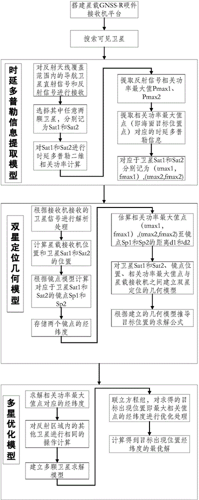
[0025] figure 1 Shown is the geometric model of the dual-satellite positioning of the sea surface target. From the figure, we can see the positional geometric relationship between the double star, the sea surface target, the spaceborne receiver platform and the earth. figure 2 Shown is a simplified double-star positioning model for sea surface targets, and the implementation steps of the present invention described below are based on this simplified model. image 3 For the present invention's sea surface target double-star positioning flow chart, the specific implementation steps are as follows:

[0026] Step 1: Spaceborne receiver platform R p Receive the reflected signals of all satellites within the coverage of the reflecting antenna, and select two of them as the data source for calculating the position of the sea surface target, deno...


PUM


Abstract

The invention discloses a GNSS-R-based double-star positioning method for sea-surface targets. The method comprises the following six steps: step one, extracting and storing time delay Doppler maximum correlation values PMax 1 and PMax 2 of two satellites Sat 1 and Sat 2 corresponding to a receiver platform; step two, extracting time layer values and Doppler frequency values of the delay Doppler maximum correlation values, and respectively recording the time layer values and Doppler frequency values as tMa*1, tMa*2 and fMa*2; step three, calculating longitudes and latitudes of mirror spot positions of the two corresponding satellites according to a mirror spot position calculating method; step four, estimating distances between the correlation power maximum value points to the mirror spots according to the time delay Doppler distribution of detection areas, and recording the distances as d1 and d2; step five, calculating longitude and latitude (TLon, TLat) of the corresponding correlation value maximum spot which is a target occurring position spot according to parameters obtained by the steps 1-4; step six, building a multi-satellite optimization model, calculating all the navigational satellites at the moment according to the method of the step five, then fitting results to obtain an optimum value.

Description

technical field [0001] The invention belongs to the technical field of sea surface target positioning, and in particular relates to a GNSS-R-based sea surface target double-star positioning method. When a large target appears in the sea surface detection area, the reflected signal at the current moment is received by the spaceborne receiver, and the delay Doppler and other information of two or more satellites in this area are extracted, and the dual-satellite positioning model of the sea surface target is established. In this model Based on this, the position of the sea surface target is obtained. Since the algorithm uses the time delay value and Doppler frequency shift value to calculate the distance between the mirror point and the maximum value of the two-dimensional correlation power, the two satellites can locate and detect the sea surface target. Formal expression, and using more than two satellites at the same time, use the multi-satellite optimization algorithm provi...

Claims


Application Information

Patent Timeline
IPC IPC(8): G01S5/02
CPCG01S19/42
Inventor 杨东凯高超群裘雪敬齐雅男
Owner BEIHANG UNIV
Why Eureka
Try Eureka