Method and system for sharing map data

A map data and map technology, applied in the field of navigation, can solve the problems of information interaction and different display forms.

Inactive Publication Date: 2015-08-19
SHENZHEN CARELAND TECH
View PDF6 Cites 5 Cited by
  • Summary
  • Abstract
  • Description
  • Claims
  • Application Information

AI Technical Summary

Problems solved by technology

[0005] Based on the problems existing in the above-mentioned prior art, the present invention provides a method and system for sharing map data, which can avoid sharing information due to different map version information when information interaction is performed between devices with different map version information. The display forms in different devices are different or the problem that information interaction cannot be carried out

Method used


Image

  • Method and system for sharing map data
  • Method and system for sharing map data

Examples


Embodiment Construction

[0018] The following clearly and completely describes the technical solutions in the embodiments of the present invention. Obviously, the described embodiments are only some of the embodiments of the present invention, but not all of them. Based on the embodiments of the present invention, all other embodiments obtained by persons of ordinary skill in the art without making creative efforts belong to the protection scope of the present invention.

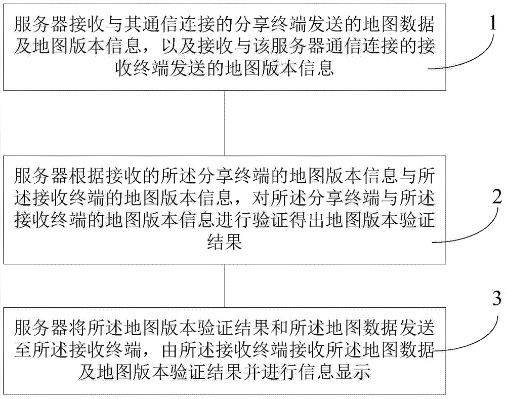
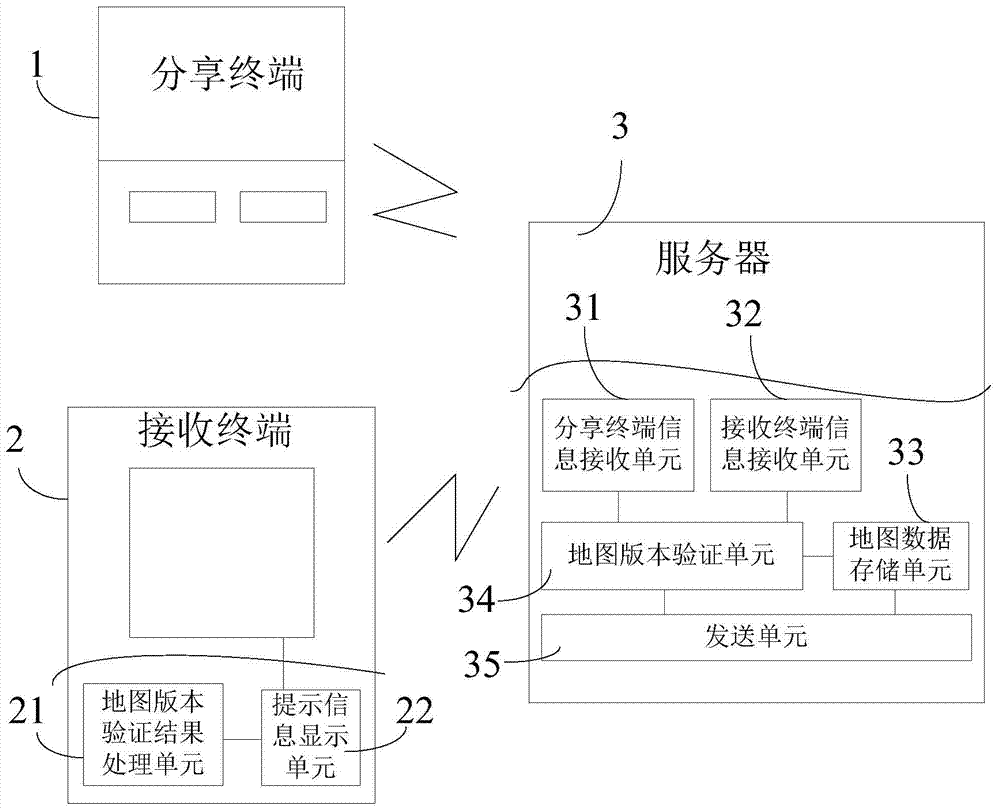
[0019] Such as figure 1 As shown, the embodiment of the present invention provides a map data sharing method, including:

[0020] Step 1: The server receives the map data and map version information sent by the sharing terminal connected to the server, and receives the map version information sent by the receiving terminal connected to the server;

[0021] Step 2: The server verifies the map version information of the sharing terminal and the receiving terminal according to the received map version information of the sharing termin...


PUM


Abstract

The invention discloses a method and system for sharing map data. The method comprises the following steps: 1) a server receiving map data and map version information transmitted by a sharing terminal, and receiving map version information transmitted by a receiving terminal; according to the received map version information of the sharing terminal and the map version information of the receiving terminal, verifying the map version information of the sharing terminal and the receiving terminal to obtain a map version verification result; transmitting the map version verification result and the map data to the receiving terminal, and the receiving terminal receiving the map data and the map version verification result and displaying the information. The method can facilitate the sharing of the map data between different terminals, can enable users to have a rough understanding to map versions applicable to the received map data when the map versions in the terminals are not unitary, can prompt map update and can guarantee the compatibility maximization during data sharing. The problem that the compatibility during data sharing is not high during the development of modern Internet of Vehicles is solved.

Description

technical field [0001] The invention relates to the field of navigation, in particular to a method and system for sharing map data. Background technique [0002] A navigation device refers to a device with a location service function and related functions. Its working principle is that the navigation device determines the location coordinates of a specific location and matches them with the location coordinates recorded in the electronic map stored by itself, so as to determine the location of the vehicle equipped with the device. The accurate position of the navigation object of the navigation device in the electronic map. The navigation device can be a vehicle terminal, a portable navigator, a mobile phone terminal, and the like. Navigation objects can be vehicles, pedestrians, etc. After the user sets the starting point and the destination, the navigation device will calculate the navigation route, and navigate for the user according to the calculated navigation route. ...

Claims


Application Information

Patent Timeline
Patent Type & Authority Applications(China)
IPC IPC(8): G01C21/00
CPCG01C21/005
Inventor 张文星
Owner SHENZHEN CARELAND TECH
Why Eureka
Try Eureka