Spatial subdivision method for intersecting linear geographic elements

A technology of geographic elements and spatial subdivision, applied in the field of geographic information technology and application, can solve problems such as low efficiency, influence of original element shape, subdivision error, etc.

Inactive Publication Date: 2015-09-16
NANJING NORMAL UNIVERSITY
View PDF2 Cites 8 Cited by
  • Summary
  • Abstract
  • Description
  • Claims
  • Application Information

AI Technical Summary

Problems solved by technology

This method is similar to Wang Xinsheng's method, and for the intersection line element, a processing method is designed to break the intersection line at the intersection point and make a slight offset to the intersection point, although it avoids the intersection point being considered to belong to multiple occurrence elements and cannot In the case of generating a Voronoi diag

Method used


Image

  • Spatial subdivision method for intersecting linear geographic elements
  • Spatial subdivision method for intersecting linear geographic elements
  • Spatial subdivision method for intersecting linear geographic elements

Examples


Embodiment Construction

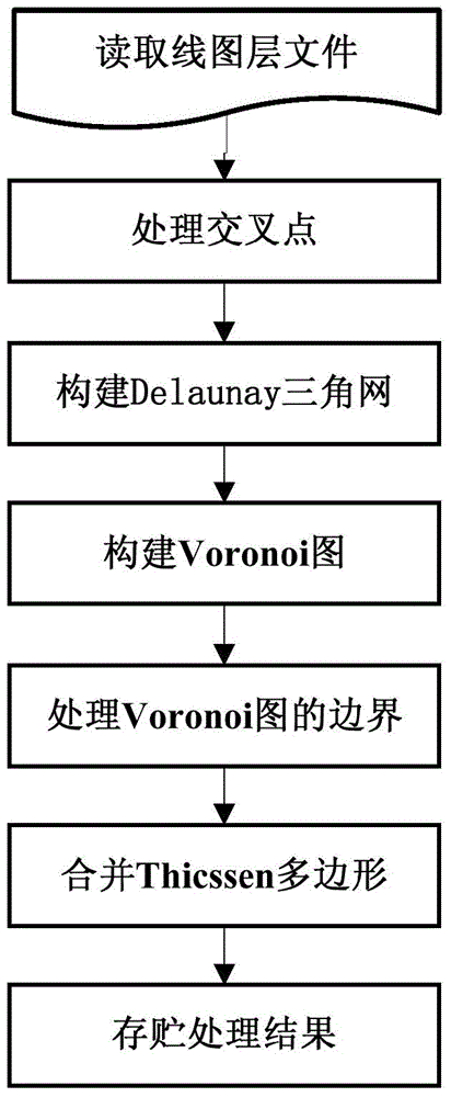
[0039] The effects of the present invention will be further described below by describing an example of spatial division for linear geographic elements in conjunction with the accompanying drawings. In this example, a line layer in shp format is selected as the experimental data.

[0040] The specific implementation process is as follows:

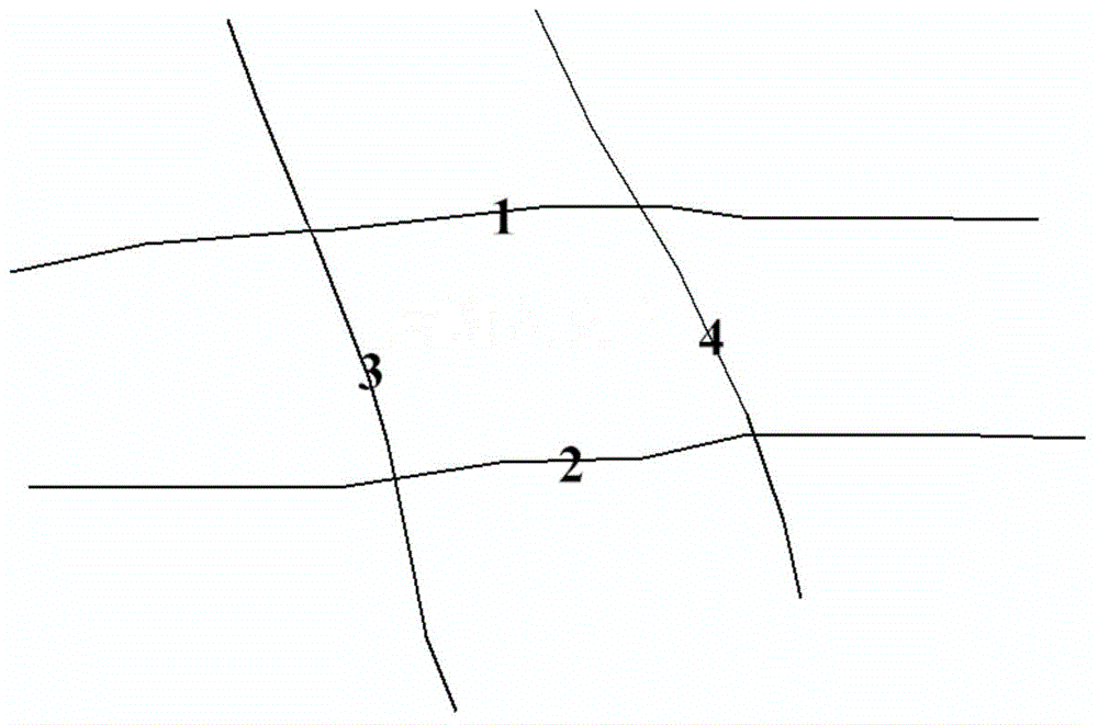
[0041] 1. Open the line layer file named "Road", such as figure 2 shown. Stored in the line feature set L, in this example the set L contains 4 line features, namely l 1 , l 2 , l 3 , l 4 . Its ID attributes are 1, 2, 3, 4 respectively.

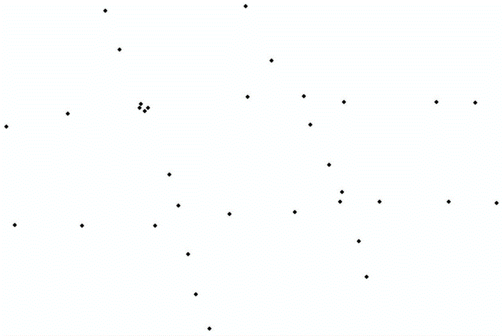
[0042] 2. Obtain the intersection point C between different line elements in L and perform interpolation processing. The point sets of the four line elements in this example are as follows image 3 shown. There are 4 intersection points in the example, namely point C 1 (-96.07, 0.33), point C 2 (-24.39, 5.74), point C 3 (-75.71, -51.78) and point C 4 (-0.39, -42.68). For each intersection po...


PUM


Abstract

The invention discloses a spatial subdivision method for intersecting linear geographic elements. The method includes the following steps that: intersecting linear elements are dispersed so as to form point sets based on the principle of a Voronoi distribution model; point addition processing is performed on intersecting positions of every two intersecting linear elements; Delaunay triangulation and Voronoi diagram generation are performed based on the point sets; and a generated Voronoi diagram is clipped, and sub regions generated by point sets which belong to the same linear element are merged, so that sub regions of different linear elements can be obtained, and therefore, spatial subdivision of the intersecting linear geographic elements can be realized.

Description

technical field [0001] The invention belongs to the field of geographic information technology and application, and in particular relates to a method for subdividing geographic space based on intersecting linear geographic elements of intersecting auxiliary points. Background technique [0002] In the field of geographic information technology and application, it is mostly related to the solution of the optimal allocation problem. In the optimal configuration, the first thing to consider is the determination of the influence range of each element. How to reasonably determine the scope of influence of each element? At present, the most widely used method is the spatial subdivision method, and the related research mainly focuses on the spatial subdivision of point elements, while the research on the spatial subdivision method based on linear elements is less. [0003] Wang Xinsheng et al. proposed a Voronoi diagram approximation method for arbitrary occurrence elements ("App...

Claims


Application Information

Patent Timeline
IPC IPC(8): G06T17/05
Inventor 李安波姚蒙蒙陈楹
Owner NANJING NORMAL UNIVERSITY
Why Eureka
Try Eureka