

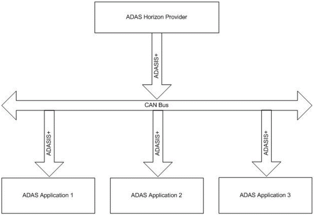
ADASIS (advanced driver assistance systems interface specifications) extended information output device and method based on safe driving map
A technology for safe driving and map information, applied in the field of in-vehicle navigation, can solve problems such as inability to provide electronic map information and lack of description of lane-level road information, and achieve the effect of intelligent running trajectory, improving safety and comfort, and optimizing control parameters.
- Summary
- Abstract
- Description
- Claims
- Application Information
AI Technical Summary
Problems solved by technology
Method used
Image

Examples
Embodiment Construction
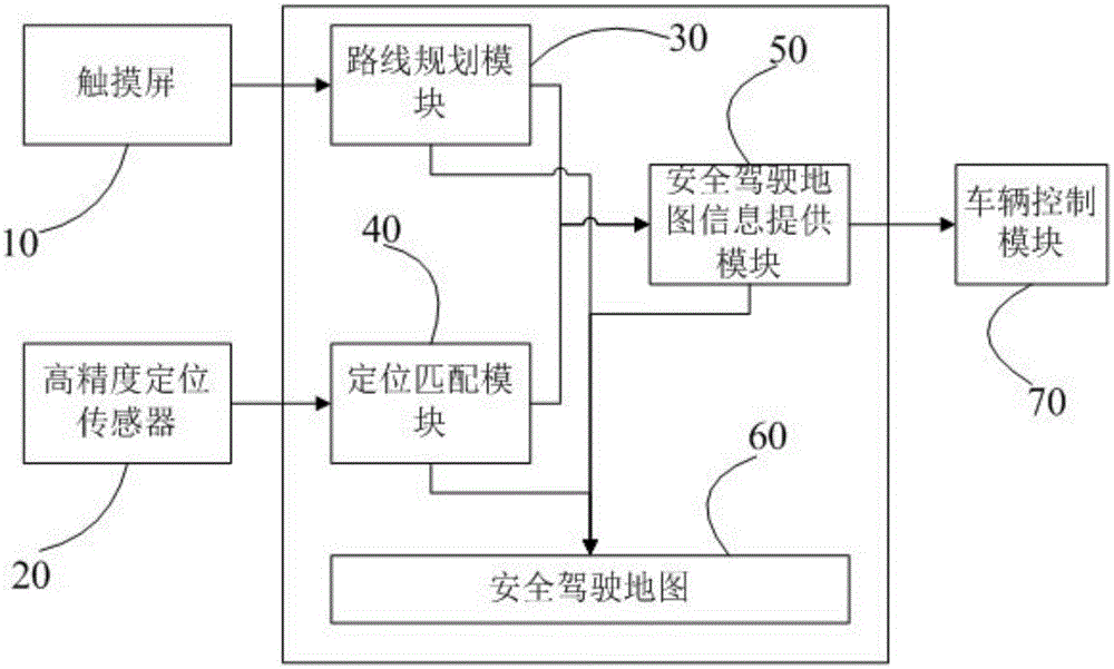
[0026] Such as figure 1 As shown, the embodiment of the present invention provides an ADASIS extended information output device based on a safe driving map 60, which includes a touch screen 10, a high-precision positioning sensor 20, a route planning module 30, a positioning matching module 40, a safe driving The map information providing module 50 and a safe driving map 60 .
[0027] The route planning module 30 is electrically connected to the touch screen 10, the safe driving map information providing module 50, the positioning matching module 40, and the safe driving map 60 respectively; the safe driving map information providing module 50 is electrically connected to the positioning matching module 40 and the safe driving map 60 respectively; The positioning matching module 40 is electrically connected to the high-precision positioning sensor 20 and the safe driving map 60 respectively.
[0028] The touch screen 10 is used to acquire route passing point information input...
PUM
 Abstract
Description
Claims
Application Information