A VTS system radar echo video display method based on geographic coordinate system
A geographic coordinate system and radar echo technology, applied to radio wave measurement systems, instruments, etc., can solve the problems of radar target mismatch, increase system overhead, and inability to use map data sets, etc., to achieve the effect of ensuring consistency
- Summary
- Abstract
- Description
- Claims
- Application Information
AI Technical Summary
Problems solved by technology
Method used
Image
Examples
Embodiment Construction
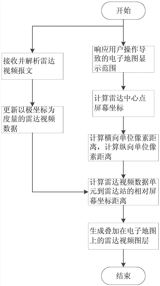
[0038] Aiming at the map data stored in the geographical coordinate system, the present invention adopts the characteristics of an electronic map projected in equal proportions of latitude and longitude, and proposes a method to directly convert the radar echo video data measured by polar coordinates into data measured by screen coordinates , and displayed on the electronic map, while ensuring that the radar echo video is consistent with the map data, it also reduces the amount of conversion calculations, and supports the real-time display function of the radar echo video of the VTS system.
[0039] Such as figure 1 As shown, the present invention proposes a radar echo video display method based on a geographic coordinate system, comprising steps as follows:
[0040] Step 1. Create thread 1 to receive radar echo messages and cache them.
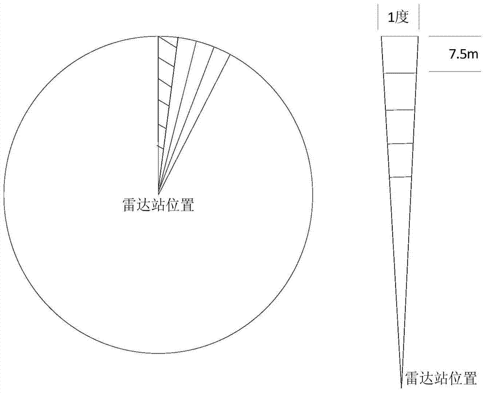
[0041] 1-1 Analyze the message to generate radar echo data measured in polar coordinates;
[0042] Such as figure 2 As shown, the area c...
PUM
 Abstract
Description
Claims
Application Information
 - R&D
- Intellectual Property
- Life Sciences
- Materials
- Tech Scout
- Unparalleled Data Quality
- Higher Quality Content
- 60% Fewer Hallucinations
Browse by: Latest US Patents, China's latest patents, Technical Efficacy Thesaurus, Application Domain, Technology Topic, Popular Technical Reports.
© 2025 PatSnap. All rights reserved.Legal|Privacy policy|Modern Slavery Act Transparency Statement|Sitemap|About US| Contact US: help@patsnap.com


