

A Method of Urban Hierarchical Region Division Based on Vector Map Data Model
A technology of vector map data and area division method, which is applied in the field of geographic information systems, and can solve problems such as difficult modification and operation, high computational time complexity, and increased computational complexity.
- Summary
- Abstract
- Description
- Claims
- Application Information
AI Technical Summary
Problems solved by technology
Method used
Image

Examples
Embodiment Construction
[0048] In order to make the object, technical solution and advantages of the present invention clearer, the present invention will be further described in detail below in conjunction with the accompanying drawings and embodiments. It should be understood that the specific embodiments described here are only used to explain the present invention, not to limit the present invention. In addition, the technical features involved in the various embodiments of the present invention described below can be combined with each other as long as they do not constitute a conflict with each other.
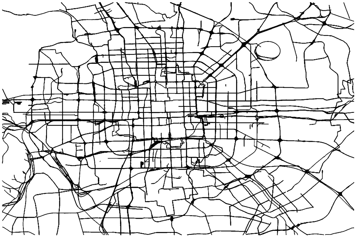
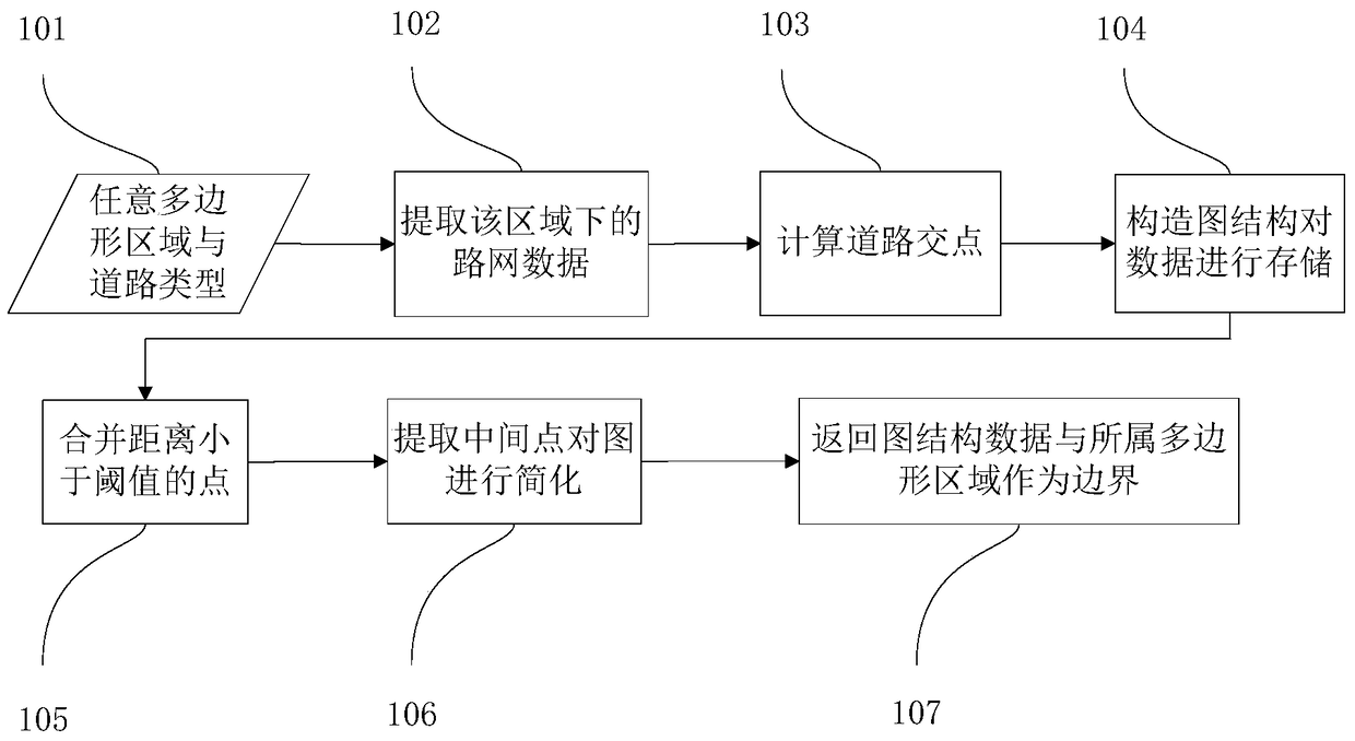
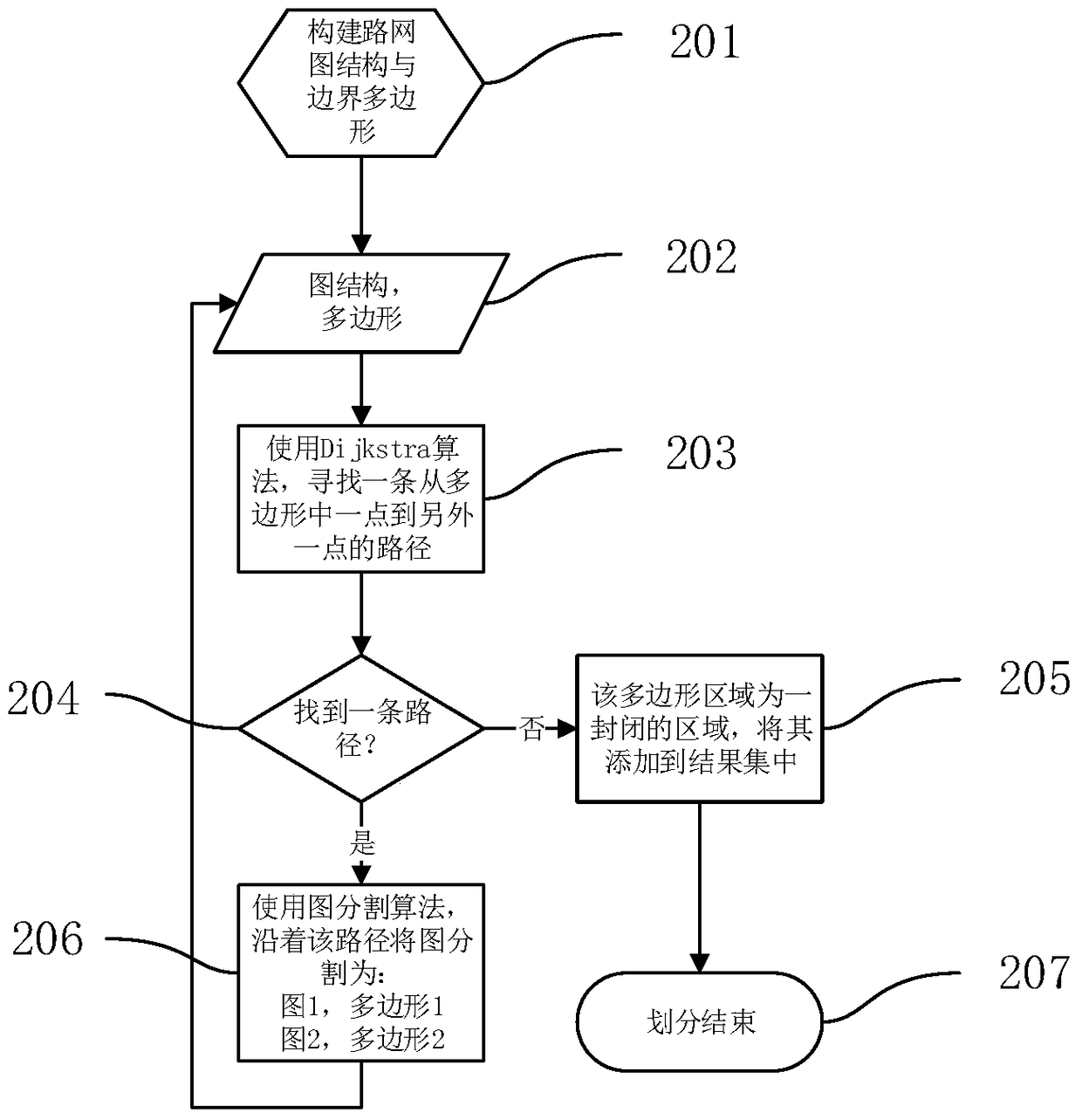
[0049] The present invention hopes to use a pure vector model to divide the map area, and reduce redundant data in the calculation process while maintaining the original road network information. One of the challenges is that we want to maintain the hierarchy of the road map during the zoning process. Take the Beijing road map as an example. Such as figure 1 As shown, the main highways can di...
PUM
 Abstract
Description
Claims
Application Information