A method and apparatus for identifying and communicating locations

A technology of identification and identifier, which is applied in the direction of location information-based services, measurement devices, satellite radio beacon positioning systems, etc., and can solve the problems of limited role in identifying or transmitting specific locations

A technology of identification and identifier, which is applied in the direction of location information-based services, measurement devices, satellite radio beacon positioning systems, etc., and can solve the problems of limited role in identifying or transmitting specific locations

CN105409252AActive Publication Date: 2016-03-16WHAT3WORDS

Image

  • A method and apparatus for identifying and communicating locations
  • A method and apparatus for identifying and communicating locations
  • A method and apparatus for identifying and communicating locations

Examples


Embodiment Construction

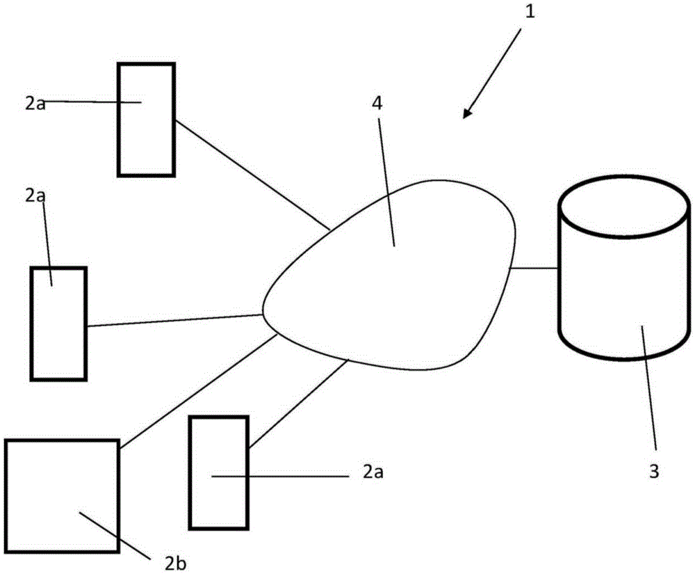
[0083] figure 1 An example overview of the position identification and transmission system 1 of the invention is shown.

[0084] System 1 includes system user equipment 2 and central server 3 . The user equipment 2 includes a smart phone 2a and a personal computer (PC) 2b, and each user equipment 2 (that is, the user smart phone 2a and the user PC 2b) can communicate with the central server 3 through the Internet 4. Although only in the figure 1 Three user smartphones 2a and a single user PC 2b are shown in , however it should be understood that in practice the system 1 may comprise a large number of user devices 2, for example, a large number of user smartphones 2a and user PC 2b.

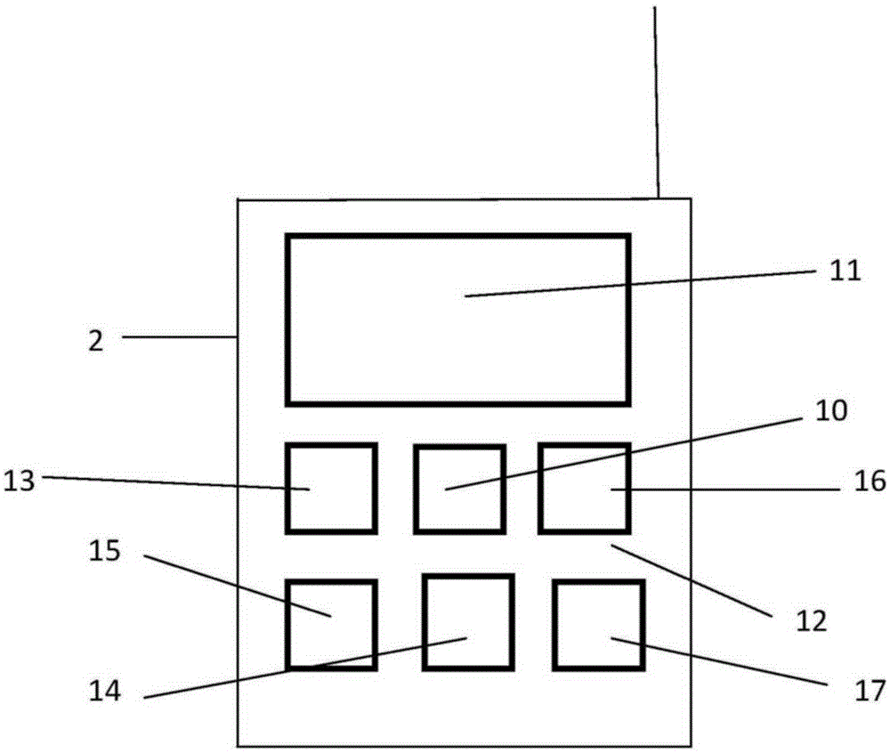
[0085] figure 2 An example of a user's smartphone 2a in the system 1 is shown in more detail. Such as figure 2 As shown, the user's smartphone 2a includes a data processor 10, a visual display 11, a user interface 12, a speaker 13 and a microphone 14, wherein the user interface 12 allows inp...


PUM


Abstract

A method of producing a location identifier comprising: obtaining the geographical coordinates of a location; converting the geographical coordinates into single unique value n; converting the single unique value n into a unique group of a plurality of values; converting the plurality of values into an equal plurality of respective words; and providing the plurality of words as a location identifier, and a method of identifying a location comprising: obtaining a location identifier for a location, the location identifier comprising a plurality of words; converting the plurality of words into a unique group of an equal plurality of respective values; converting the unique group of a plurality of values into a single unique value n; converting the single unique value n into geographical coordinates; and outputting the geographical coordinates.

Description

technical field [0001] The present invention relates to methods and devices for identifying and communicating locations, and in particular, to methods and devices for identifying and communicating locations in a human-friendly manner. Background technique [0002] In recent years, satellite-based positioning systems have become more and more common, and positioning systems can be used to determine the location of devices with positioning systems with high accuracy. Satellite-based positioning systems are often incorporated into smartphones or similar mobile communication devices and / or general-purpose computing devices as well as into specialized navigation devices. [0003] It is relatively common to identify locations using geometric numerical coordinates (such as latitude and longitude coordinates or grid coordinates), which are typically used by satellite-based positioning systems to identify locations. For example, the GPS system identifies locations using GPS coordina...

Claims


Application Information

Patent Timeline
16 Mar 2016
Publication
CN105409252A
IPC
H04W4/02; H04W4/021
CPC
H04W4/021; G06F16/29; H04W4/02; G01S19/14; G09B29/003; H04W64/006
Inventors
莫汉·迦尼萨林加姆; 克里斯多夫·谢尔德里克