

Method for probing multi-source satellite image corresponding image point imaging intersection angles
A technology of satellite images and image points of the same name, which is applied in the field of satellite image photogrammetry and can solve problems such as the absence of effective methods
- Summary
- Abstract
- Description
- Claims
- Application Information
AI Technical Summary
Problems solved by technology
Method used
Image

Examples
Embodiment Construction
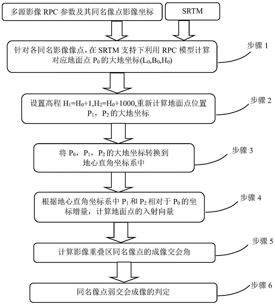
[0054] The method of using RPC to detect the image point imaging intersection angle of multi-source satellite images with the same name is supported by global SRTM data, through the change of ground point elevation, calculate the change of ground point position vector, and then calculate the ground incident corresponding to any image point. angle, and the imaging intersection angle of the ground target corresponding to the image point of the same name in any two images. like figure 1 As shown, the method is implemented by the following steps:
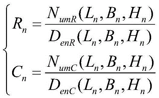
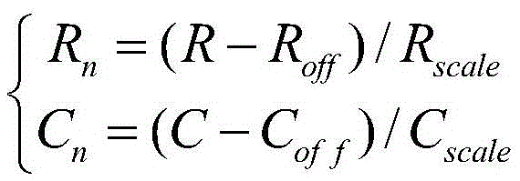
[0055] Step 1: Using the RPC parameters attached to the satellite remote sensing image, using the global SRTM data for the elevation, and using the RPC model to calculate the ground point P corresponding to each image point p(R, C) 0 The geodetic longitude, latitude and elevation (L 0 , B 0 , H 0 ); geodetic coordinates P 0 (L 0 , B 0 , H 0 ) is calculated according to the RPC parameters and SRTM data by using the RPC model thro...
PUM
 Abstract
Description
Claims
Application Information