
Large-scale remote sensing image sea-land segmentation method and system

A remote sensing image, sea and land segmentation technology, applied in the field of remote sensing image processing, can solve the problems of low segmentation accuracy and local effectiveness, and achieve the effect of accurate segmentation results and strong practicability

Active Publication Date: 2016-04-20
SHENZHEN UNIV
View PDF4 Cites 29 Cited by
  • Summary
  • Abstract
  • Description
  • Claims
  • Application Information

AI Technical Summary

Problems solved by technology

[0010] The technical problem to be solved by the present invention is to provide a method and system for sea-land segmentation of large-scale remote sensing images, aiming to solve the problems of local effectiveness and low segmentation accuracy in the method for sea-land separation of optical remote sensing images proposed in the prior art

Method used


Image

  • Large-scale remote sensing image sea-land segmentation method and system
  • Large-scale remote sensing image sea-land segmentation method and system
  • Large-scale remote sensing image sea-land segmentation method and system

Examples


Embodiment Construction

[0038] In order to make the object, technical solution and advantages of the present invention clearer, the present invention will be further described in detail below in conjunction with the accompanying drawings and embodiments. It should be understood that the specific embodiments described here are only used to explain the present invention, not to limit the present invention.

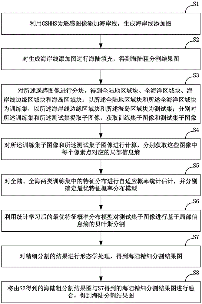
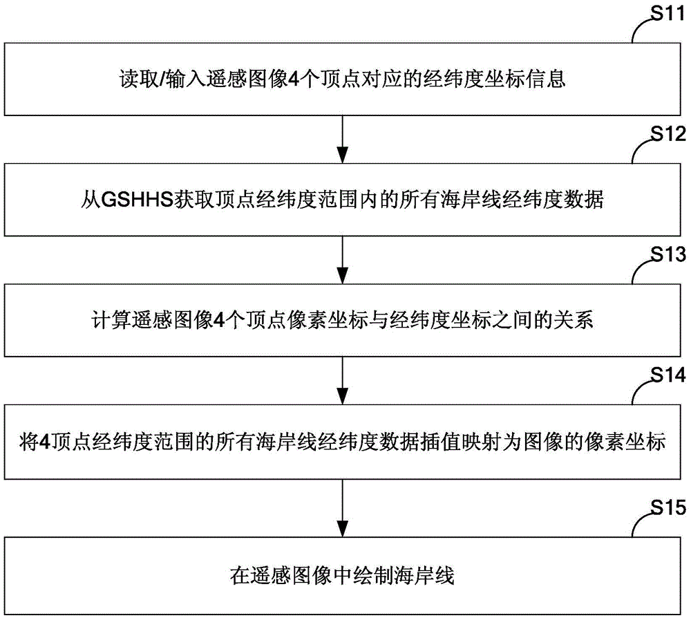
[0039] In order to solve the problems existing in the prior art, the sea-land segmentation method for large-scale remote sensing images proposed by the present invention mainly includes two parts: the rough sea-land segmentation of remote sensing images based on geographic information and the fine sea-land segmentation based on statistical learning. This method first uses the longitude and latitude information of remote sensing images, and fills most of the land areas on the basis of the global consistent multi-level high-resolution coastline database (GSHHS, AGlobal Self-consistent Hierarchical Hig...


PUM


Abstract

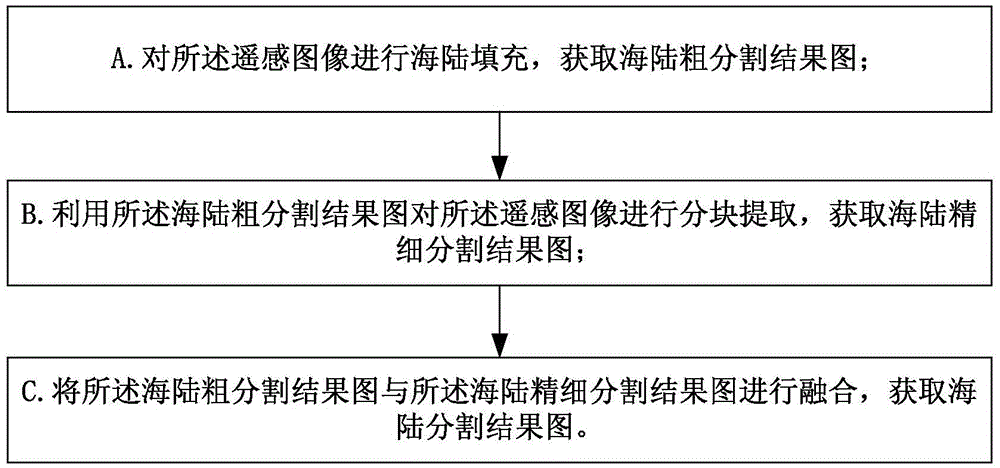
The invention is suitable for the technical field of remote sensing image processing, and provides a large-scale remote sensing image sea-land segmentation method. The method comprises the steps: A, carrying out the sea-land filling of a remote sensing image, and obtaining a sea-land rough segmentation result image; B, carrying out the segmented extraction of the remote sensing image through combining with the sea-land rough segmentation result image, and obtaining a sea-land precise segmentation result image; C, carrying out the fusion of the sea-land rough segmentation result image and the sea-land precise segmentation result image, and obtaining a sea-land segmentation result image. The method achieves the automatic sea-land segmentation of the large-scale remote sensing image, and better solves problems in the prior art of sea-land segmentation that the sea-land segmentation is poor in precision and very bad in effect in offshore and offshore multi-island regions and a sea-land region with complex landform features.

Description

technical field [0001] The invention belongs to the technical field of remote sensing image processing, and in particular relates to a method and system for segmenting land and sea of ​​a large-format remote sensing image. Background technique [0002] In recent years, the detection and recognition of maritime targets based on remote sensing images has attracted more and more attention of researchers. However, a large number of research results show that the ocean target detection algorithm for remote sensing images always has a lower detection probability and a higher false alarm probability when the remote sensing image contains land areas or island areas. fluctuate within. In order to make the marine target detection algorithm only work on the marine remote sensing area, thereby improving the detection rate of the algorithm and reducing false alarms and missed detections, large-scale remote sensing images must be shielded or removed from land and island areas before dete...

Claims


Application Information

Patent Timeline
IPC IPC(8): G06T7/00G06T5/50
CPCG06T7/00G06T5/50G06T2207/10032G06T2207/20221G06T2207/30184
Inventor 裴继红杨继成杨烜
Owner SHENZHEN UNIV
Learn More