Method for positioning and environment modeling of coal mine tunnel robot
A technology of robot positioning and modeling methods, applied in the field of navigation control of intelligent mobile robots, can solve problems such as difficult measurement work, complex environment, and endangering the safety of measurement personnel
- Summary
- Abstract
- Description
- Claims
- Application Information
AI Technical Summary
Problems solved by technology
Method used
Image
Examples
Embodiment Construction
[0044] The present invention is described in detail below in conjunction with accompanying drawing and example:
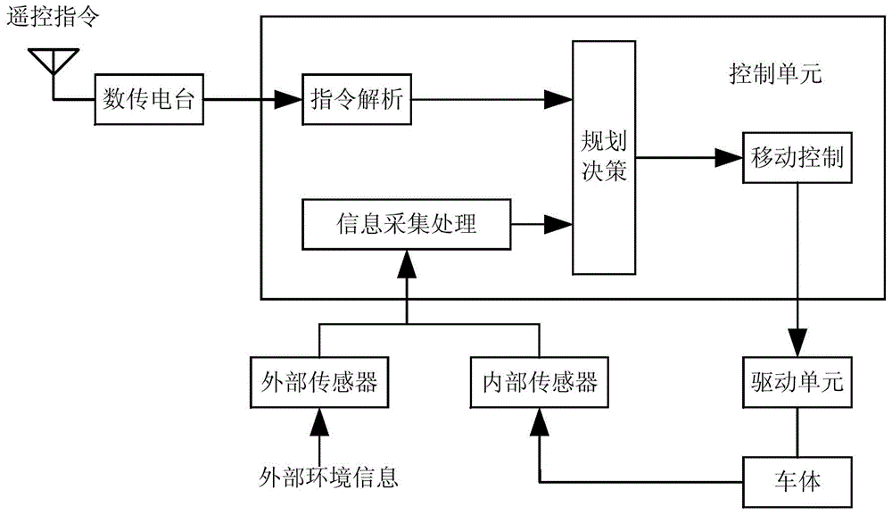
[0045]The control principle of coal mine roadway detection robot is as follows: figure 1 shown. Internal sensors include odometry and an inertial navigation system to measure the robot's displacement and attitude. External sensors include laser radar, camera, ultrasonic ranging sensor, and infrared ranging sensor. Among them, laser radar and camera are used to directly perceive environmental information, and ultrasonic and infrared ranging sensors are used for emergency obstacle avoidance. The on-board computer is used to collect information from various sensors, process the information, make decisions, and send control instructions to the drive unit.
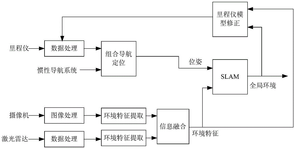
[0046] The algorithm principle of the information collection and processing module is as follows: figure 2 shown. The internal sensor odometer and inertial navigation system obtain the current position and head...
PUM
 Abstract
Description
Claims
Application Information
 - R&D
- Intellectual Property
- Life Sciences
- Materials
- Tech Scout
- Unparalleled Data Quality
- Higher Quality Content
- 60% Fewer Hallucinations
Browse by: Latest US Patents, China's latest patents, Technical Efficacy Thesaurus, Application Domain, Technology Topic, Popular Technical Reports.
© 2025 PatSnap. All rights reserved.Legal|Privacy policy|Modern Slavery Act Transparency Statement|Sitemap|About US| Contact US: help@patsnap.com


