Mass remote sensing data classification and organization method

A technology of massive remote sensing data and remote sensing data, applied in the fields of instruments, character and pattern recognition, computer parts, etc., can solve problems such as limiting the value of data utilization, inability to visually view database information, search efficiency and information acquisition ability limitations. , to achieve the effect of dynamic organization and management

Active Publication Date: 2016-06-08
济钢防务技术有限公司
View PDF6 Cites 5 Cited by
  • Summary
  • Abstract
  • Description
  • Claims
  • Application Information

AI Technical Summary

Problems solved by technology

[0003] The traditional data organization is simply stored in the database, and the database is searched and information obtained according to the application requirements. On the one hand, the search efficiency and the ability to obtain information are limited, and on the other hand, the information in the database cannot be viewed intuitively, which greatly limits Utilization value of data

Method used


Image

  • Mass remote sensing data classification and organization method

Examples


Embodiment approach

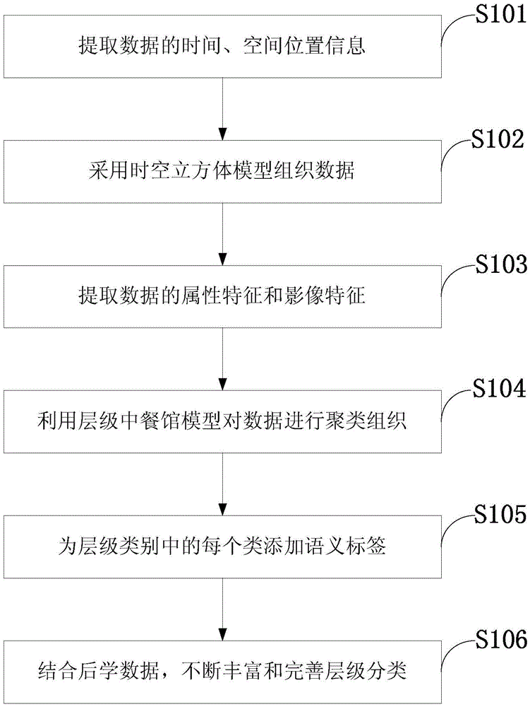
[0017] According to an embodiment of the present invention, the method for classifying and organizing massive remote sensing data includes:

[0018] S0, extract the time information and spatial information of each remote sensing data, and unify them into a standard format, for example, the time can be unified to Beijing time, and the spatial information can be unified to the CGCS2000 geodetic coordinate system.

[0019] S1, according to the spatial information and time information of each remote sensing data in the massive remote sensing data, divide the massive remote sensing data into at least one data set, wherein each data set includes at least one remote sensing data;

[0020] S2, extract the data features in each data set, where the data features include attribute features and image features, the attribute features refer to the source, type, resolution, etc. of the data, and the image features are histogram features, edge features, texture features, etc. ;

[0021] S3, ...


PUM


Abstract

The invention provides a mass remote sensing data classification and organization method. Mass remote sensing data is divided into a plurality of data sets according to space information and time information of all the remote sensing data; and the remote sensing data in each data set is subjected to graded clustering according to data characteristics in each data set, so that the remote sensing data is classified. A graded classification system is automatically established according to the data, and a clustering result from layer-by-layer refining from coarse to fine is provided; and the method is flexible and convenient, and the graded classification system can be dynamically and continuously adjusted and completed according to new data in subsequent use processes, so that dynamic organization and management of the data are realized.

Description

technical field [0001] The invention belongs to the technical field of automatic data organization, and in particular relates to a classification and organization method for massive remote sensing data oriented to classification system learning. Background technique [0002] With the development of aerospace technology and sensor technology, there are more and more ways to obtain remote sensing data. Remote sensing data generally has a huge amount of data, and the information is intertwined. How to organize these data effectively and reasonably is the key to make full use of these data. [0003] The traditional data organization is simply stored in the database, and the database is searched and information obtained according to the application requirements. On the one hand, the search efficiency and the ability to obtain information are limited. On the other hand, the information in the database cannot be viewed intuitively, which greatly limits the The utilization value of...

Claims


Application Information

Patent Timeline
Patent Type & Authority Applications(China)
IPC IPC(8): G06K9/62
CPCG06F18/214
Inventor 付琨许光銮孙显王磊黄宇李峰张利利
Owner 济钢防务技术有限公司
Why Eureka
Try Eureka