
Coordinate transformation tool and method of 3D laser scanning data based on high-precision point measurement

A technology of three-dimensional laser and point measurement, which is applied in the field of conversion tools for scanning point cloud data

Active Publication Date: 2016-10-12
BEIJING UNIVERSITY OF CIVIL ENGINEERING AND ARCHITECTURE
View PDF5 Cites 12 Cited by
  • Summary
  • Abstract
  • Description
  • Claims
  • Application Information

AI Technical Summary

Problems solved by technology

[0005] In view of this, the main purpose of the present invention is to provide a three-dimensional laser scanning data coordinate transformation tool and method based on high-precision point measurement. The target is combined and fixed to form a measurement conversion tool; the problem of spherical prism and spherical target placement is solved; and the problem of coordinate conversion from 3D laser scanning data to the coordinate system of the total station is solved; for the construction of the laboratory coordinate system, a precision It is obtained by the industrial detection method of spherical center point fitting, which ensures the accuracy of the laboratory coordinates; according to the principle of spatial coordinate conversion, the fusion of the measurement data of the industrial-grade total station and the data of the 3D laser scanner is completed; after detailed Error theory analysis and engineering practice prove that this technical solution can control the multi-station splicing data accuracy of the 3D laser scanner within the range of single-station measurement accuracy

Method used


Image

  • Coordinate transformation tool and method of 3D laser scanning data based on high-precision point measurement
  • Coordinate transformation tool and method of 3D laser scanning data based on high-precision point measurement

Examples


Embodiment Construction

[0019] The specific embodiments of the present invention will be further described in detail below in conjunction with the accompanying drawings.

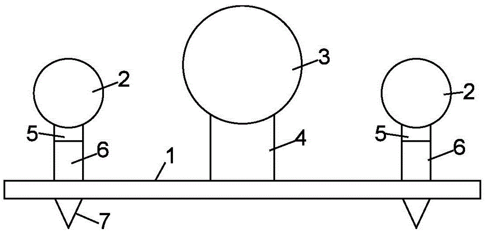
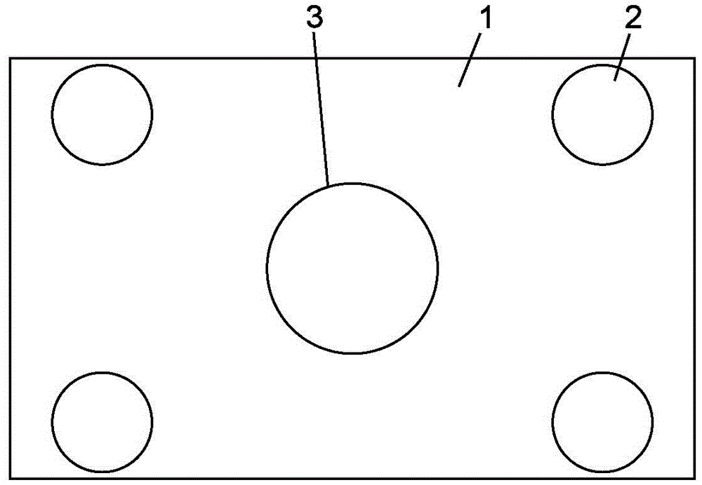
[0020] Such as Figure 1-Figure 2 As shown, the present invention relates to a three-dimensional laser scanning data coordinate conversion tool based on high-precision point measurement, including a substrate 1, and also includes an industrial total station spherical prism 2, a three-dimensional laser scanner spherical target 3, and a prism support seat 6 and a target support seat 4, the target support seat 4 is arranged in the middle of the substrate 1, the three-dimensional laser scanner spherical target 3 is arranged on the target support seat 4, and four prism supports are arranged on the four corners of the substrate 1 Seat 6, the spherical prism 2 of the industrial total station is arranged on the prism support seat 6.

[0021] As a further technical solution, a magnet block 5 is arranged inside the prism support base 6 .

...


PUM


Abstract

The invention relates to a coordinate transformation tool and method of 3D laser scanning data based on high-precision point measurement. The tool comprises a substrate, industrial total-station spherical prisms, a 3D laser scanner spherical target, prism supporting seats and a target supporting seat. The transformation tool establishes a lab coordinate system, an industrial total station and the industrial total-station spherical prisms of the tool are used for measurement, and a 3D laser scanner and the 3D laser scanner spherical target of the tool are used for measurement, so that the problem in placing the prisms and the target as well as the problem in coordinate transformation is solved; and further measurement data of the industrial total station is fused with that of the 3D laser scanner to improve the precision of data of the 3D laser scanner. An industrial detection means in which the precise spherical center point is fit to obtain the lab coordinate system, and precision requirement for lab coordinates is ensured.

Description

technical field [0001] The invention relates to a conversion tool for scanned point cloud data in the field of surveying and mapping, in particular to a coordinate conversion tool and method for three-dimensional laser scanning data based on high-precision point measurement. Background technique [0002] In the field of surveying and mapping, the traditional measurement principle is "first the whole and then the part, first control and then the fragment, from high level to low level". Its error control can only be completed by the accuracy of the instrument, and the control principle of "first the whole and then the part" and "high-level to low-level" cannot be realized. In particular, in the long-distance multi-site measurement environment, the error accumulation of point cloud data after station alignment is relatively large. In practice, the error accumulation sometimes even reaches the meter level, and its accuracy has long been unable to meet the application needs of ac...

Claims


Application Information

Patent Timeline
IPC IPC(8): G01B11/00G01B11/24
CPCG01B11/00G01B11/24
Inventor 胡云岗侯妙乐张向前吴育华
Owner BEIJING UNIVERSITY OF CIVIL ENGINEERING AND ARCHITECTURE
Learn More