Eureka AIR delivers breakthrough ideas for toughest innovation challenges, trusted by R&D personnel around the world.

Ocean-land geographic information element encoding method and apparatus

A technology of geographic elements and geographic information, which is applied in the field of coding methods and devices for sea and land geographic information elements, and can solve problems such as inconsistent coding of sea and land information elements

Inactive Publication Date: 2016-11-09
TIANJIN INST OF SURVEYING & MAPPING
View PDF0 Cites 1 Cited by
  • Summary
  • Abstract
  • Description
  • Claims
  • Application Information

AI Technical Summary

Problems solved by technology

[0004] The embodiment of the present invention provides a coding method and device for sea and land geographic information elements, so as to solve the technical problem that the sea and land information elements are not uniformly coded when the existing sea and land data are fused

Method used


Image

  • Ocean-land geographic information element encoding method and apparatus
  • Ocean-land geographic information element encoding method and apparatus
  • Ocean-land geographic information element encoding method and apparatus

Examples


Embodiment 1

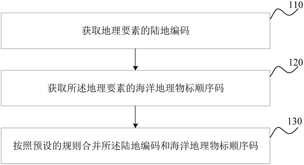
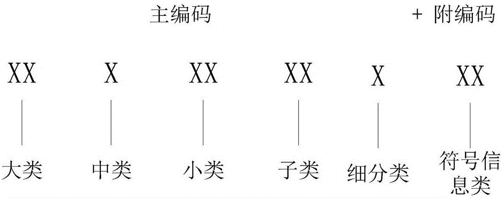
[0049] figure 1 It is a schematic flow chart of the encoding method of the land and sea geographic information elements provided in Embodiment 1 of the present invention; figure 2 It is a schematic diagram of encoding land geographic information elements in the method for encoding sea and land geographic information elements provided in Embodiment 1 of the present invention; image 3 It is a schematic diagram of coding the sea and land geographic information elements in the coding method of the sea and land geographic information elements provided in Embodiment 1 of the present invention. This embodiment can be applied to the encoding of sea and land geographic information elements, and the method can be executed by an encoding device for sea and land geographic information elements, which can be realized by software / hardware, and can be integrated into a computer or computer for data fusion in the server.

[0050] see figure 1 , the fusion method of the topographic map da...

Embodiment 2

[0062] Figure 4 It is a schematic structural diagram of the encoding device for the sea and land geographical information elements provided by the second embodiment of the present invention, as shown in Figure 4 As shown, the device includes:

[0063] A code acquisition unit 210, configured to acquire the land code of the geographic element;

[0064] A sequence code acquiring unit 220, configured to acquire the sequence code of the marine geographic object mark of the geographic element;

[0065] The merging unit 230 is configured to combine the land code and the serial code of the marine geographic object mark according to a preset rule.

[0066] The encoding device for sea and land geographic information elements provided in this embodiment generates a sequence with both ocean and land identifiers by obtaining the land code and the sequence code of the marine geographic object mark of the geographic element, and according to the combination of the land code and the seque...


PUM


Abstract

Embodiments of the invention provide an ocean-land geographic information element encoding method and apparatus. The method comprises the steps of obtaining a land code of a geographic element; obtaining an ocean geographic object sequence code of the geographic element; and combining the land code with the ocean geographic object sequence code according to a preset rule. Therefore, unified expression of land-ocean basic geographic information data is realized and a user can obtain an original source of data subjected to unified encoding through code information.

Description

technical field [0001] The invention belongs to the field of geographic information system data processing, and in particular relates to a coding method and device for sea and land geographic information elements. Background technique [0002] The data fusion of sea and land vector maps can integrate the information of vector sea charts and vector land maps, so it can eliminate the single information and space limitations brought by a single vector sea map or a single vector land map data, and obtain rich information and high quality. Higher information can better meet people's application needs. With the application of geographic information system more and more widely, people's demand for geospatial vector data is more and more urgent, and sea and land vector data often have differences in spatial reference, semantic coding, storage format, etc., which makes sea and land vector data The integration and fusion of map data has been widely used. [0003] Spatial data fusion...

Claims


Application Information

Patent Timeline
Patent Type & Authority Applications(China)
IPC IPC(8): G06F17/30
CPCG06F16/29
Inventor 马华山胡珂杨玉忠周奎张胜柱周丽珠王冬张志全张奇雷雨袁生礼
Owner TIANJIN INST OF SURVEYING & MAPPING
Why Eureka
Eureka Blog
Learn More