Base station deployment method, network server and unmanned aerial vehicle
A technology for network servers and drones, applied in the field of network servers, drones, and base station deployment methods, can solve the problems of reducing base station deployment efficiency and long deployment time, etc.
- Summary
- Abstract
- Description
- Claims
- Application Information
AI Technical Summary
Problems solved by technology
Method used
Image
Examples
Embodiment 1
[0132] It should be noted that the executor of a base station deployment method provided in an embodiment of the present invention may include a UAV loaded with a base station or a network server on the network side that is communicatively connected to the UAV.
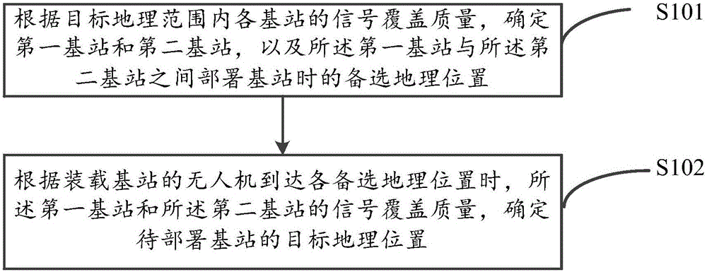
[0133] Such as figure 1 As shown, it is a flow chart of a base station deployment method provided by an embodiment of the present invention, and the method includes:
[0134] Step 101 , according to the signal coverage quality of each base station within the target geographic range, determine a first base station and a second base station, and an alternative geographic location when base stations are deployed between the first base station and the second base station.
[0135] Wherein, before determining the first base station and the second base station, and the candidate geographic location when the base station is deployed between the first base station and the second base station, firstly determine the target geog...
Embodiment 2
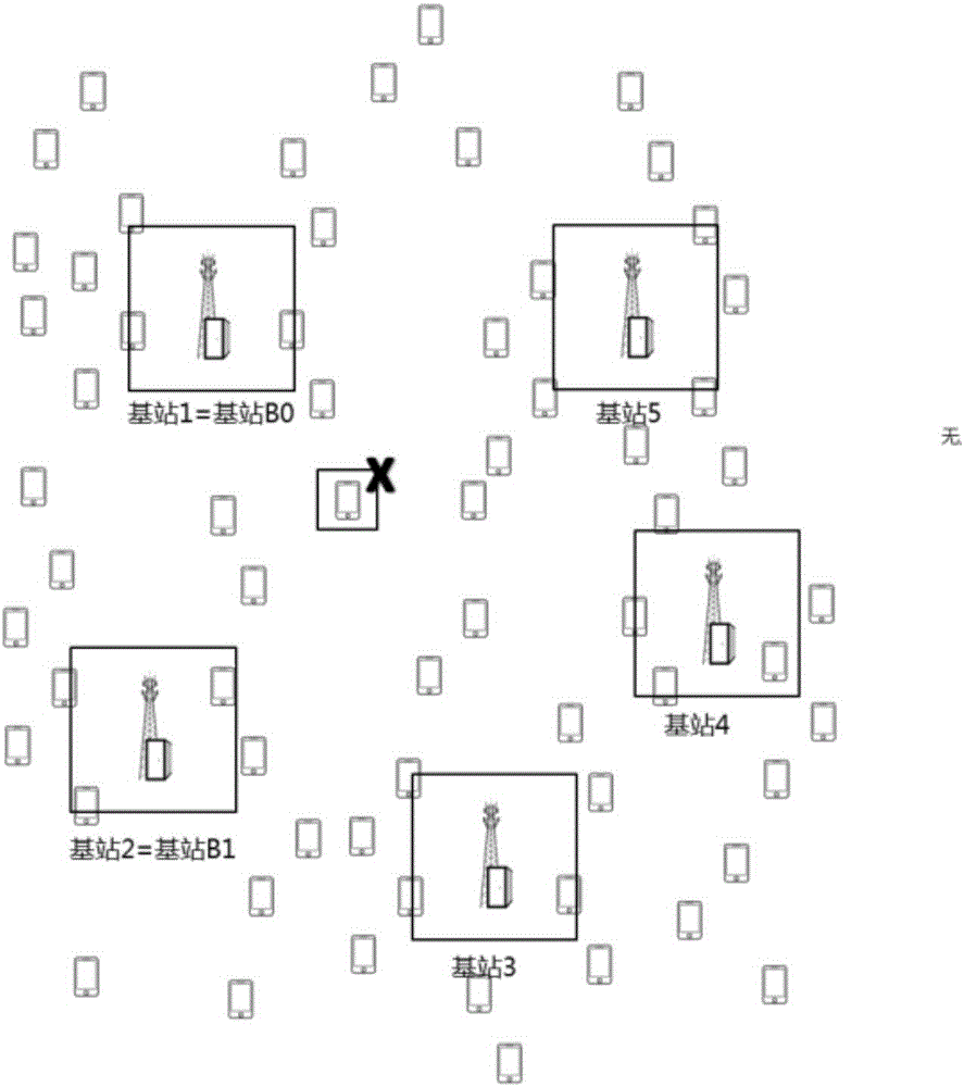
[0161] After receiving the information reported by the terminal, determine the target geographical range of the base station to be deployed according to the information, such as figure 2 As shown, it is the distribution map of each base station in the target geographical range provided by the embodiment of the present invention, which is represented by figure 2 It can be seen that there are base station 1, base station 2, base station 3, base station 4 and base station 5 within the target geographic range.
[0162] According to the signal coverage quality of each base station within the target geographic range, determine the first base station and the second base station, and alternative geographical locations when the base stations are deployed between the first base station and the second base station.
[0163] Such as figure 2 As shown, it is the distribution diagram of each base station provided by the embodiment of the present invention, wherein the signal coverage qu...
Embodiment 3
[0174] Such as Figure 5 As shown, it is a structural diagram of a network server provided by an embodiment of the present invention, wherein the server includes:
[0175] The first determination unit 51 is configured to determine the first base station and the second base station, and the alternative geography when the base station is deployed between the first base station and the second base station according to the signal coverage quality of each base station within the target geographic range Location;
[0176] The second determining unit 52 is configured to determine the target geographic location of the base station to be deployed according to the signal coverage quality of the first base station and the second base station when the UAV loaded with the base station arrives at each candidate geographic location.
[0177] Wherein, the first determining unit 51 is specifically configured to: acquire the base station with the worst signal coverage quality in the target geo...
PUM
 Abstract
Description
Claims
Application Information
 - R&D
- Intellectual Property
- Life Sciences
- Materials
- Tech Scout
- Unparalleled Data Quality
- Higher Quality Content
- 60% Fewer Hallucinations
Browse by: Latest US Patents, China's latest patents, Technical Efficacy Thesaurus, Application Domain, Technology Topic, Popular Technical Reports.
© 2025 PatSnap. All rights reserved.Legal|Privacy policy|Modern Slavery Act Transparency Statement|Sitemap|About US| Contact US: help@patsnap.com


