Method for designing and developing traffic channelization map

A traffic channelization and map technology, applied in design optimization/simulation, calculation, special data processing applications, etc., can solve problems such as difficult to describe the detailed basic attributes of roads

Active Publication Date: 2017-05-31
KUNMING UNIV OF SCI & TECH +1
View PDF6 Cites 24 Cited by
  • Summary
  • Abstract
  • Description
  • Claims
  • Application Information

AI Technical Summary

Problems solved by technology

[0006] The technical problem to be solved by the present invention is to propose a design and development method for traffic canalization maps to solve the problem that the existing maps mainly display road info...

Method used


Image

  • Method for designing and developing traffic channelization map
  • Method for designing and developing traffic channelization map
  • Method for designing and developing traffic channelization map

Examples


Embodiment Construction

[0042] In order to make the content, technical solutions and advantages of the present invention clearer, the following will further describe the embodiments of the present invention in detail in conjunction with the accompanying drawings:

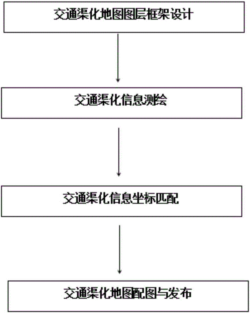
[0043] A traffic channelization map design and development method,

[0044] Step 1: Design the product structure of the traffic channelization map, which includes layer structure, pattern structure, and layer display;

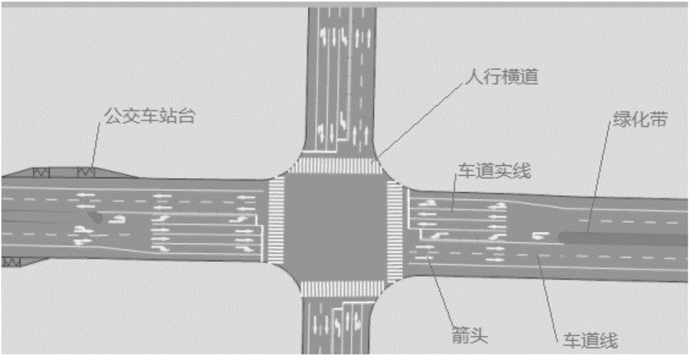
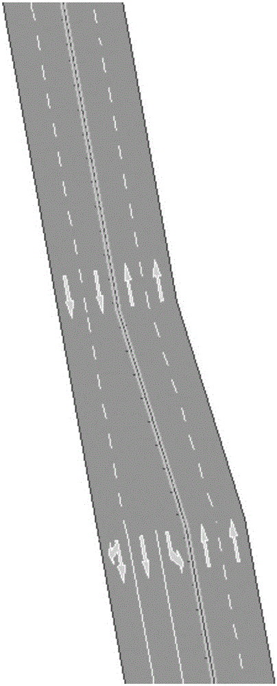
[0045] Layer structure: including traffic channelization information layer and position labeling information layer and attribute parameter data specification;

[0046] Pattern construction: Graphically display the above layer structure, specify the pattern construction and layer superposition of the layer information and parameter information contained in it;

[0047] Layer display: According to the traffic channelization layer structure and pattern structure, the layer is displayed in the way of zooming in, zooming out, d...


PUM


Abstract

The invention relates to a method for designing and developing a traffic channelization map and belongs to the field of computer digital map technology and intelligent transportation technology. The invention presents a new structure design and development method of map pattern structure, which is used for displaying road traffic channelization information in a map way. And complex channelization patterns can be displayed based on two-dimensional vector diagram. Users can view the traffic channelization information on the display terminal, such as browsers, in an enlarged, narrow and translational mode. Measurement and drawing of traffic channelization map, map coordinate matching, display of publishing processes and methods are developed, which solves the difficult problem that traditional traffic channelization information is difficult to display and difficult to draw.

Description

technical field [0001] The invention relates to a method for designing and developing a traffic channelization map, which belongs to the fields of computer digital map technology and intelligent traffic technology. Background technique [0002] Existing maps (two-dimensional vector graphics) are generally composed of vector graphics of points, lines, and planes, icons, and text superimposed. It is actually measured and drawn by the surveying and mapping unit according to a certain geographic coordinate system, and is directly drawn and released by map software such as ArcMap. Generally, a single geographic coordinate point and text description are used to mark the location information of a single point; Draw road information in the direction of travel; use circles and irregular rectangles to draw area and range information; currently released general maps (such as Baidu maps and Gaode maps) can meet the actual needs of the public, but for traffic planning and design and traf...

Claims


Application Information

Patent Timeline
IPC IPC(8): G06F17/50
CPCG06F30/20G06F2111/04
Inventor 成卫胡建东陈冬妮杨金刚
Owner KUNMING UNIV OF SCI & TECH
Why Eureka
Try Eureka