

High-speed rail line surveying and mapping method
A line surveying and high-speed rail technology, applied in surveying and navigation, surveying instruments, surveying devices, etc., can solve the problems of large surveying and mapping costs, surveying and mapping time, idle resources, and occupation of high-speed rail tracks, and achieve high surveying and mapping efficiency, less resource occupation, and low cost effect
Active Publication Date: 2019-10-01
HUNAN MAXWELL ELECTRONICS TECH
View PDF10 Cites 0 Cited by
- Summary
- Abstract
- Description
- Claims
- Application Information
AI Technical Summary
Problems solved by technology
However, because the existing surveying and mapping vehicles need to travel on the high-speed rail, it will occupy the high-speed rail track for a long time, resulting in a large amount of idle resources on the high-speed rail line, and will generate a lot of surveying and mapping costs and time
Method used
View moreImage
Smart ImageViewing Examples

Examples
Embodiment Construction
Login to View More PUM
 Abstract
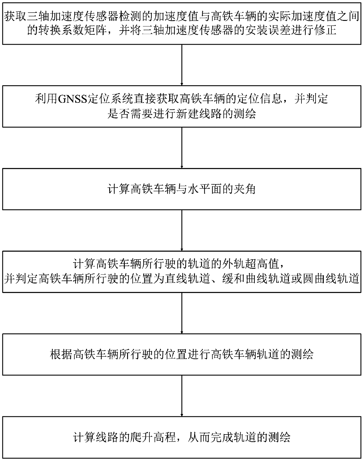
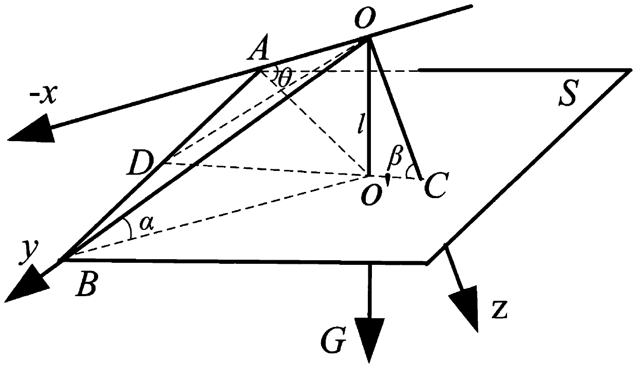
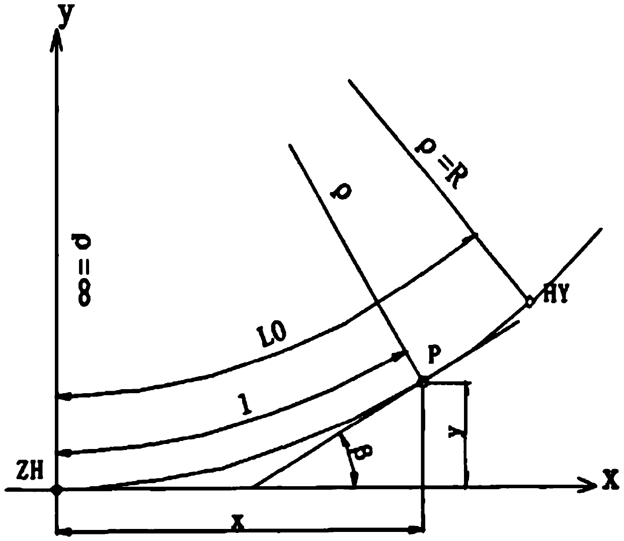
The invention discloses a high-speed railway line surveying and mapping method which is as follows: correcting a detection value of a three-axis acceleration sensor into an actual acceleration value of a high-speed railway vehicle; using a GNSS positioning system for positioning the high-speed railway vehicle and determining whether a new constructed line is surveyed and mapped; calculating the included angle between the high-speed railway vehicle and the horizontal plane; determining the driving position of the high-speed railway vehicle; surveying and mapping a high-speed railway vehicle track; and calculating line climbing height to complete line surveying and mapping. The high-speed railway line surveying and mapping method overcomes the traditional disadvantages of need of a specialized surveying and mapping vehicle for professional surveying and mapping of a new constructed high-speed railway line, the surveying and mapping is performed during running, a series of sensors are used for detection, data is calculated, high-speed railway design standards in China are combined, the new constructed high-speed railway line can be successfully surveyed and mapped in the driving processing of the high-speed railway vehicle in the new constructed high-speed railway track, and the high-speed railway line surveying and mapping method has the advantages of high surveying and mapping efficiency, low cost, and few occupied resources.
Description
technical field The invention specifically relates to a method for surveying and mapping a high-speed rail line. Background technique With the development of the country's economy and technology and the improvement of people's living standards, high-speed rail has gradually become the preferred mode of transportation for people's daily travel due to its advantages of fast operation, good comfort, and high cost performance. Because of this, the surveying and mapping of high-speed rail lines has become an important step after the construction of high-speed rail lines. At present, for the high-speed rail lines that have been built, the surveying and mapping methods are carried out by dedicated line surveying and mapping vehicles. The driver drives the surveying and mapping vehicle on the newly repaired high-speed rail line, and uses the surveying and mapping equipment and corresponding surveying and mapping methods carried by the surveying and mapping vehicle to survey and ma...
Claims
Login to View More Application Information
Patent Timeline
 Patent Type & Authority Patents(China)
IPC IPC(8): G01C15/00
Inventor 方元坤张传胜袁卫忠周惠根许良晓
Owner HUNAN MAXWELL ELECTRONICS TECH