A method and system for automatic identification of UAV aerial survey control points

A technology for automatic identification and control points, applied in the directions of measuring devices, surveying and navigation, computer components, etc., can solve the problems of ground control point picking errors, restricting aerial survey processing speed, time-consuming, etc., and achieve strong applicability and structure Simplicity and the effect of improving processing efficiency

Active Publication Date: 2020-08-11
YUNNAN AEROSPACE ENG GEOPHYSICAL SURVEY INSPECTION
View PDF3 Cites 0 Cited by
  • Summary
  • Abstract
  • Description
  • Claims
  • Application Information

AI Technical Summary

Problems solved by technology

At this stage, the processing of ground control points in photos by ground control points is still in the stage of manual interpretation. Specifically, the identification of ground control points is achieved by manually pricking points on aerial photos, which is time-consuming and inefficient. At the same time, during photo processing, there is a certain error in the picking of ground control points, which has become one of the main factors restricting the post-processing speed of aerial surveys.

Method used


Image

  • A method and system for automatic identification of UAV aerial survey control points
  • A method and system for automatic identification of UAV aerial survey control points
  • A method and system for automatic identification of UAV aerial survey control points

Examples


Embodiment Construction

[0032] In order to make the technical problems, technical solutions and beneficial effects solved by the present invention clearer, the present invention will be further described in detail below in conjunction with the accompanying drawings and embodiments. It should be understood that the specific embodiments described here are only used to explain the present invention, not to limit the present invention.

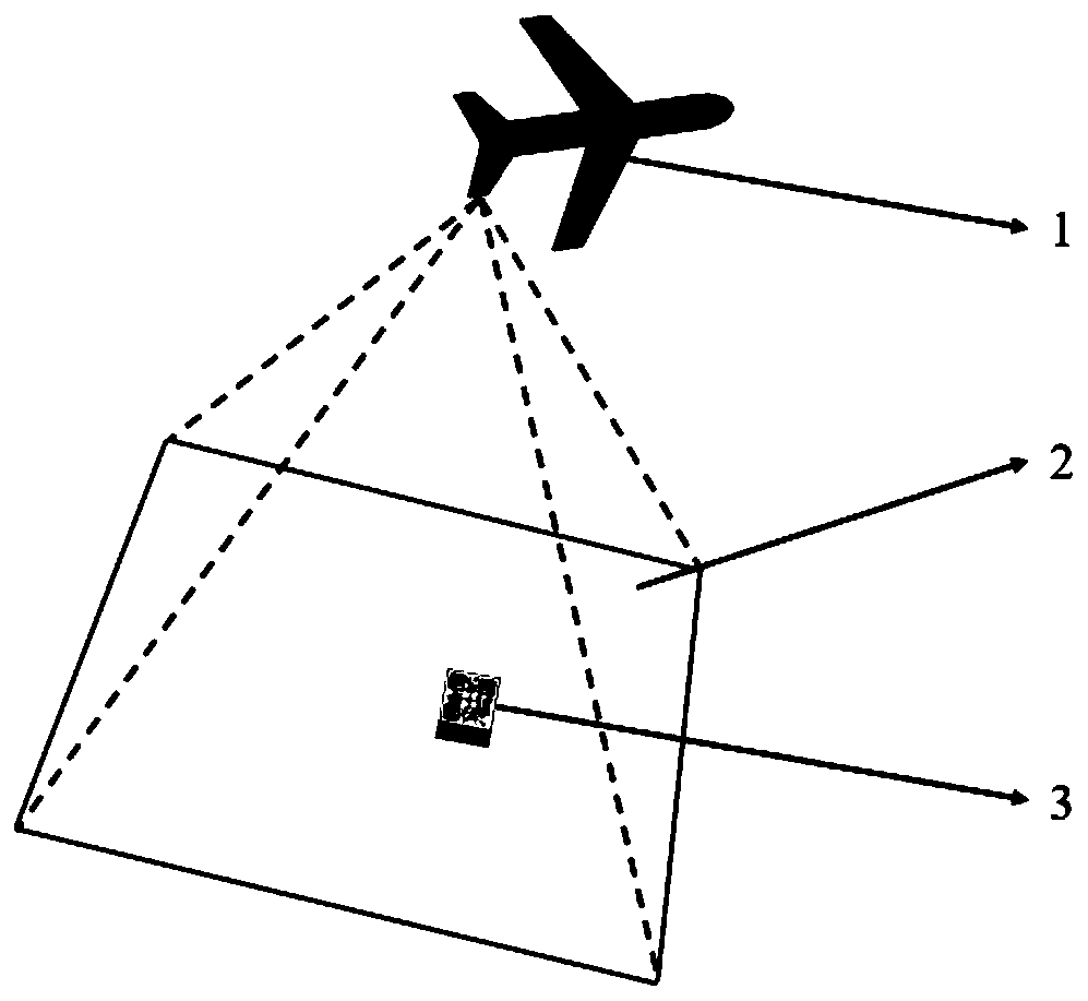
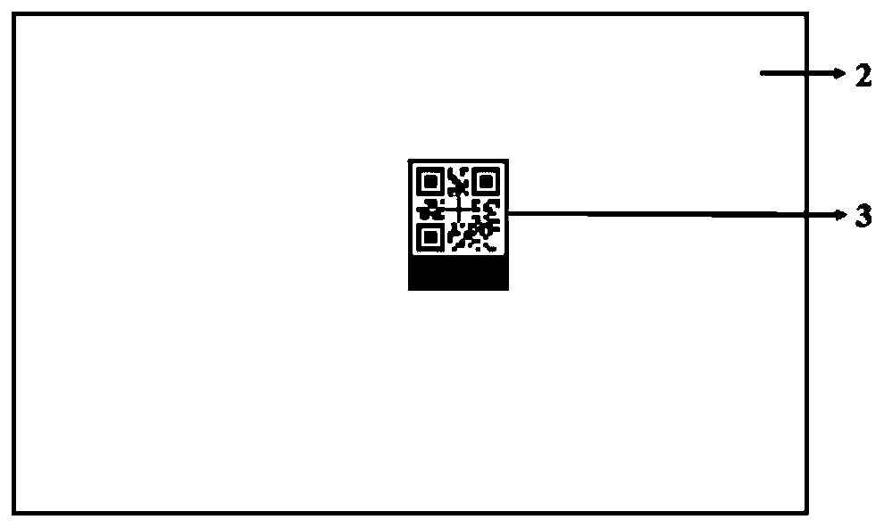
[0033] The existing aerial survey operation involves the joint measurement technology of ground control points. The specific process is: before the aerial photogrammetry of the aircraft, several ground control points are laid out within the aerial survey range, and their coordinate data are measured. Import the coordinate data of the software into the software, and manually connect the photos containing the same control points to optimize the model data. At the same time, in order to calculate the 3D position of a control point / manual connection point, at least two photo...


PUM


Abstract

The invention provides an automatic recognizing method and system for UAV aerial survey control points. The method comprises the following steps: manufacturing a portable and recyclable two-dimensional code control point device; recording a mapping relation of ground control point coordinate information and the two-dimensional code control point device into a record sheet; recognizing an image ofthe two-dimensional code control point device in each aerial survey picture through an image processing platform; then recognizing two-dimensional code recognizing code graphic in the image of each two-dimensional code control point device to obtain the device number; searching the record sheet through the image processing platform in order to obtain the ground control point coordinate informationcorresponding to the recognized device number, thus finishing the automatic recognizing process of the UAV aerial survey control points. The method and the system have the advantages that the structure is simple; the field operability is high; the operation is convenient; the two-dimensional code control point device is recyclable; the ground control point coordinates can be easily and automatically recognized in the aerial survey picture processing progress. Therefore, the aerial survey process is simplified, and as a result, the aerial survey picture processing efficiency is improved; the adaptability is high.

Description

technical field [0001] The invention belongs to the technical field of aerial photogrammetry, and in particular relates to a method and a system for automatic recognition of control points in aerial surveys of unmanned aerial vehicles. Background technique [0002] Aerial surveying, also called photogrammetry and remote sensing, belongs to the remote sensing science in surveying and mapping science. Remote sensing science and technology is an emerging marginal subject developed on the basis of space science, electronic science, earth science, computer science and other disciplines interpenetration and mutual integration. It uses non-contact sensors to obtain temporal and spatial information about targets. It not only focuses on solving the geometric positioning of traditional targets, but more importantly, interprets the image and non-image information acquired by sensors in outer space, and extracts the geometric and physical feature information of various target objects in...

Claims


Application Information

Patent Timeline
Patent Type & Authority Patents(China)
IPC IPC(8): G01C11/00G06K7/14
CPCG01C11/00G06K7/1417
Inventor 苏建坤李万宝代柳娟
Owner YUNNAN AEROSPACE ENG GEOPHYSICAL SURVEY INSPECTION
Why Eureka
Try Eureka