
Geological boundary point cloud data extraction method based on BIM environment and system

A technology for point cloud data and extraction methods, applied in image data processing, details involving processing steps, 3D modeling, etc.

Active Publication Date: 2018-06-01
CENT & SOUTHERN CHINA MUNICIPAL ENG DESIGN & RES INST
View PDF10 Cites 12 Cited by
  • Summary
  • Abstract
  • Description
  • Claims
  • Application Information

AI Technical Summary

Problems solved by technology

However, the three-dimensional modeling of geological information requires the extraction of point cloud data of different formations in geological survey. The existing geological survey original profile files cannot directly ex

Method used


Image

  • Geological boundary point cloud data extraction method based on BIM environment and system
  • Geological boundary point cloud data extraction method based on BIM environment and system
  • Geological boundary point cloud data extraction method based on BIM environment and system

Examples


Embodiment Construction

[0024] In order to make the objectives, technical solutions and advantages of the present invention clearer, the present invention will be described in further detail below in conjunction with the accompanying drawings and embodiments. It should be understood that the specific embodiments described here are only used to explain the present invention and are not intended to limit the invention.

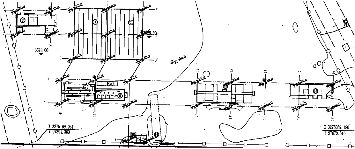
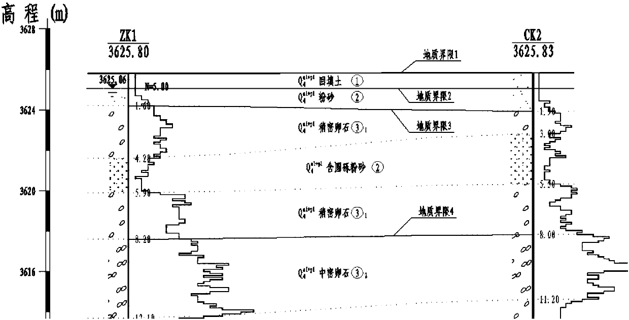
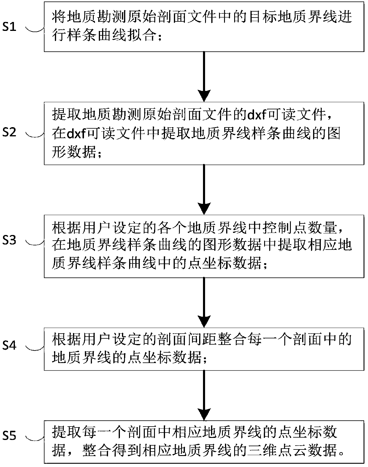
[0025] The present invention provides a method for extracting geological boundary point cloud data based on BIM environment, such as figure 1 to Figure 5 As shown, the described geological boundary point cloud data extraction method based on the BIM environment comprises the following steps:

[0026] S1. Perform spline curve fitting on the target geological boundaries in the original profile file of the geological survey.

[0027] Among them, such as Figure 4 As shown, the step S1 also includes the following sub-steps:

[0028] S11, selecting the target layer of the geological b...


PUM


Abstract

The invention discloses a geological boundary point cloud data extraction method based on a BIM environment and system. Spline curve fitting is carried out on a target geological boundary in a geological survey original section document; according to the number of control points set by a user in each geological boundary, point coordinate data of a corresponding geological boundary spline curve areextracted from graphic data of the geological boundary spline curve of a dxf readable file; according to a section interval set by the user, the point coordinate data of the geological boundary in each section are integrated; and the point coordinate data of the corresponding geological boundary in each section are extracted, and three-dimensional point cloud data of the corresponding geologicalboundary are integrated, and extraction of point cloud data in different formations is realized. The obtained point cloud data can realize surface fitting in multiple BIM software, boundary surfaces in different formations are generated, and a civil engineering BIM model is built and obtained.

Description

technical field [0001] The invention relates to geological data modeling technology, in particular to a method for extracting geological boundary point cloud data based on a BIM environment. Background technique [0002] The traditional engineering design is mainly carried out by the person in charge of each project and the person in charge of the project as a whole. When it comes to the design of the construction plan of the civil engineering in the factory area, it is more to follow the individual project. When the individual project needs to excavate the foundation pit , foundation treatment and pile foundation scheme design, we can only rely on the CAD geological drilling information histogram and two-dimensional geological section plan provided by the geological survey unit. [0003] In actual engineering, the design unit will generally provide the survey unit with geological hole layout requirements. The spacing and depth of the hole layout must not only meet the spe...

Claims


Application Information

Patent Timeline
IPC IPC(8): G06T17/05G06T17/10
CPCG06T17/05G06T17/10G06T2200/08G06T2210/32
Inventor 胡纯沈文吴迪张辛平魏耀红安海堂蒲广明
Owner CENT & SOUTHERN CHINA MUNICIPAL ENG DESIGN & RES INST
Learn More