Road network clustering-based hotspot region mining method

A hotspot area and clustering technology, applied in the direction of instruments, climate sustainability, computing, etc., can solve the problems of large impact of clustering results and large differences in results, and achieve the effect of solving data sparsity and huge amount of calculation

Active Publication Date: 2018-08-21
CHONGQING UNIV OF POSTS & TELECOMM
View PDF3 Cites 27 Cited by
  • Summary
  • Abstract
  • Description
  • Claims
  • Application Information

AI Technical Summary

Problems solved by technology

But the disadvantage is that the method of trajectory segmentation has a great impact on the cl

Method used


Image

  • Road network clustering-based hotspot region mining method
  • Road network clustering-based hotspot region mining method

Examples


Embodiment Construction

[0031] The technical solutions in the embodiments of the present invention will be described clearly and in detail below with reference to the drawings in the embodiments of the present invention. The described embodiments are only some of the embodiments of the invention.

[0032] The technical scheme that the present invention solves the problems of the technologies described above is:

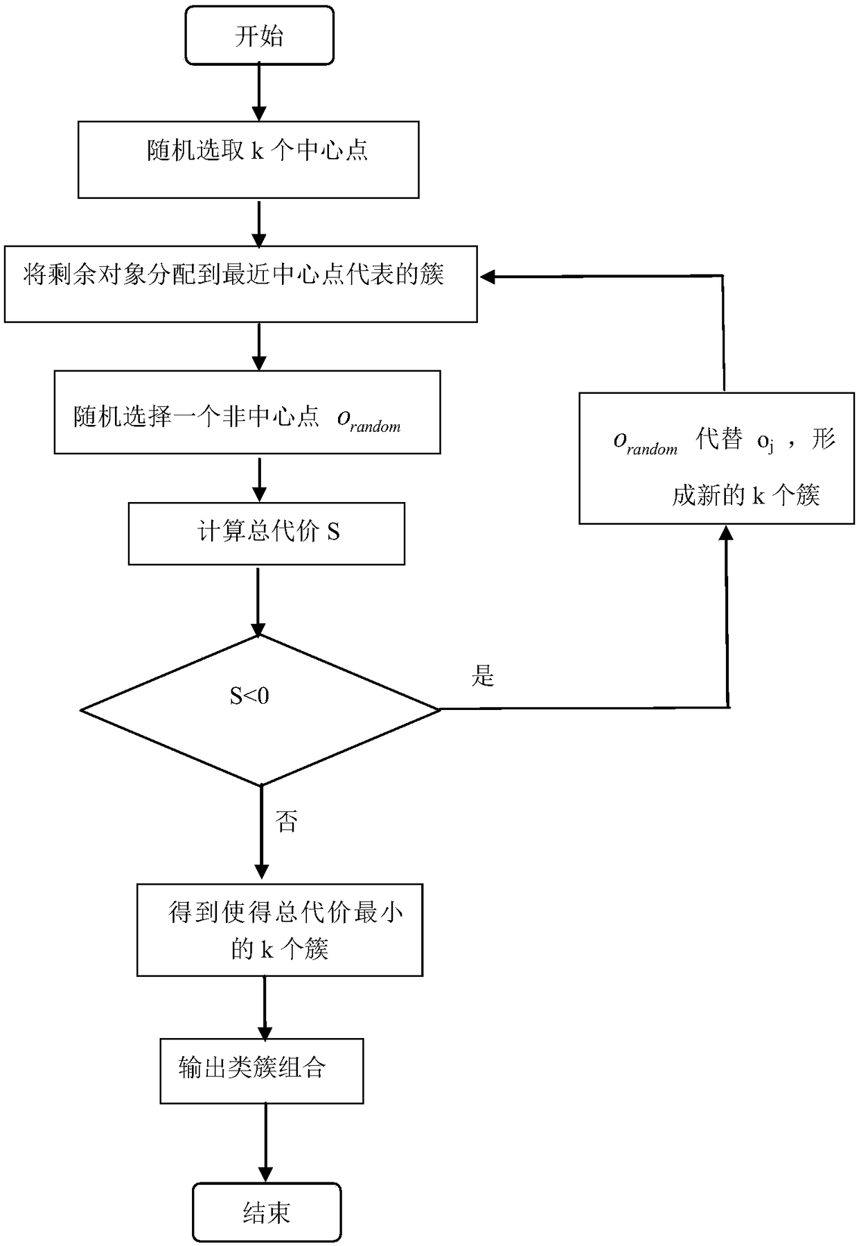
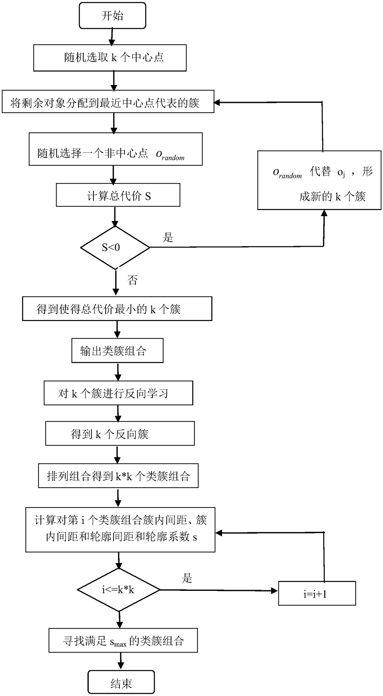
[0033] Such as figure 2 As shown, the invention adopts the OPAM clustering algorithm based on the density peak optimization initial center and the road network to combine the specific steps of the hotspot area mining method as follows:

[0034] Step 1: Collect the taxi trajectory data set of a certain month in the city, and select the trajectory data of the city with a relatively concentrated amount of data for one week. Carry out data preprocessing, retain valid fields such as longitude and latitude data of getting on and off track points, time data of getting on and off the car, and del...


PUM


Abstract

The invention relates to a road network trajectory clustering-based travel hotspot region mining method. According to the method, taxi trajectories are mapped into a road network, and a clustering method combining points of interest and trajectories collected in actual roads is adopted; on the basis of a density peak clustering algorithm, an OPAM algorithm which optimizes an initial center based on density peaks is provided, namely, a namely DP-OPAM algorithm is provided; according to the algorithm, the local density of data points and shortest distances from the points to points with higher density are adopted, and a decision graph is adopted to select the category of data points with higher density and closest distance, and the category is adopted as an initial clustering center; and onthe basis of the initial clustering center, an OPAM clustering algorithm additionally adopting inverse learning is used to obtain a clustering result. Compared with an original OPAM algorithm, the newalgorithm can not only automatically determine a clustering center, but also improve accuracy and shorten clustering time and realize the analysis of user travel hotspots.

Description

technical field [0001] The invention belongs to a data mining method, in particular to a taxi track clustering method based on a road network. Background technique [0002] As a hot spot in the development of transportation in the world today, intelligent transportation not only supports transportation management, but also pays more attention to meeting the needs of people's travel and public transportation. In recent years, the construction of intelligent transportation systems has developed rapidly, and many advanced technologies have been widely used in intelligent transportation systems. The wide application of GPS devices makes trajectory extraction more convenient. These GPS devices can collect a large amount of mobile location sequence information and vehicle status information, which contains rich traffic information and user behavior information. By analyzing and mining trajectory data, we can understand traffic conditions, plan trips reasonably, discover crowd be...

Claims


Application Information

Patent Timeline
IPC IPC(8): G06K9/62G06F17/30
CPCG06F16/9038G06F18/23Y02D10/00
Inventor 仇国庆赵婉滢马俊张少昀
Owner CHONGQING UNIV OF POSTS & TELECOMM
Why Eureka
Try Eureka