
Binocular camera and laser radar combined robot positioning method

A technology of robot positioning and binocular camera, which is applied in the field of robot positioning combined with binocular camera and laser radar, can solve the problems of less 2D laser environment information and high cost of 3D laser, and achieve accurate outdoor positioning information, consistent scanning frequency, Guaranteeing the effect of accuracy

Inactive Publication Date: 2018-10-02
北京克路德人工智能科技有限公司
View PDF1 Cites 13 Cited by
  • Summary
  • Abstract
  • Description
  • Claims
  • Application Information

AI Technical Summary

Problems solved by technology

[0004] In view of this, the present invention provides a robot positioning method combining a binocular camera and a laser radar. Through the combined use of the binocular camera and the laser radar, more abundant environmental information is conveyed to the robot, and the two-dimensional laser environment information is resolved. less, high cost of 3D laser, but also provides more accurate outdoor positioning information

Method used


Image

  • Binocular camera and laser radar combined robot positioning method

Examples


Embodiment Construction

[0021] The present invention will be described in detail below with reference to the accompanying drawings and examples.

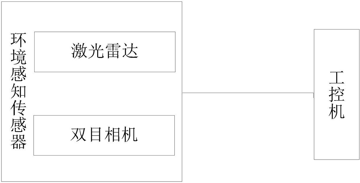
[0022] The invention provides a robot positioning method combined with a binocular camera and a laser radar. As shown in the accompanying drawings, the environment recognition sensor transmits the collected external environment information to the industrial computer and draws an environment map, and judges through mutual cooperation. The pose of the robot itself and whether it moves to the target area can be used to position the robot well through the use of sensor data.

[0023] The environment recognition sensor of the present invention includes: laser radar and binocular camera.

[0024] The specific positioning steps are as follows:

[0025] Step 1: Jointly calibrate the binocular camera and the lidar to obtain the internal and external parameters of the binocular camera and the rotation and translation array of the binocular camera relative to the li...


PUM


Abstract

The invention provides a binocular camera and laser radar combined robot positioning method. An environment identification sensor transmits collected outer environment information to an industrial control machine, an environmental map is drawn, through mutual cooperation, the pose of a robot is judged, whether the robot is moved to the target area or not is judged, and through sensor data cooperation use, the robot can be well positioned; through cooperative use of a binocular camera and a laser radar, more rich environment information is transmitted to the robot, the problems that two-dimensional laser environment information is little, and three-dimensional laser cost is high are solved, and meanwhile, the more accurate outdoor positioning information is provided.

Description

technical field [0001] The invention relates to a robot positioning method, in particular to a robot positioning method combining a binocular camera and a laser radar. Background technique [0002] As technologies such as computing power and sensors continue to increase, the functions of outdoor patrol and security robots are also becoming more and more, and at the same time, the mixed use of multi-sensor data is becoming more and more diverse. At this time, the robot is no longer limited to the use of a single sensor, but can obtain more prepared environment and pose information through the mutual cooperation of multi-sensor data. The mutual use of multi-sensor data is an important means of robot positioning, which requires relatively strong computing power. The development of computers now provides a good foundation for this condition. [0003] Most of the existing robot positioning methods use multiple two-dimensional sensors to obtain environmental information. The inev...

Claims


Application Information

Patent Timeline
Patent Type & Authority Applications(China)
IPC IPC(8): B25J19/02
CPCB25J19/022B25J19/023
Inventor 沈俊韩锐王坤
Owner 北京克路德人工智能科技有限公司
Learn More