Drought remote sensing monitoring method suitable for high altitude areas

A remote sensing monitoring and high-altitude technology, applied in the field of environmental remote sensing applications, can solve problems such as differences and difficulty in implementation, few weather stations, and inability to represent the overall situation of the weather, so as to achieve the effect of reducing the uneven distribution of point data

Active Publication Date: 2018-11-06
SOUTHWEST PETROLEUM UNIV
View PDF11 Cites 23 Cited by
  • Summary
  • Abstract
  • Description
  • Claims
  • Application Information

AI Technical Summary

Problems solved by technology

However, the study area is located in a high-altitude area, and the distribution of meteorological stations is small and extremely uneven, which cannot reflect the overall situation o...

Method used


Image

  • Drought remote sensing monitoring method suitable for high altitude areas
  • Drought remote sensing monitoring method suitable for high altitude areas
  • Drought remote sensing monitoring method suitable for high altitude areas

Examples


Embodiment 1

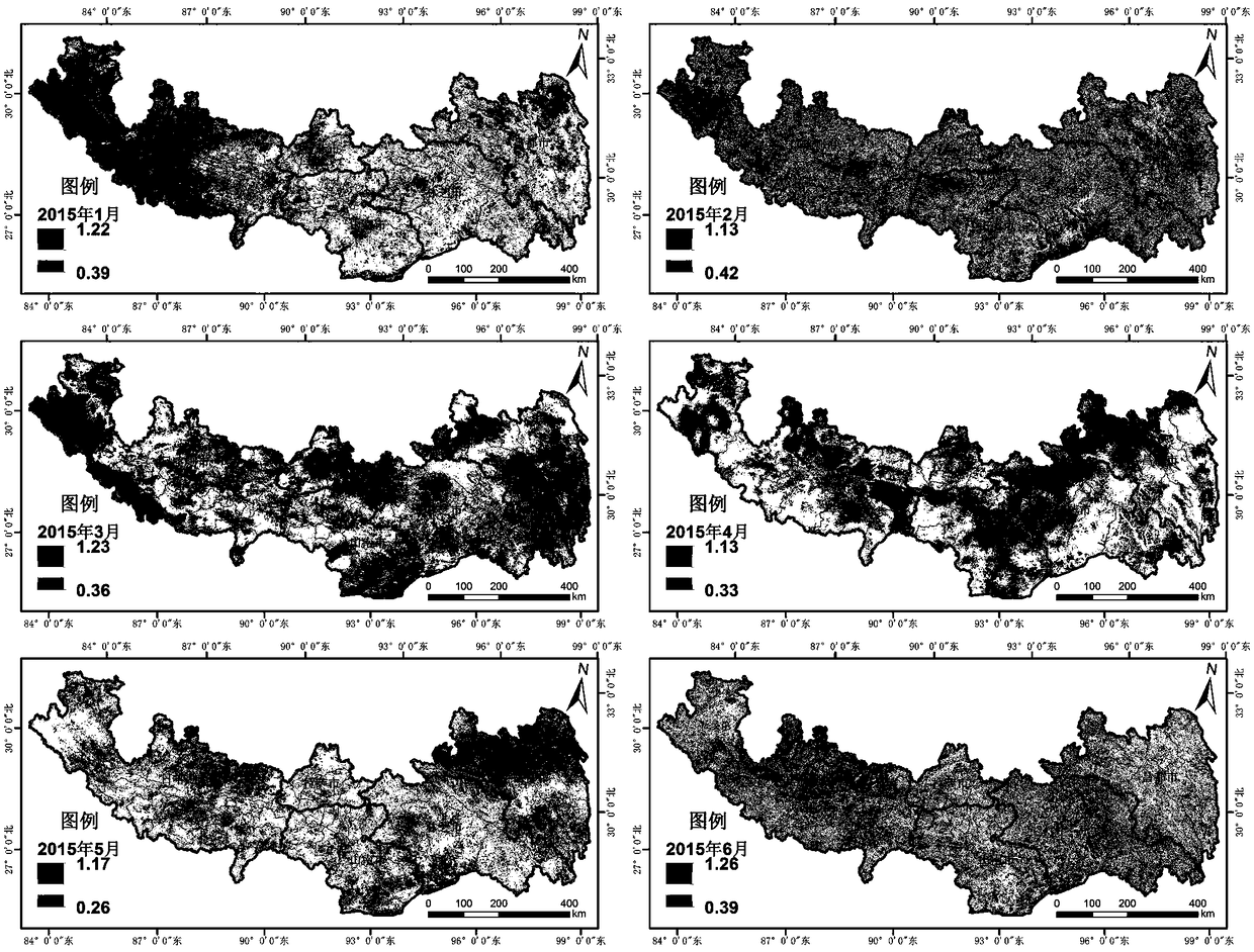
[0128] Taking Lhasa City, Shigatse City, Qamdo City, Shannan City and Nyingchi City in the southeast of Tibet at high altitude as the research area, the method of the present invention is used to carry out comprehensive monitoring of drought in the research area.

[0129] The research area is located in the two major areas of the southern Tibet valley and the eastern Tibet valley in the Tibet Autonomous Region, including 56 counties (districts) in five regions including Lhasa, Qamdo, Nyingchi, Shannan and Shigatse. The research area is mainly distributed in Tibet The eastern and southern parts of the autonomous region cover an area of ​​about 516,900 km 2 , accounting for about 42.37% of the region's land area. This area is the main agricultural area in Tibet. Lhasa’s agriculture is mainly distributed in Yangbajing and Duilongdeqing in the Lhasa Valley. Shigatse City has the largest cultivated soil area in the region. Shannan City is known as the “Tibet Granary” and mainly gro...


PUM


Abstract

The invention discloses a drought remote sensing monitoring method suitable for high altitude areas. The method comprises: S10, collecting data of a target area, S20, preprocessing the data obtained in step S10 to obtain an enhanced vegetation index, a surface temperature index, a land cover type and downscaling rainfall data, S30, calculating a vegetation state index, a temperature condition index, a rainfall state index, a reclassified land cover type and elevation by the data in step S20, and S40, constructing a drought remote sensing monitoring model based on spatial principal component analysis. The method comprehensively considers various factors affecting drought, wherein the various factors include a vegetation factor, a surface temperature factor, a rainfall factor, a land cover type factor and a topographic factor, a drought monitoring model is constructed by a spatial principal component analysis method, can effectively eliminate variables with large correlation in the selected variables and can extract few unrelated comprehensive indicators.

Description

technical field [0001] The invention belongs to the application field of environmental remote sensing, and in particular relates to a drought remote sensing monitoring method suitable for high-altitude areas. Background technique [0002] Drought remote sensing monitoring is based on the information of various drought-causing factors in the process of drought, and establishes a comprehensive monitoring model of drought remote sensing and carries out drought monitoring. As a common and frequent disaster, drought has always caused serious threats to agricultural production, food security, ecological environment, and economic and social development. China is a large agricultural country, and the rise and fall of agriculture has a very serious impact on the national economy. For agriculture, droughts are more serious than floods. Droughts account for more than half of the farmland area and crop production losses suffered by various natural disasters every year. Therefore, impr...

Claims


Application Information

Patent Timeline
IPC IPC(8): G01N21/17G01W1/00
CPCG01N21/17G01N2021/1793G01W1/00
Inventor 熊俊楠刘志奇范春捆刘姗龚颖张昊朱吉龙
Owner SOUTHWEST PETROLEUM UNIV
Why Eureka
Try Eureka