Method for simulating urban waterlogging depth based on SWMM of pipe network and road dual system
A simulation method, dual-system technology, applied in special data processing applications, instruments, climate change adaptation, etc.
- Summary
- Abstract
- Description
- Claims
- Application Information
AI Technical Summary
Benefits of technology
Problems solved by technology
Method used
Image
Examples
Embodiment Construction
[0029] The present invention will be further described below in conjunction with the accompanying drawings.
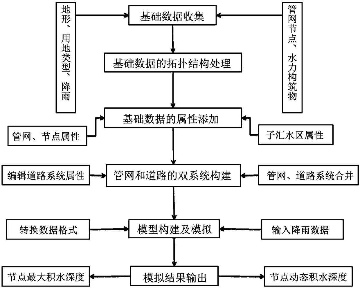
[0030] The method for simulating urban waterlogging water depth based on the pipe network and road dual system SWMM of the present invention, on the basis of SWMM software conventional modeling and hydraulic simulation, adds a road system to form a pipe network and road dual system to realize node alignment The dynamic simulation of the depth of water accumulation simulates the depth of water accumulation on roads in the case of urban waterlogging. Such as figure 1 As shown, the specific process is as follows:
[0031] (1) Collection of basic data
[0032] Collect and organize the topographic data (including roads, elevation points), land use type data, pipe network node data, hydraulic structure data, rainfall data and other related data in the research area.
[0033] (2) Topological structure processing of basic data
[0034] The initial modeling data is mostly i...
PUM
 Abstract
Description
Claims
Application Information
 - R&D
- Intellectual Property
- Life Sciences
- Materials
- Tech Scout
- Unparalleled Data Quality
- Higher Quality Content
- 60% Fewer Hallucinations
Browse by: Latest US Patents, China's latest patents, Technical Efficacy Thesaurus, Application Domain, Technology Topic, Popular Technical Reports.
© 2025 PatSnap. All rights reserved.Legal|Privacy policy|Modern Slavery Act Transparency Statement|Sitemap|About US| Contact US: help@patsnap.com


