Method for planning paths on basis of ocean current prediction models

A technology for path planning and prediction model, applied in climate sustainability, instrumentation, water resource assessment, etc., can solve problems such as poor real-time performance and complex calculation process, and achieve the effect of accelerating convergence speed and reducing complexity

Active Publication Date: 2018-11-13
HARBIN ENG UNIV
View PDF7 Cites 22 Cited by
  • Summary
  • Abstract
  • Description
  • Claims
  • Application Information

AI Technical Summary

Benefits of technology

The present invention considers real-time ocean currents and predicts future ocean elements to plan paths more effectively. It uses advanced algorithms to obtain real-time ocean current information and finds the optimal solution through reinforcement learning. This speeds up the planning process and improves the accuracy of the planned path.

Problems solved by technology

This patented describes different methods for guiding autonomously operated dronys (AU) boats towards their destination without causing any harm during exploration activities. These techniques involve analyzing sea waves and other environmental variables like wave height, water temperature, pressure, orientation angle, directionality, and acceleration measurements over time to create a virtual world called "undersea". To accurately navigate through the marine environment, there must exist advanced technologies including radomics, image processing, machine vision, and artificial intelligence. Current approaches rely heavily on mathematical models derived from past experience and require significant computational resources.

Method used


Image

  • Method for planning paths on basis of ocean current prediction models
  • Method for planning paths on basis of ocean current prediction models
  • Method for planning paths on basis of ocean current prediction models

Examples


Embodiment 1

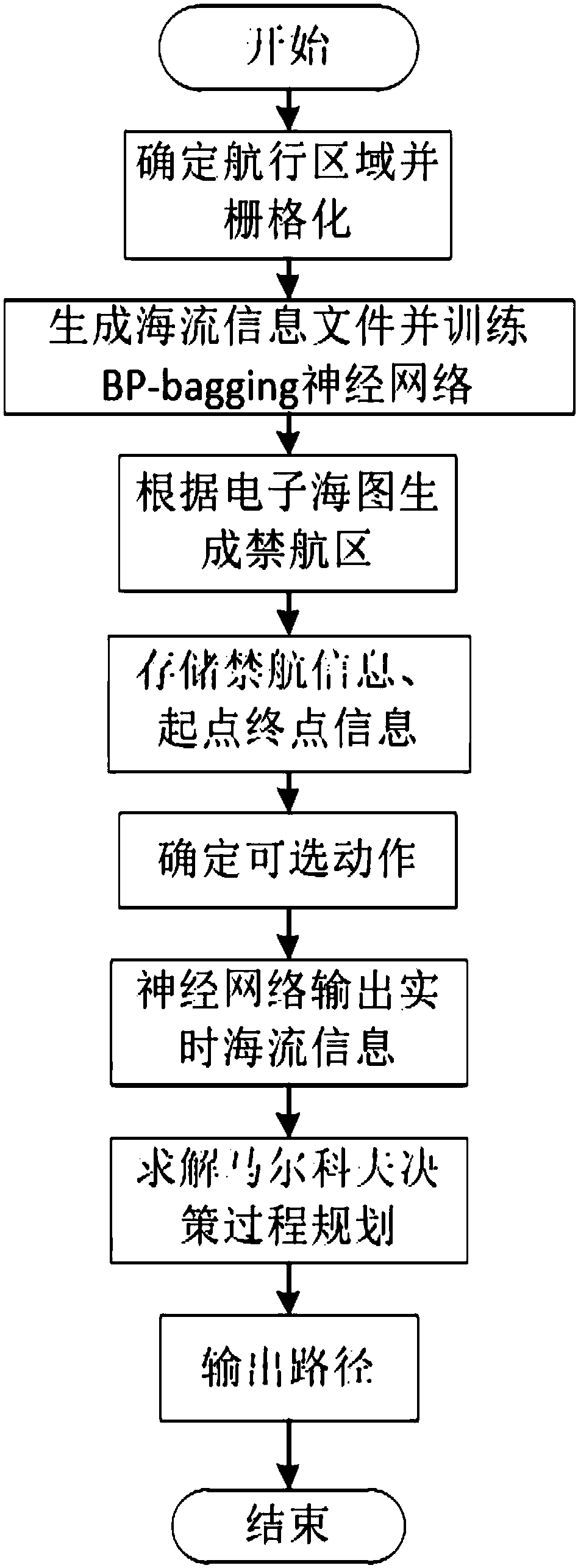
[0046] Such asfigure 1 , a path planning method based on the ocean current prediction model, including the following steps:

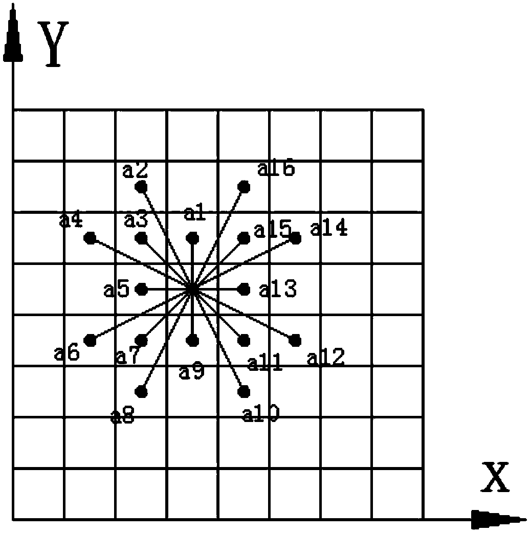
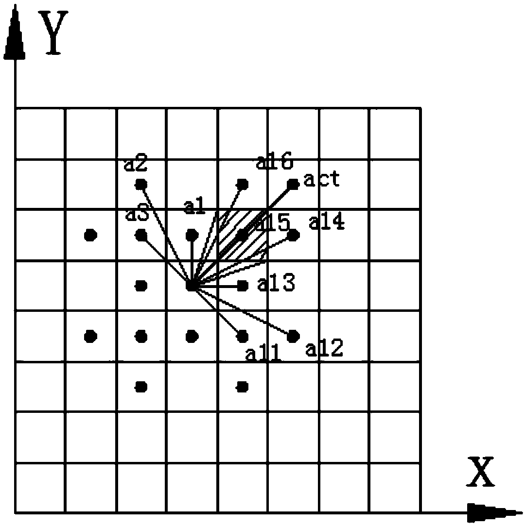
[0047] Step (1): Determine the navigation area according to the key points of the path, and perform grid processing on the navigation area;

[0048] The rectangular navigation area is determined according to the starting and ending points of the path of the underwater robot; the orthogonal curve grid is used in the horizontal direction, the grid spacing is set at 2km to 30km, and 20 to 30 layers are divided into equal depths in the vertical direction.

[0049] Step (2): Use the regional ocean model to predict the ocean current with a time step of ΔT in the navigation area, and use the bagging algorithm and BP neural network to fit and calculate Get real-time ocean current information:

[0050] The vertical direction adopts the σ coordinate, and the vertical coordinate scale is controlled at [-1,0] through the vertical transformation function and the st...


PUM


Abstract

The invention belongs to the field of underwater robot control, and discloses a method for planning paths on the basis of ocean current prediction models. The method includes steps of carrying out rasterization processing on sailing regions according to path critical points; predicting ocean current for the sailing regions by the aid of regional ocean modes and acquiring real-time ocean current information by means of fitting computation; marking prohibited areas by the aid of electronic ocean map information; storing prohibition information of different depths and starting point and end pointlocation information according to plain grids at different depths, and storing longitudes and latitudes of various points of the grids, whether the points are the prohibited areas or not and whetherend points are reached or not; computing the directions from current locations to the end points and determining optional actions in travel directions at all next steps; seeking the optimal strategiesby the aid of Q-learning and outputting the paths. The optimal strategies are planned in Markov decision-making processes. The method has the advantages that influence of the real-time ocean currenton path planning is sufficiently considered, fitting is carried out by the aid of BP (back propagation) neural networks and bagging algorithms, the optimal solution can be sought by means of reinforcement learning, accordingly, the convergence speeds can be increased, and the computational complexity can be lowered.

Description


Claims


Application Information

Patent Timeline
Owner HARBIN ENG UNIV
Why Eureka
Try Eureka