A Location Map Construction Method Based on Virtual Source Estimation and Trajectory Correction
A map construction and trajectory technology, which can be used in services based on location information, services based on specific environments, positioning, etc., and can solve problems such as bloated fingerprint database errors and rough user trajectories.
- Summary
- Abstract
- Description
- Claims
- Application Information
AI Technical Summary
Problems solved by technology
Method used
Image

Examples
Embodiment 1
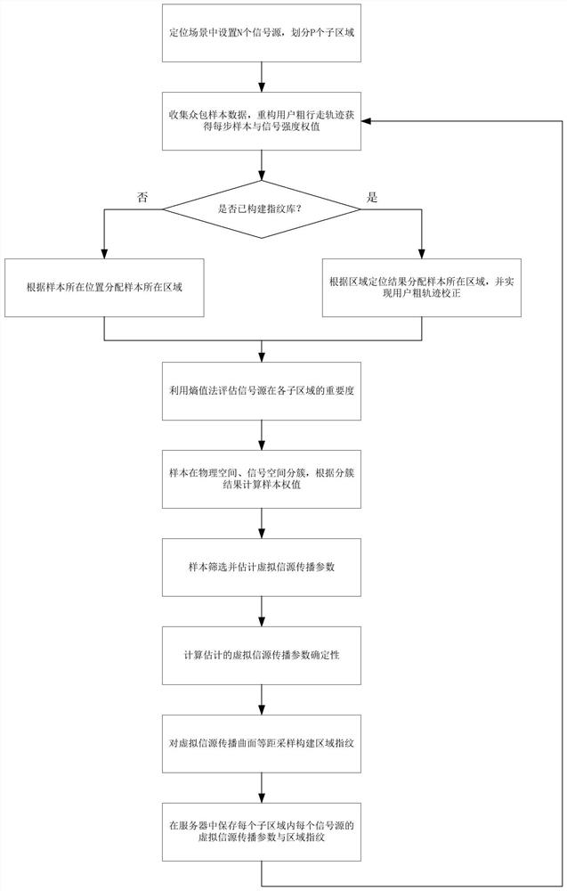
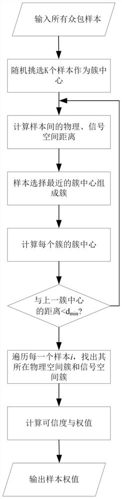
[0129] Such as Figure 4 As shown, the scene in Embodiment 1 of the present invention can be divided into three sub-areas according to whether there is obvious wall occlusion, including straight corridors at both ends and a square area in the center of the target area. The central square area has hollow railings instead of solid walls, so it can be divided into an open sub-area. The straight corridors at both ends are 29.7m long and 2.4m wide, and the central square area is 15.6m long and 18m wide. N=492 signal sources can be measured in the scene, and the signal strength of at least one signal source can be received at any position in the scene. The number of physical space clusters and signal space clusters divided in each sub-area is 49 (straight corridors at both ends) and 42 (central square area) respectively.
[0130] Use Mi 6 smart phone as the terminal to measure the signal strength. The sampling data is divided into two parts, one is dynamic walking sampling data, ...
PUM
 Abstract
Description
Claims
Application Information
 - Generate Ideas
- Intellectual Property
- Life Sciences
- Materials
- Tech Scout
- Unparalleled Data Quality
- Higher Quality Content
- 60% Fewer Hallucinations
Browse by: Latest US Patents, China's latest patents, Technical Efficacy Thesaurus, Application Domain, Technology Topic, Popular Technical Reports.
© 2025 PatSnap. All rights reserved.Legal|Privacy policy|Modern Slavery Act Transparency Statement|Sitemap|About US| Contact US: help@patsnap.com