Region-oriented offline map creation and location method
A technology of offline maps and positioning methods, applied in maps/plans/charts, special data processing applications, instruments, etc.
- Summary
- Abstract
- Description
- Claims
- Application Information
AI Technical Summary
Problems solved by technology
Method used
Image
Examples
Embodiment Construction
[0025] The present invention will be further described below in conjunction with accompanying drawing.
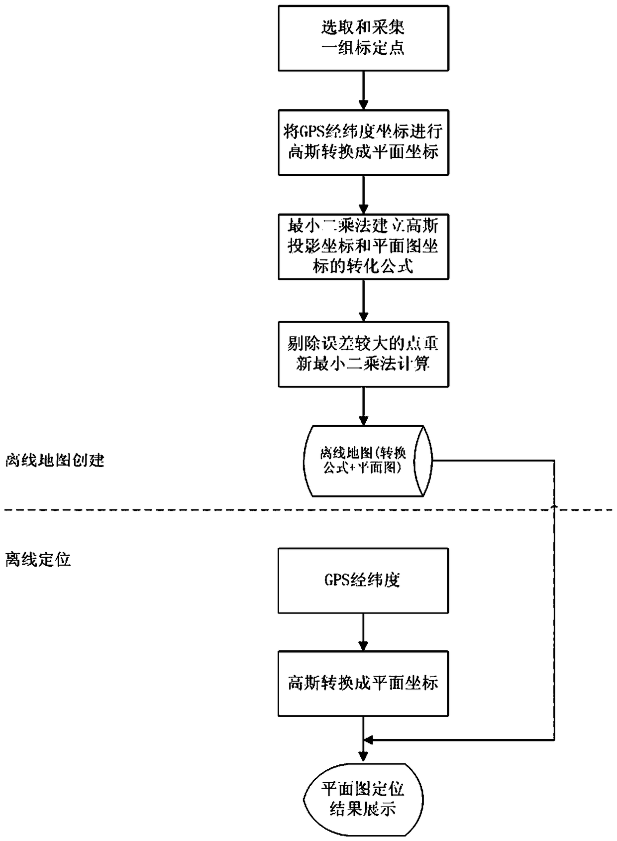
[0026] Such as figure 1 As shown, the region-oriented offline map creation and positioning method of the present invention selects a group of calibration points, that is, the pixel points of the regional plan and the GPS latitude and longitude information collected near the actual position of the corresponding pixel, aiming at the transformation of the latitude and longitude information and the plan , using Gaussian projection transformation and least square method to realize their transformation relationship.
[0027] Specific steps are as follows:
[0028] 1. Calibration
[0029] 1) Randomly select several eye-catching locations on the electronic plan, and record their pixel coordinates;
[0030] 2) Use a terminal device with a GPS module to collect the latitude and longitude information of the above-mentioned corresponding positions, and establish the corresponding re...
PUM
 Abstract
Description
Claims
Application Information
 - R&D
- Intellectual Property
- Life Sciences
- Materials
- Tech Scout
- Unparalleled Data Quality
- Higher Quality Content
- 60% Fewer Hallucinations
Browse by: Latest US Patents, China's latest patents, Technical Efficacy Thesaurus, Application Domain, Technology Topic, Popular Technical Reports.
© 2025 PatSnap. All rights reserved.Legal|Privacy policy|Modern Slavery Act Transparency Statement|Sitemap|About US| Contact US: help@patsnap.com

