National land space resource real-time dynamic intelligent survey monitoring device
A space resource, real-time dynamic technology, applied in the field of geographic information, can solve the problem of consuming a lot of manpower and material resources
- Summary
- Abstract
- Description
- Claims
- Application Information
AI Technical Summary
Problems solved by technology
Method used
Image
Examples
Embodiment 1
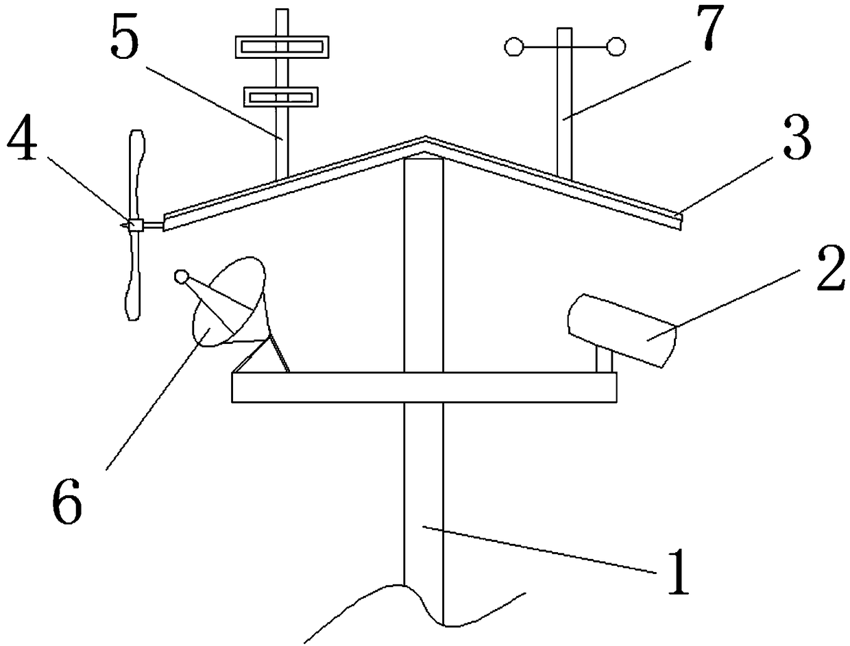
[0027] A real-time dynamic intelligent investigation and monitoring equipment for land and space resources, such as figure 1 As shown, it includes a pole 1 and a monitoring device 2 arranged on the pole 1. A processor for processing information of the monitoring device 2 is also arranged on the pole 1, and the monitoring device 2 is connected to the processor.
[0028] Through the real-time dynamic intelligent investigation and monitoring equipment for land and space resources of the above structure, its monitoring device 2 can monitor the growth and decline information of vegetation near the monitoring point, the activities of wild animals, the habitat of birds, and the protection of farmland at the base , forest fires, geological disasters, river water resources, and environmental pollution, etc., and the information is processed by the processor to form a statistical table, which can visually display the surveyed data, thereby reducing the need for investigations such as "cl...
Embodiment 2
[0044] As a further optimization of the above embodiment, the real-time dynamic intelligent survey and monitoring equipment for land and space resources also includes an anemometer 7, which is arranged on the pole 1; the value of the instantaneous wind speed can be detected by the anemometer 7.
[0045] Optimally, the pole 1 is provided with a humidity sensor, which can be used to detect the humidity in the air at the monitoring point, and record the humidity information, so as to facilitate the collection of investigators.
[0046] Optimally, the pole 1 is also provided with a rain sensor, which can detect the rainfall information at the monitoring point, and record the rainfall information, so as to facilitate the collection of investigators.
[0047] Optimally, the above-mentioned monitoring device 2 includes a high-definition camera and a far-infrared thermal imager, through which the high-definition camera and infrared imager can better detect the information of the animal...
PUM
 Abstract
Description
Claims
Application Information
 - R&D
- Intellectual Property
- Life Sciences
- Materials
- Tech Scout
- Unparalleled Data Quality
- Higher Quality Content
- 60% Fewer Hallucinations
Browse by: Latest US Patents, China's latest patents, Technical Efficacy Thesaurus, Application Domain, Technology Topic, Popular Technical Reports.
© 2025 PatSnap. All rights reserved.Legal|Privacy policy|Modern Slavery Act Transparency Statement|Sitemap|About US| Contact US: help@patsnap.com

