Method for automatically generating dual line network by GIS single line network
A technology of automatic generation and line network, applied in the field of GIS road network, can solve the problems of long cycle, high production cost, limited road network production efficiency, etc., and achieve the effect of low cost and short cycle
- Summary
- Abstract
- Description
- Claims
- Application Information
AI Technical Summary
Problems solved by technology
Method used
Image

Examples
Embodiment
[0043] The present invention adopts the GIS road data of the single-line network model, and completes the automatic production of the two-line road data through certain data processing.
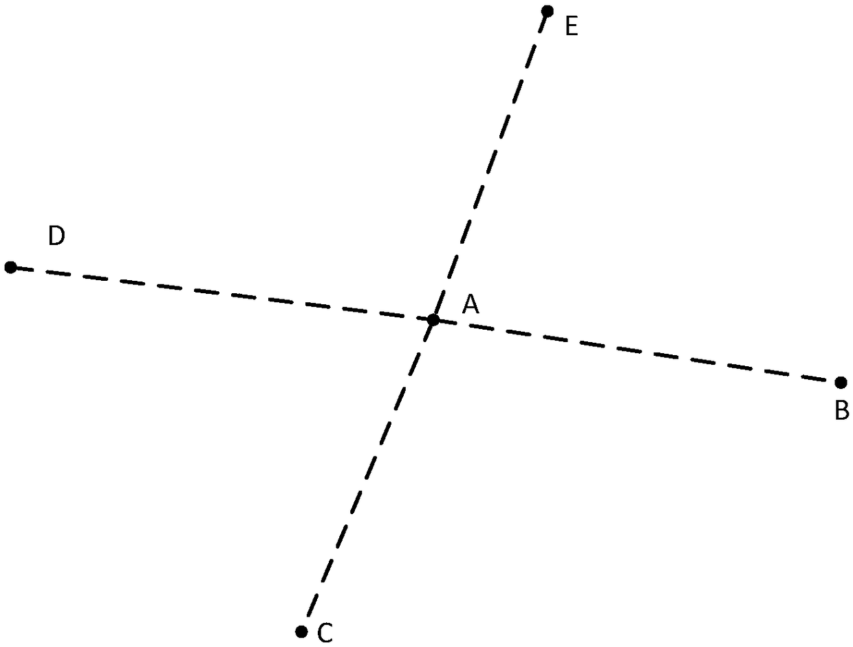
[0044] Single-line dual-attribute road data mainly includes the node layer (Point type) and road network layer (Polyline) of the single-line network. The node layer needs to contain the node ID field and the coordinate field. The id field is used to mark the distance between different nodes. number difference. The coordinate field identifies the location of the node; see figure 1 For A, B, C, and D nodes in , the road network layer needs to contain four fields: the number of forward lanes (CDS), the number of reverse lanes (RCDS), the starting node ID, and the ending node ID. Among them, there is an association relationship between the starting node ID, the ending node ID and the ID field of the node layer. See figure 1 AB, AC, AD, AE road sections in .
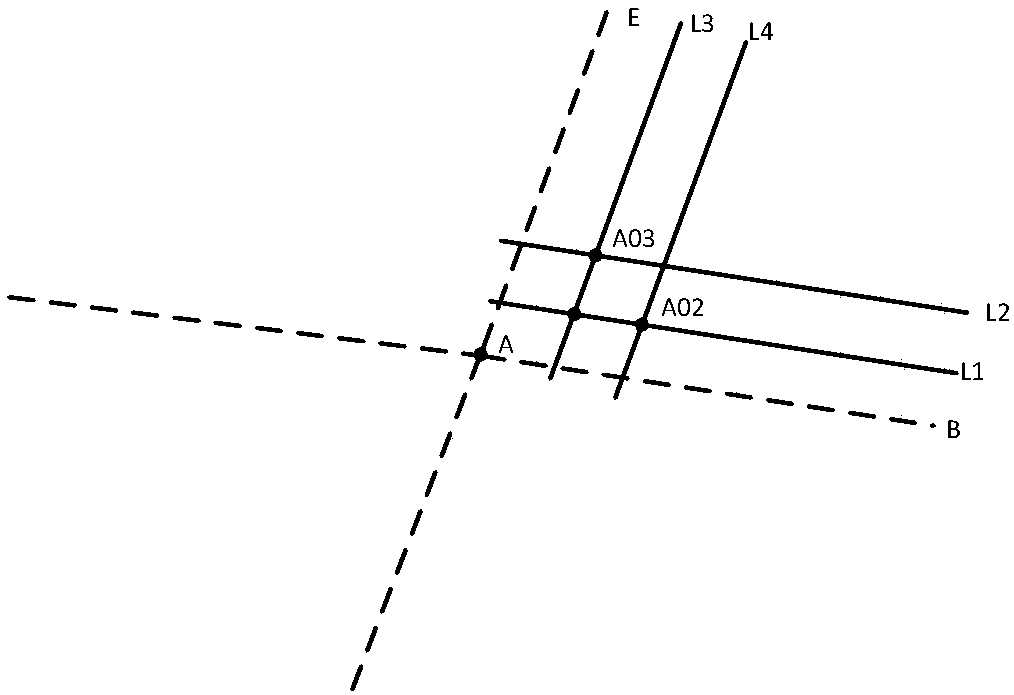
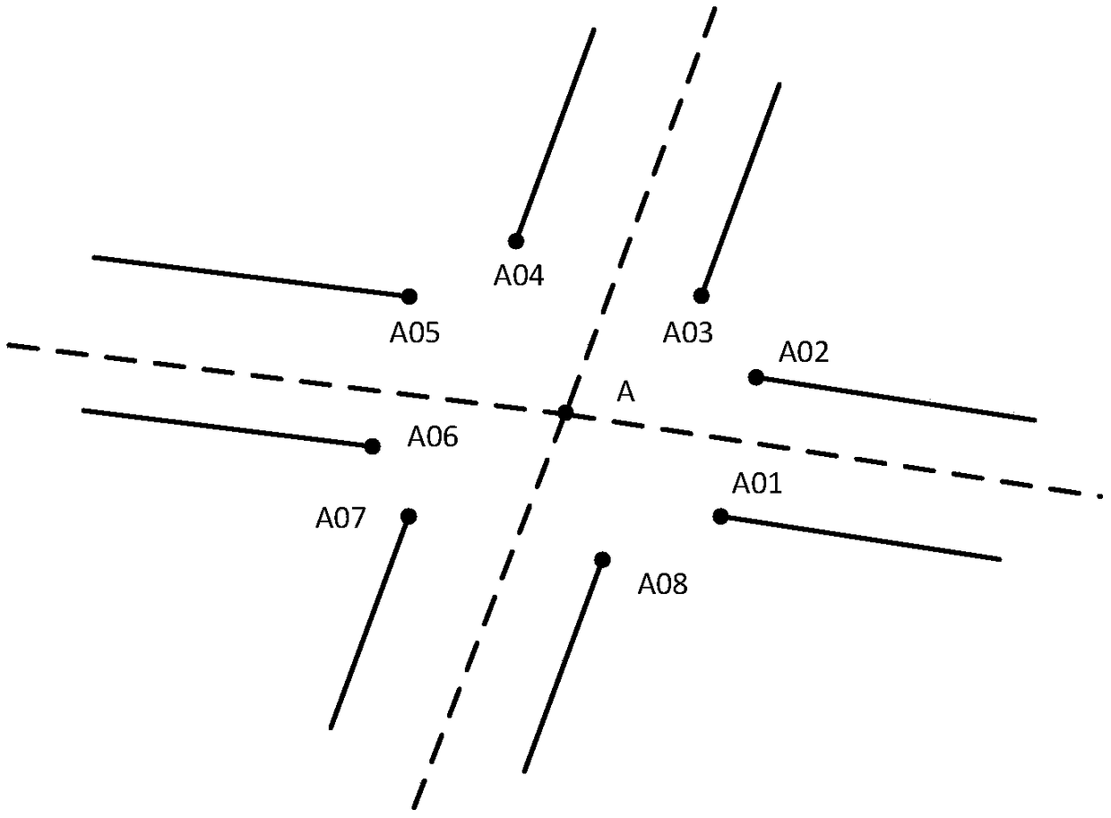
[0045] Concrete method of the pre...
PUM
 Abstract
Description
Claims
Application Information