Supercharge Your Innovation With Domain-Expert AI Agents!

Video quick invocation method based on GIS map

A GIS map and video technology, applied in the field of GIS video processing, can solve the problems of difficulty, prolong the map loading time and the speed of video calling, and achieve the effect of improving the viewing efficiency.

Inactive Publication Date: 2019-03-08
北京京航计算通讯研究所
View PDF2 Cites 2 Cited by
  • Summary
  • Abstract
  • Description
  • Claims
  • Application Information

AI Technical Summary

Problems solved by technology

However, in the GIS system, the video content is a huge information group. This method of calling greatly prolongs the loading time of the map and the speed of video calling, making it difficult for users to view or classify the video content. are quite large, and how to manage or view the video content in the GIS system has become a major problem in this field

Method used


Image

  • Video quick invocation method based on GIS map

Examples


Embodiment 1

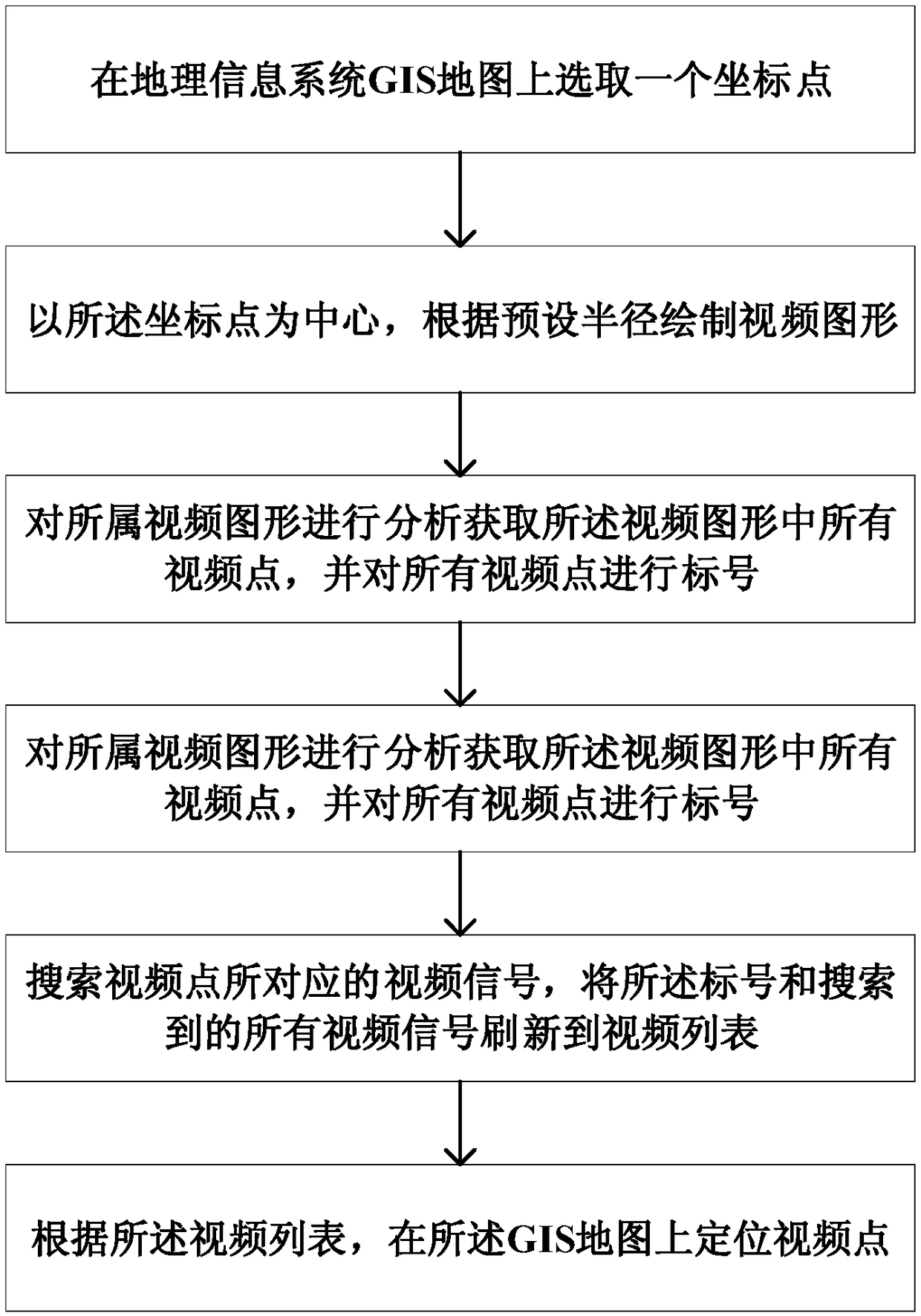
[0069] This embodiment provides a method for viewing video points based on a GIS map, which can quickly locate and search for video points on the GIS map, and improve the viewing rate of video points.

[0070] In the embodiment of the present invention, the video processing system based on the GIS map may be a pan-tilt control system, and the pan-tilt control system is bound with the camera. The embodiment of the present invention can not only quickly locate and search the dynamic video points being monitored, but also quickly locate and identify historical video points, and then group and display the located video points to improve the viewing efficiency of video points. Easy to manage video.

[0071] see figure 1 , figure 1 It is a basic flowchart of a method for viewing video points based on a GIS map provided by an embodiment of the present invention. Such as figure 1 As shown, a video point viewing method based on G1S map, including:

[0072] Step 1: Select coordinat...


PUM


Abstract

The invention belongs to the technical field of GIS video processing, in particular to a video quick invocation method based on a GIS map, which is used for quickly and accurately positioning video points and improving the efficiency of viewing and managing video. The method comprises the following steps of selecting a coordinate point on a GIS map of a geographical information system; taking thecoordinate point as a center, drawing a video graph according to a preset radius; obtaining all video points in the video graphics by analyzing the video graphics, and labeling all video points; searching a video signal corresponding to a video point, refreshing the label and all the searched video signals into a video list; locating a video point on the GIS map according to the video list. The method can quickly view the required video, and improves the viewing efficiency.

Description

technical field [0001] The invention belongs to the technical field of GIS video processing, and in particular relates to a method for quickly invoking video based on a GIS map. Background technique [0002] At present, the mature GIS map-based video calling method in the market is: input the coordinates and video information of video points into the system, and then mark and display according to the coordinate information. However, in the GIS system, the video content is a huge information group. This method of calling greatly prolongs the loading time of the map and the speed of video calling, making it difficult for users to view or classify the video content. are quite large, and how to manage or view the video content in the GIS system has become a major problem in this field. Contents of the invention [0003] (1) Technical problems to be solved [0004] The technical problem to be solved by the present invention is: how to provide a method for viewing video points...

Claims


Application Information

Patent Timeline
Patent Type & Authority Applications(China)
IPC IPC(8): G06F16/70G06F16/29H04N7/18
CPCH04N7/18
Inventor 李义龙高亮张文博初奇黄琰尹春于冶李淼陈浩刘晖赵新哲
Owner 北京京航计算通讯研究所
Features
  • R&D
  • Intellectual Property
  • Life Sciences
  • Materials
  • Tech Scout
  • Unparalleled Data Quality
  • Higher Quality Content
  • 60% Fewer Hallucinations
Learn More