Grid inertial navigation method without longitude updating in polar region

A technology of inertial navigation and grid, which is applied in the direction of navigation, measuring devices, instruments, etc. through speed/acceleration measurement. It can solve the problems that affect the navigation performance and cannot fully adapt to the application environment, so as to achieve high engineering application value and restrain inertial navigation. The effect of system performance degradation

Inactive Publication Date: 2019-09-03
HARBIN ENG UNIV
View PDF4 Cites 4 Cited by
  • Summary
  • Abstract
  • Description
  • Claims
  • Application Information

AI Technical Summary

Problems solved by technology

However, in the existing grid inertial navigation method, the longitude information still participates in the navigation calculation, which will inevitably introduce the enlarged longitude error into the navigation system and affect the navigation performance
To sum up, the existing navigation methods cannot fully adapt to the special application environment in polar regions

Method used


Image

  • Grid inertial navigation method without longitude updating in polar region
  • Grid inertial navigation method without longitude updating in polar region
  • Grid inertial navigation method without longitude updating in polar region

Examples


Embodiment Construction

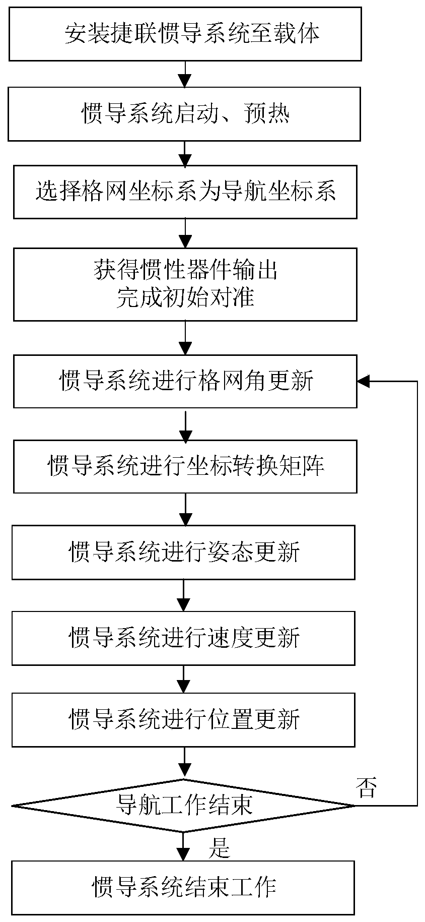
[0047] The present invention will be further described in detail below in conjunction with the accompanying drawings and specific embodiments.

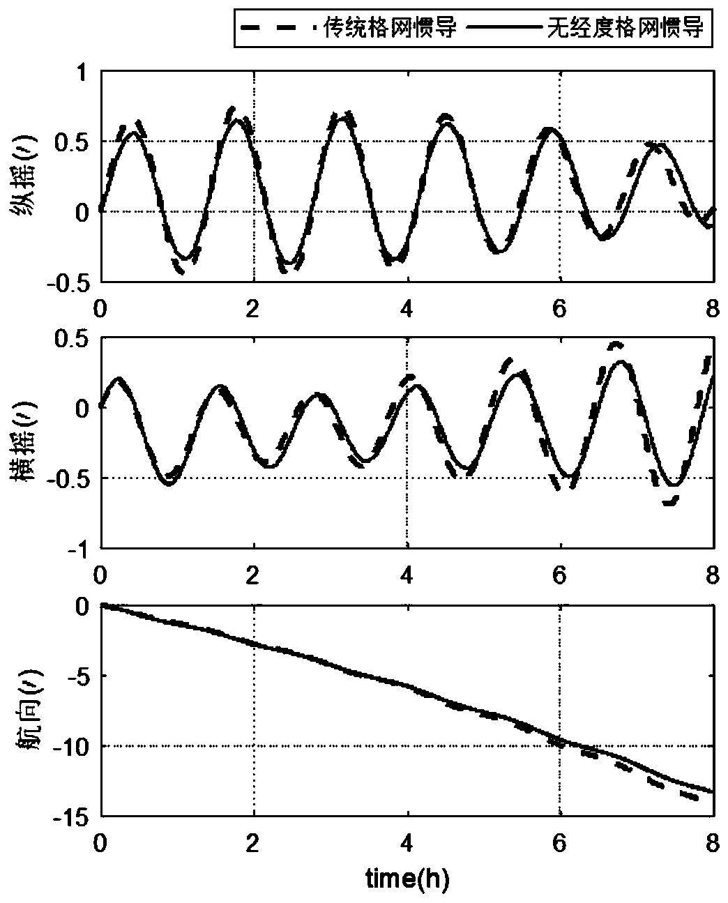
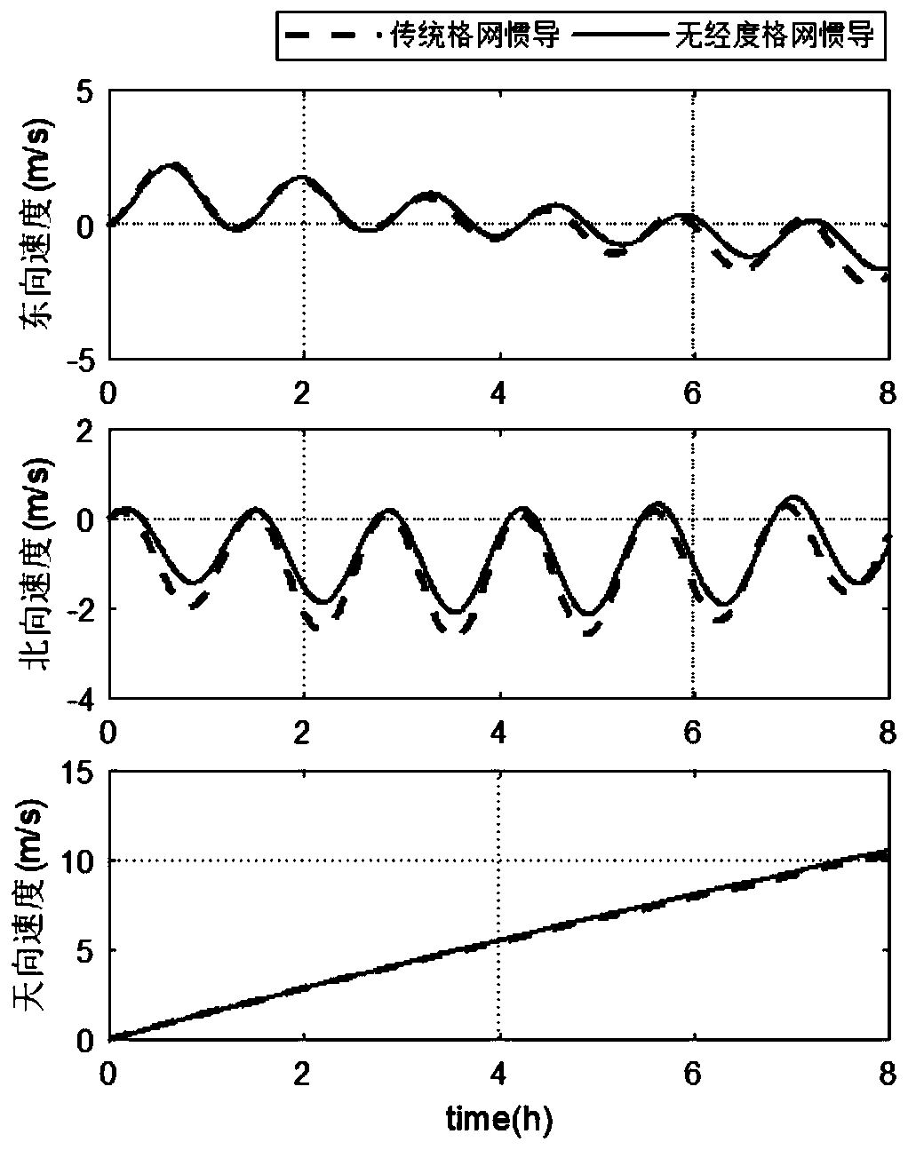
[0048] The invention discloses a grid inertial navigation method without longitude update in polar regions. In this method, the grid coordinate system is used as the navigation coordinate system, and the position coordinates in the earth-centered and ground-fixed coordinate system are used to represent the position of the vehicle. An inertial navigation method is proposed in which the longitude positioning information does not participate in the navigation update at all, effectively eliminating the polar meridian The longitude error amplification caused by convergence brings error amplification to the inertial navigation system, achieving the purpose of real-time, continuous, and long-term autonomous navigation in polar regions. This method not only solves the positioning error amplification caused by the longitude error amplification...


PUM


Abstract

The invention provides a grid inertial navigation method without longitude updating in a polar region. The method uses a grid coordinate system as a navigation coordinate system, the position of a carrier is represented by the position coordinates in an earth centered earth fixed coordinate system, an inertial navigation method with longitude positioning information completely not participating innavigation updating is put forward, the phenomenon that longitude error amplification caused by convergence of the longitude in the polar region results in error amplification to the inertial navigation system can be effectively eliminated, and the purpose of autonomous navigation in the polar region in the case of real-time, continuous and long voyage is achieved. The method solves the positioning error amplification caused by longitude error amplification and can also effectively avoid the influences of the longitude error amplification on the navigation performance of the inertial navigation system and can better guarantee the performance of the navigation system.

Description

technical field [0001] The invention relates to a grid inertial navigation method in polar regions, in particular to a grid inertial navigation method without longitude update in polar regions. Background technique [0002] High-precision navigation technology is an important prerequisite for the vehicle to work and sail safely in the polar region. The inertial navigation system has become one of the necessary navigation equipment for marine vehicles due to its autonomy, concealment and information integrity. However, the polar region vehicle’s The inertial navigation system faces two major problems. One is the orientation problem caused by the convergence of the meridians, and it is difficult to find the north direction in the polar region; the other is the positioning problem caused by the convergence of the meridians. The longitude error is seriously enlarged due to the convergence of the meridians. In order to solve the orientation problem, the grid inertial navigation s...

Claims


Application Information

Patent Timeline
Patent Type & Authority Applications(China)
IPC IPC(8): G01C21/18G01C25/00
CPCG01C21/18G01C25/005
Inventor 赵琳康瑛瑶程建华赵砚驰杨逸潼董萍程思翔
Owner HARBIN ENG UNIV
Why Eureka
Try Eureka