Navigation route processing method, device and equipment

A technology for navigation routes and processing methods, which is applied in directions such as navigation, measuring devices, mapping and navigation, and can solve problems such as non-compliance with user driving habits and inconsistency of driving routes.

Active Publication Date: 2019-12-17
BAIDU ONLINE NETWORK TECH (BEIJIBG) CO LTD
View PDF14 Cites 13 Cited by
  • Summary
  • Abstract
  • Description
  • Claims
  • Application Information

AI Technical Summary

Problems solved by technology

[0005] The present invention provides a navigation route processing method, device and equipment to solve the problem in the prior art that the driving route corresponding to the induced arrow on the enlarged intersection map does not match the user's actual driving route and does not conform to the user's driving habits

Method used


Image

  • Navigation route processing method, device and equipment
  • Navigation route processing method, device and equipment
  • Navigation route processing method, device and equipment

Examples


Embodiment 1

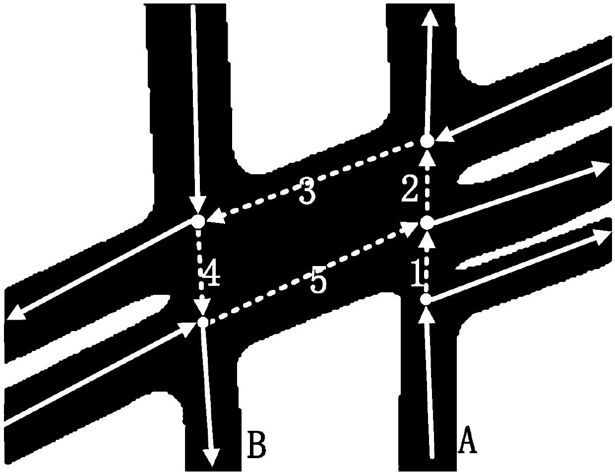
[0035] In a navigation electronic map, a road network may be composed of a plurality of connection points (intersections) and road segments between the connection points. The intersection of any two roads in a road network forms a connection point. A road segment refers to a straight road segment and a virtual road segment between any two adjacent connection points. The virtual road segment refers to the road segment in the intersection area; the straight road segment refers to the road segment in the non-intersection area, and the straight road segment does not include any intersection. In the map data, the data information of a road segment includes a plurality of shape points on the road segment, and the road segment can be represented by a link (linked list node). A route can be represented by a link sequence, and multiple links in the link sequence are arranged in the order of the corresponding road segments in the route.

[0036] image 3 A flowchart of a method for p...

Embodiment 2

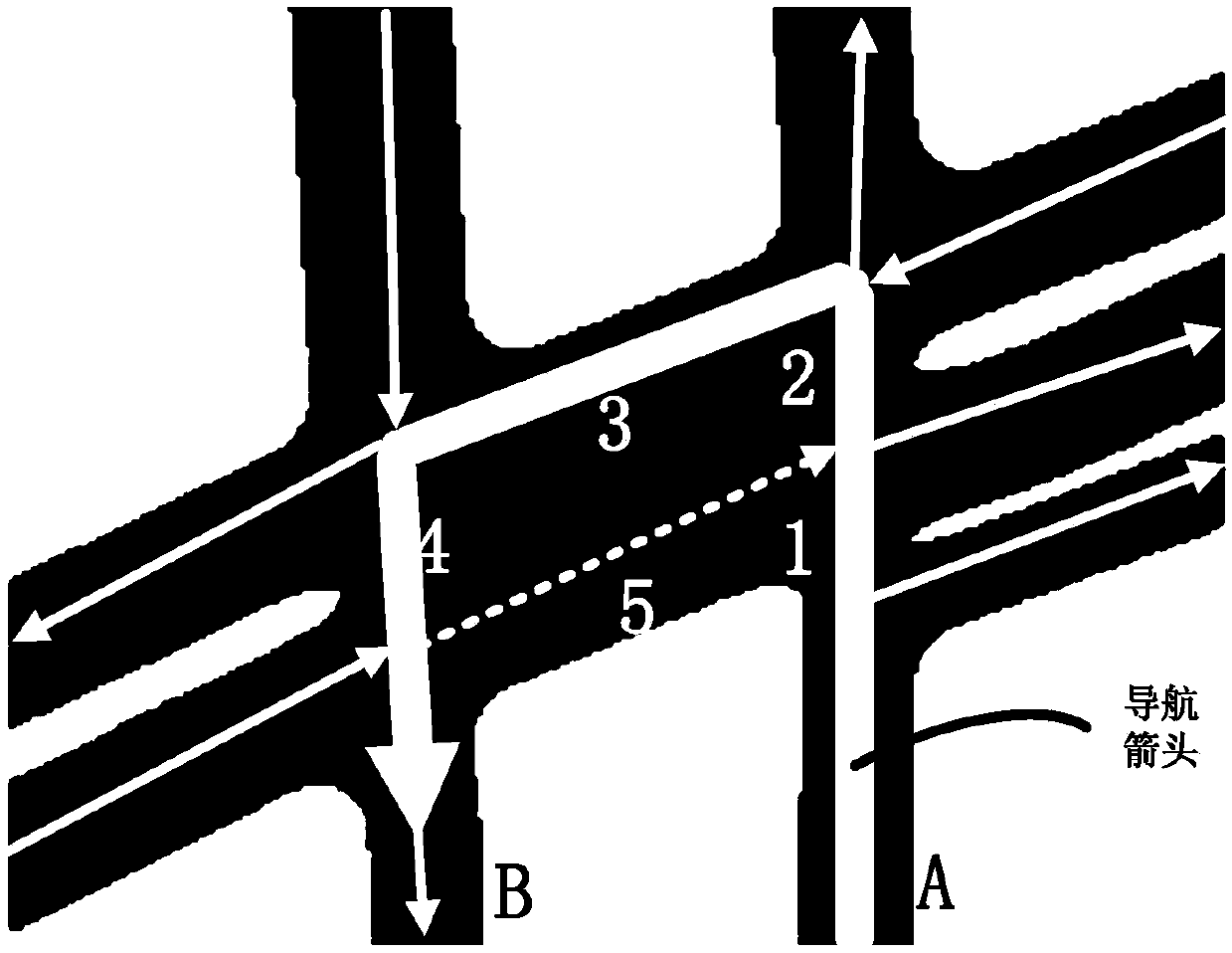
[0055] Figure 4 A flowchart of the navigation route processing method provided in Embodiment 2 of the present invention, Figure 5 is a schematic diagram of the center line of the driving lane provided in the second embodiment of the present invention, Image 6 This is a schematic diagram of a control point provided in Embodiment 2 of the present invention. On the basis of the above-mentioned first embodiment, in this embodiment, when traveling to the intersection, determining the entry shape point and the exit shape point of the navigation route on the intersection includes: obtaining the shape point of the guiding arrow corresponding to the intersection; Determine the link set that the guiding arrow passes through; determine the center line of the driving lane that the guiding arrow passes through according to the link set; truncate the driving lane center line, remove the part of the driving lane center line belonging to the intersection area in the intersection, and get ...

Embodiment 3

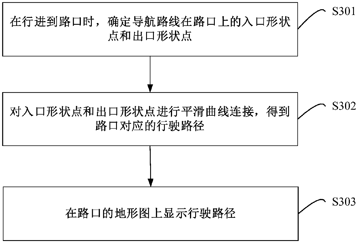
[0097] Figure 7 It is a schematic structural diagram of a navigation route processing apparatus provided in Embodiment 3 of the present invention. The navigation route processing apparatus provided by the embodiment of the present invention may execute the processing flow provided by the navigation route processing method embodiment. like Figure 7 As shown, the apparatus 70 includes: a determination module 701 , a curve generation module 702 and a display module 703 .

[0098] Specifically, the determining module 701 is configured to determine the entry shape point and the exit shape point of the navigation route on the intersection when traveling to the intersection.

[0099] The curve generation module 702 is used to connect the entrance shape point and the exit shape point with a smooth curve to obtain the driving path corresponding to the intersection.

[0100] The display module 703 is used to display the driving route on the topographic map of the intersection.

[...


PUM


Abstract

The invention provides a navigation route processing method, device and equipment. The method comprises the steps: determining an entrance shape point and an exit shape point of a navigation route atan intersection under the condition of moving to the intersection; carrying out smooth curve connection on the entrance shape point and the exit shape point to obtain a driving path corresponding to the intersection; and displaying the driving path on the topographic map of the intersection. According to the method, the entrance shape point and the exit shape point of the navigation route at the intersection are determined under the condition of moving to the intersection, the smooth curve connection is performed on the entrance shape point and the exit shape point to obtain the driving path corresponding to the intersection, and the driving path is displayed on the topographic map of the intersection. Since the driving-in road section and the driving-out road section of the navigation route at the intersection are connected directly by the smooth curve in the driving path and the driving path conforms to the actual driving route of the user to conform to the driving habit of the user,so that the user can quite easily recognize the driving way at the intersection.

Description

technical field [0001] The present invention relates to the technical field of electronic maps, and in particular, to a navigation route processing method, device and device. Background technique [0002] The road network is the most important geographical element in the application of intelligent transportation system and location service, and it is the skeleton of the whole navigation electronic map. The main purpose of the navigation electronic map is to complete the path planning through the road network, and provide navigation services to users on this basis. [0003] In a navigation electronic map, a road network may be composed of a plurality of connection points (intersections) and road segments between the connection points. The intersection of any two roads in a road network forms a connection point. A road segment refers to a straight road segment and a virtual road segment between any two adjacent connection points. The virtual road segment refers to the road ...

Claims


Application Information

Patent Timeline
Patent Type & Authority Applications(China)
IPC IPC(8): G01C21/36
CPCG01C21/3632
Inventor 孙晔邵胜均朱举章郭欣
Owner BAIDU ONLINE NETWORK TECH (BEIJIBG) CO LTD
Why Eureka
Try Eureka