Preprocessing optimization method for spatial line features of crowdsourcing fragment map

An optimization method and line feature technology, applied in the field of preprocessing optimization of spatial line features, can solve problems such as low accuracy of spatial line feature data

Pending Publication Date: 2020-05-26
WUHAN ZHONGHAITING DATA TECH CO LTD
View PDF7 Cites 3 Cited by
  • Summary
  • Abstract
  • Description
  • Claims
  • Application Information

AI Technical Summary

Problems solved by technology

[0004] Aiming at the technical problems existing in the prior art, the present invention provides a method for preprocessing and optimizing the spatial line characteri

Method used


Image

  • Preprocessing optimization method for spatial line features of crowdsourcing fragment map
  • Preprocessing optimization method for spatial line features of crowdsourcing fragment map
  • Preprocessing optimization method for spatial line features of crowdsourcing fragment map

Examples


Embodiment 1

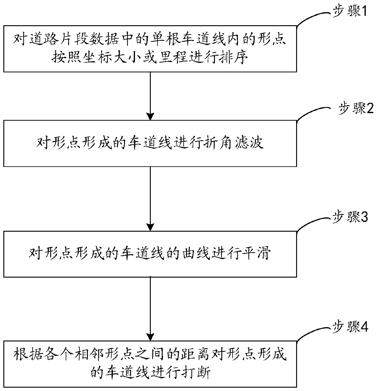
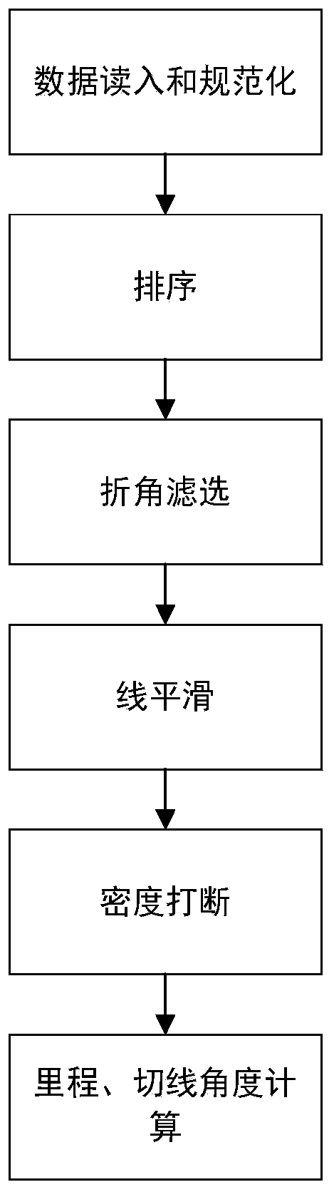
[0051] Embodiment 1 provided by the present invention is an embodiment of a method for preprocessing and optimizing spatial line features of a crowdsourced fragment map provided by the present invention, such as figure 2 Shown is a flow chart of an embodiment of a preprocessing optimization method for spatial line features of a crowdsourced fragment map provided by the present invention, consisting of figure 2 As can be seen, the embodiments of the optimization method include:

[0052] First, the data is read in and normalized. Data reading and normalization mainly deal with possible field missing and data loss situations in the data directly parsed from crowdsourcing collection vehicles, retain the fields required for subsequent fusion, and eliminate useless fields. A line that has only one, two or three points but is assigned a single line ID is deleted. Prevent calculation exceptions during subsequent processing, and remove lines with too small data volumes.

[0053] S...


PUM


Abstract

The invention relates to a preprocessing optimization method for spatial line features of a crowdsourcing fragment map. The preprocessing optimization method comprises the steps of sorting shape points in a single lane line in road fragment data according to coordinate sizes or mileage; performing bevel filtering on a lane line formed by the shape points; smoothing a curve of a lane line formed bythe shape points; and breaking the lane lines formed by the shape points according to the distances between the adjacent shape points. The method is used as a pre-process of a crowdsourcing fusion processing process to pre-process a fragmented map collected by crowdsourcing, so that the processed data meets the requirements of subsequent fusion optimization.

Description

technical field [0001] The invention relates to the field of high-precision maps, in particular to a method for preprocessing and optimizing spatial line features of crowdsourced fragment maps. Background technique [0002] In the field of autonomous driving, in order to accurately control the driving of vehicles, the drawing of high-precision maps is often involved. In the process of drawing high-precision maps, the lane alignment point data of the road surface is needed to provide lane-level driving guidance for autonomous vehicles. [0003] High-precision maps can be drawn after long-term data collection using expensive surveying and mapping vehicles, but due to high costs, long collection cycles, and slow updates, it is difficult to meet the high freshness requirements of high-precision maps. Compared with high-precision surveying and mapping vehicles, the cost of crowdsourcing collection vehicles is lower, and it is more suitable for extensive deployment to collect high...

Claims


Application Information

Patent Timeline
IPC IPC(8): G05D1/02
CPCG05D1/0202G05D2201/02
Inventor 朱紫威秦峰肖德雨尹玉成刘奋
Owner WUHAN ZHONGHAITING DATA TECH CO LTD
Why Eureka
Try Eureka