Airborne laser point cloud processing method based on variable resolution voxel grid

An airborne laser and processing method technology, applied in the field of remote sensing surveying and mapping, can solve problems such as complex scenes and occlusions, and achieve the effects of improving robustness, high data processing speed, and small memory usage

Active Publication Date: 2021-11-02
WUHAN UNIV
View PDF5 Cites 0 Cited by
  • Summary
  • Abstract
  • Description
  • Claims
  • Application Information

AI Technical Summary

Problems solved by technology

However, based on the existing research methods, point cloud data preprocessing is still in the exploratory stage, mainly because of the variety of point clouds (different point cloud spatial distribution, such as uneven density), the complexity of the scene (the types of scanned data and objects) Various: such as houses, dense forests, artificial ground objects, etc.) and severe occlusion lead to

Method used


Image

  • Airborne laser point cloud processing method based on variable resolution voxel grid
  • Airborne laser point cloud processing method based on variable resolution voxel grid
  • Airborne laser point cloud processing method based on variable resolution voxel grid

Examples


Embodiment Construction

[0043] The method provided by the present invention will be further described below in conjunction with the accompanying drawings.

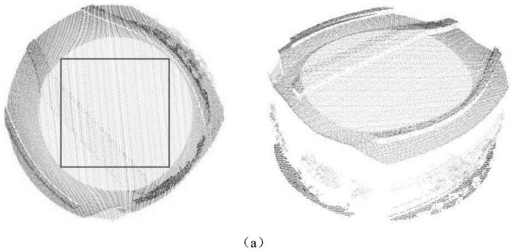
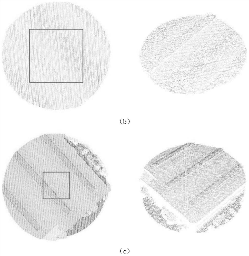
[0044] The embodiment of the present invention provides an airborne laser point cloud data compression method, which specifically includes the following steps:

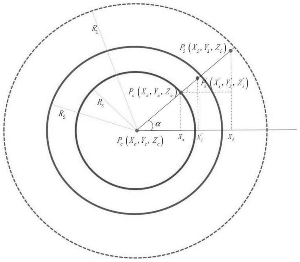
[0045] Step 1, point cloud input and block: read in the original point cloud data, and use the sliding window method to block the point cloud. The purpose of partitioning the input point cloud based on the sliding window is to divide the data whose original range is too large into target processing units that cover enough spatial information.

[0046] Read in the original airborne laser point cloud data, and use the sliding window algorithm to divide the point cloud into blocks. Assume that the geographical space occupied by the point cloud in the horizontal direction is X, Y, the sliding step size is s, the size of the interception window is w×h, and the minimum horizontal coordinates ...


PUM


Abstract

The invention relates to an airborne laser point cloud processing method and application based on a variable resolution voxel grid. First of all, the variable resolution point cloud compression algorithm of the present invention can compress the original laser point cloud into a variable resolution point cloud, and the variable resolution voxel grid obtained based on the regular grid of the variable resolution point cloud can cover more The large plane range can ensure a high resolution in the central area, so that the processing of different terrain scenes can meet the different requirements of the plane coverage and resolution of the voxel grid at the same time. Secondly, in order to be able to handle larger voxel grids and adopt a larger basic network structure, the present invention builds a three-dimensional semantic segmentation network with encoding-decoding structure based on subflow sparse convolution. The network has high data processing speed and small video memory occupation. The variable resolution voxel grid can flexibly deal with different terrain scenarios and effectively improve the robustness of the point cloud classification model.

Description

technical field [0001] The invention relates to the field of remote sensing surveying and mapping, in particular to an airborne laser point cloud data processing method. Background technique [0002] As an important part of the smart earth, 3D geographic data has always been the focus of research in the field of photogrammetry and remote sensing for its rapid acquisition technology and data post-processing methods. As a real-time, fast and active measurement method, laser scanning technology can obtain high-precision 3D point cloud and auxiliary physical properties of the measured target all day, and at the same time, it can obtain the occluded area through the vegetation gap. three-dimensional information. Research on point cloud data compression methods has been an important research topic in the past two decades. Many classic and effective preprocessing algorithms have been used to realize point cloud data preprocessing, such as projection transformation and voxel divisi...

Claims


Application Information

Patent Timeline
Patent Type & Authority Patents(China)
IPC IPC(8): G06T3/40G06K9/62G06N3/02
CPCG06T3/4092G06T3/4038G06N3/02G06F18/24
Inventor 胡翔云张津铭秦楠楠
Owner WUHAN UNIV
Why Eureka
Try Eureka