

River runoff monitoring system and method for remote sensing hydrological station
A technology for hydrological stations and rivers, applied in image data processing, instruments, calculations, etc., can solve problems such as difficult to obtain, not widely used, and low data accuracy
- Summary
- Abstract
- Description
- Claims
- Application Information
AI Technical Summary
Problems solved by technology
Method used
Image

Examples
Embodiment Construction
[0041] Embodiments of the present invention are described in detail below, examples of which are shown in the drawings, wherein the same or similar reference numerals designate the same or similar elements or elements having the same or similar functions throughout. The embodiments described below by referring to the figures are exemplary and are intended to explain the present invention and should not be construed as limiting the present invention.
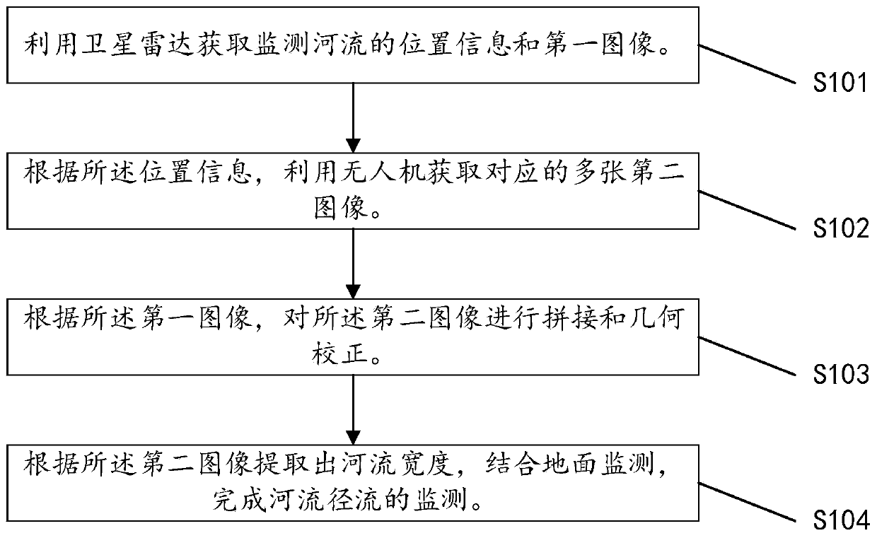
[0042] see figure 1 , the invention provides a method for monitoring river runoff at a remote sensing hydrological station, comprising:
[0043] S101. Obtain location information and a first image of a monitored river by using satellite radar.
[0044] Specifically, based on the river basin to be measured, first use satellite radar to obtain the location information of the measured river, and intercept the corresponding satellite image of the measured river, then convert the image into a grayscale image and perform filtering pro...
PUM
 Abstract
Description
Claims
Application Information