Beidou No.3 inter-satellite link data uplink and downlink visualization method

An inter-satellite link and Beidou technology, applied in the field of uplink and downlink visualization of Beidou-3 inter-satellite link data, can solve the problem of not being able to directly obtain the downlink path and remote control uplink path of Beidou-3 constellation telemetry data

Active Publication Date: 2020-09-01
CHINA XIAN SATELLITE CONTROL CENT
View PDF1 Cites 2 Cited by
  • Summary
  • Abstract
  • Description
  • Claims
  • Application Information

AI Technical Summary

Problems solved by technology

[0003] The BDS-3 inter-satellite link agile network planning generates a huge amount of link building data. The data is displaye

Method used


Image

  • Beidou No.3 inter-satellite link data uplink and downlink visualization method
  • Beidou No.3 inter-satellite link data uplink and downlink visualization method
  • Beidou No.3 inter-satellite link data uplink and downlink visualization method

Examples


Embodiment Construction

[0109] The present invention will be described in detail below in conjunction with the accompanying drawings and specific embodiments.

[0110] The present invention is a method for visualizing the uplink and downlink data of the Beidou-3 inter-satellite link, which is specifically implemented according to the following steps:

[0111] (1) Obtain the BDS-3 inter-satellite link network data, that is, obtain the satellite node list, obtain the Ka station list and obtain the link list, as follows:

[0112] Obtain satellite node list Node=[n 1 ,n 2 ,n 3 ,...,n o ], any node n i ∈ Node, i ∈ [1,2,...,o], n i Indicates the satellite code, such as BD3001, o indicates the number of satellites, where o≥1;

[0113] Obtain Ka station list Ka=[ka 1 ,ka 2 ,...,ka q ], any node ka i ∈ Ka, i ∈ [1,2,...,p], ka i Indicates the Ka station code, such as KA0001; where q indicates the number of Ka stations, where q≥1;

[0114] get list of links Link = [l 1 , l 2 ....l p ], where p re...


PUM


Abstract

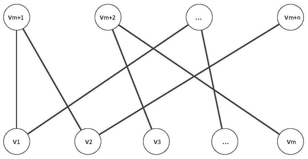
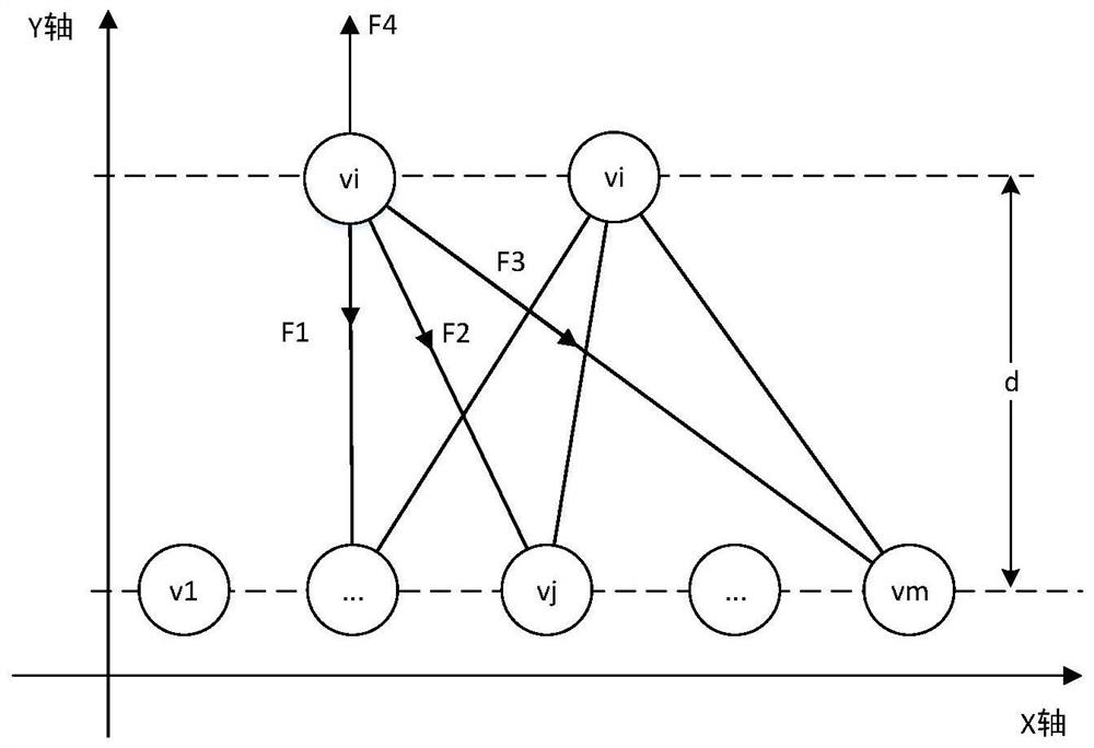
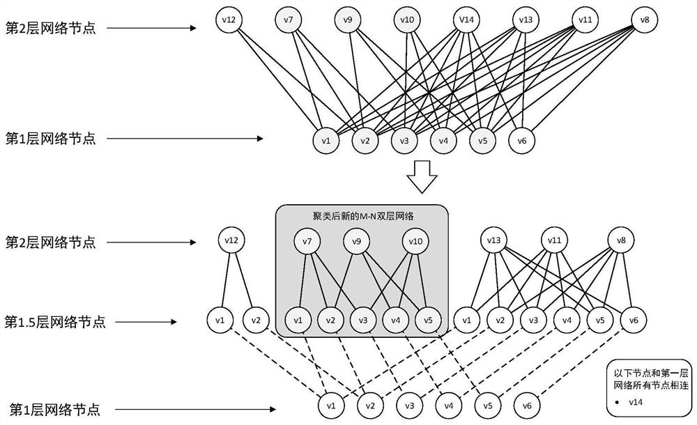
The invention discloses a Beidou No.3 inter-satellite link data uplink and downlink visualization method. The method comprises the following steps: (1) acquiring Beidou No.3 inter-satellite link network data; (2) acquiring the height and the width of a visual area; (3) calculating a key satellite node list; (4) calculating a common satellite node list; (5) deleting redundant links and updating a link list; (6) combining the common satellite nodes with the same link condition, and updating a common satellite node list and a link list; (7) establishing a visual coordinate system; (8) calculatingkey satellite node coordinates; (9) calculating Ka station node coordinates; (10) calculating common satellite node coordinates; (11) drawing network nodes and edges according to results calculated in the steps (8), (9) and (10); and (12) completing Beidou No.3 inter-satellite link data uplink and downlink network layout visualization. According to the method, the agile network planning data is displayed through a visual means, and the network structure can be visually reflected.

Description

technical field [0001] The invention belongs to the field of inter-satellite links of satellite navigation systems, and in particular relates to a visualization method for uplink and downlink data of Beidou-3 inter-satellite links. Background technique [0002] Visualization technology uses people's powerful image processing ability to convert data into graphics, and intuitively represent data by mapping data into shapes, positions, and colors. Visualization technology can greatly help people understand data, discover data rules and hidden information. [0003] The BDS-3 inter-satellite link agile network planning generates a huge amount of link building data. The data is displayed in text, and users cannot directly obtain the BDS-3 constellation telemetry data downlink path and remote control uplink path. In view of this situation, a method for visualizing the uplink and downlink paths of Beidou-3 inter-satellite link data is invented. Through the hierarchical layout of th...

Claims


Application Information

Patent Timeline
IPC IPC(8): H04L12/24G06K9/62H04B7/185
CPCH04L41/22H04L41/12H04B7/1851H04B7/18521G06F18/23Y02D30/70
Inventor 马豪姜博张智斌张斌哲冯军华孔博许虎闫龙达石磊赵向文刘羽翔
Owner CHINA XIAN SATELLITE CONTROL CENT
Why Eureka
Try Eureka