Multi-objective constrained low-altitude unmanned aerial vehicle route planning design method

A design method and route planning technology, applied in multi-aircraft traffic management, unmanned aircraft, aircraft navigation/guidance tools, etc., can solve the problems of high real-time model requirements and high density of drones

Pending Publication Date: 2020-11-10
BEIHANG UNIV
View PDF6 Cites 6 Cited by
  • Summary
  • Abstract
  • Description
  • Claims
  • Application Information

AI Technical Summary

Problems solved by technology

Finally, the density of drones is high, and the dynamic changes are significant. The real-time requirements for the model are relatively high, and the route network may need to be adjusted accordingly at different times.

Method used


Image

  • Multi-objective constrained low-altitude unmanned aerial vehicle route planning design method
  • Multi-objective constrained low-altitude unmanned aerial vehicle route planning design method
  • Multi-objective constrained low-altitude unmanned aerial vehicle route planning design method

Examples


Embodiment Construction

[0022] The present invention will be further described in detail below in conjunction with the accompanying drawings.

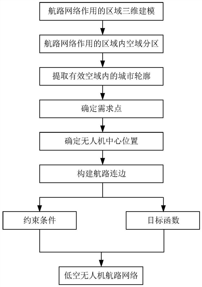
[0023] The route planning and design method of the low-altitude unmanned aerial vehicle with multi-objective constraints of the present invention, such as figure 1 Shown: The specific steps are:

[0024] Step 1: Determine the area where the route network acts, and perform 3D modeling of the area.

[0025] Step 2: Partition the airspace in the area determined in Step 1;

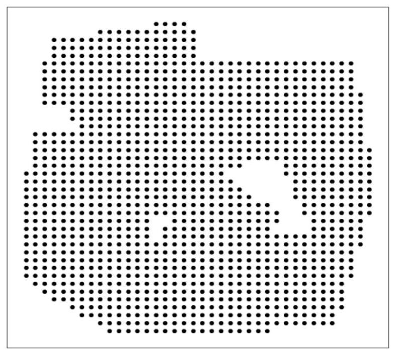
[0026] Since most urban areas have key areas such as hospitals and schools, in order to reduce the impact of drone flights and reduce the possibility of mid-air collisions, the airspace in this area is divided into free-flying airspace and restricted-flying airspace. Airspace and no-fly airspace, in which drones can fly freely in free-fly airspace, drones in restricted flight airspace can only fly along the established route, and drones in no-fly airspace are not allowed to fly. The above-...


PUM


Abstract

The invention discloses a multi-objective constrained low-altitude unmanned aerial vehicle route planning design method, and belongs to the technical field of civil aviation delay analysis. Firstly, an initial airway point and an airway network are set based on urban low-altitude requirements, then constraints such as conflict constraints, three-area constraints and passage requirement constraintsare introduced, and multi-objective function optimization such as airspace capacity, operation cost and operation safety is achieved by moving the airway point and reconstructing the airway network.Therefore, corresponding unmanned aerial vehicle low-altitude airway networks are designed for different low-altitude environments.

Description

technical field [0001] The invention belongs to the technical field of UAV route planning. It constructs waypoints and initial route network according to requirements, sets multiple constraint conditions, and realizes multi-objective function optimization by moving waypoints and reconstructing route network, and then designs UAV low-altitude route network. Background technique [0002] The relevant research on low-altitude UAVs in Xiaguan city in the UTM scenario mainly focuses on flight planning, while less on route network planning. Due to the continuity and complexity of the urban low-altitude airspace, in order to reduce the complexity, the current research on constructing the airspace environment mostly adopts the grid method (Grid) to establish the low-altitude UAV low-altitude flight airspace environment, and the grid representation maps 3D geographic information to In the grid, the airspace environment is first divided into grid blocks, and then according to the way...

Claims


Application Information

Patent Timeline
Patent Type & Authority Applications(China)
IPC IPC(8): G08G5/00
CPCG08G5/0034G08G5/0069G08G5/006G08G5/045B64C39/024G08G5/0013G08G5/0039G08G5/0043G08G5/04B64U2201/10
Inventor 曹先彬杜文博李思远张明远
Owner BEIHANG UNIV
Why Eureka
Try Eureka