System and method for enabling polygon geofence services on mobile devices
A geofence and polygon technology, applied in the direction of location information-based services, can solve problems such as limiting the shape of geofences
- Summary
- Abstract
- Description
- Claims
- Application Information
AI Technical Summary
Problems solved by technology
Method used
Image

Examples
Embodiment Construction
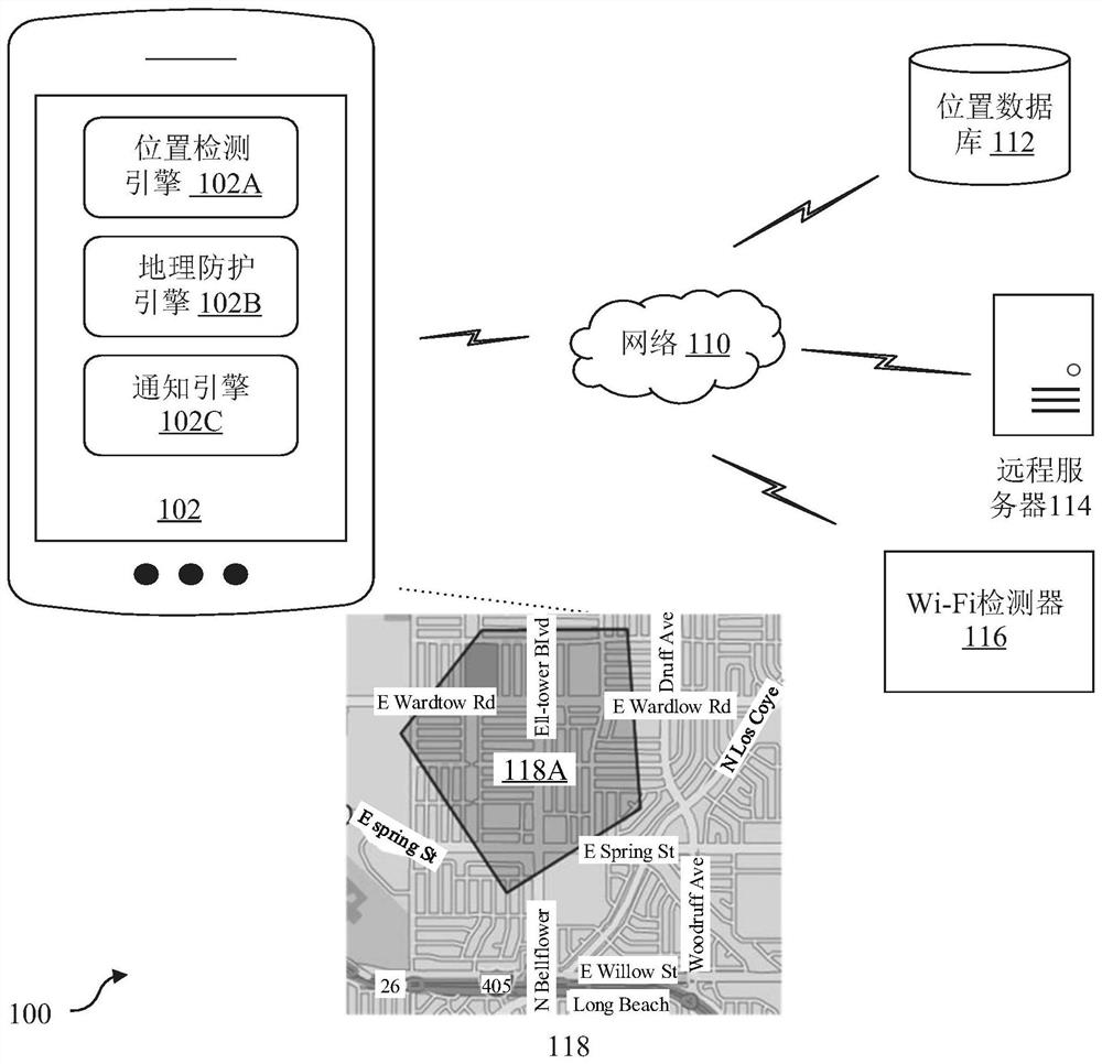
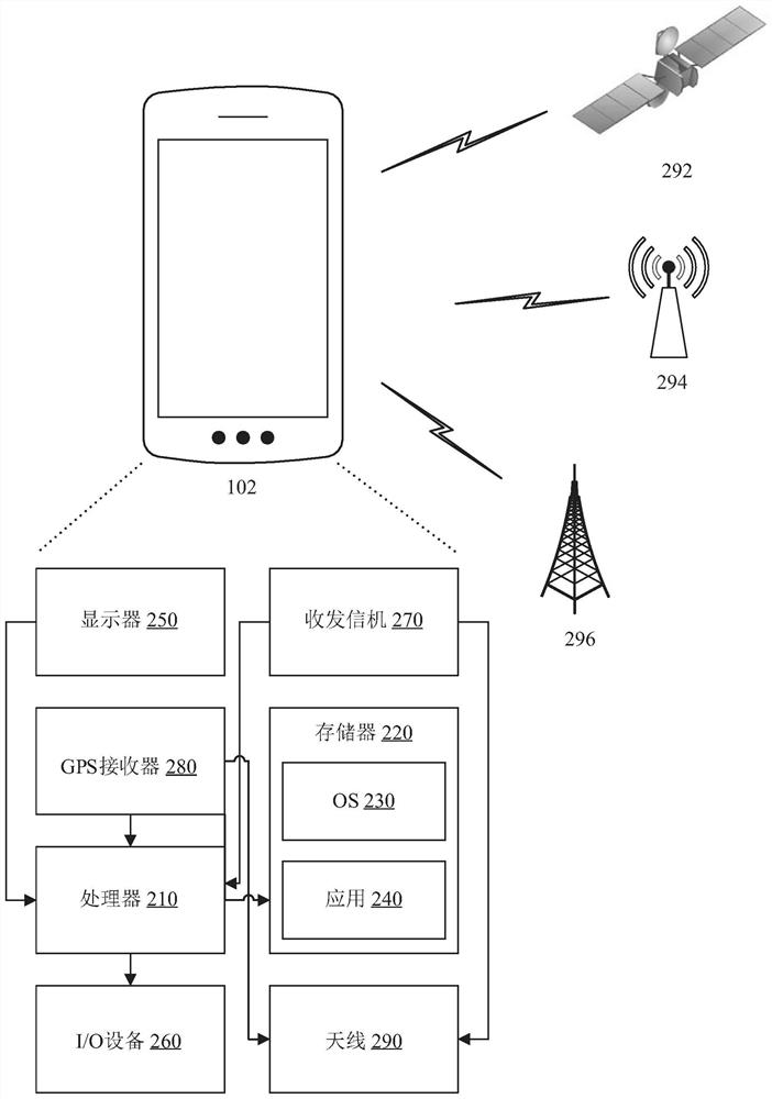
[0029] The invention is described below with reference to the accompanying drawings, which generally relate to location-based services and geo-fencing.
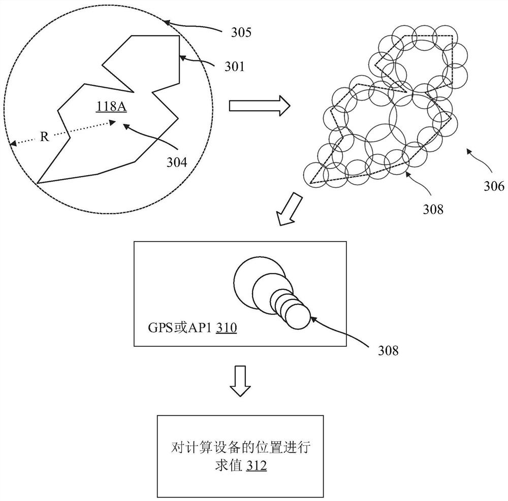
[0030] Geo-fencing is a technology used to monitor the movement of a computing device, such as a cell phone, within a geographic area and notify or alert the user of the device when the device enters or leaves the geographic area. A geofence defines the boundaries of said geographic area, such that the phone's location data can be compared to coordinates (such as latitude and longitude) of the geofence boundary or perimeter. The present invention solves the problem of accuracy when a mobile phone enters or leaves a geofence, and more specifically, provides a mechanism for determining when a mobile phone enters or leaves a polygonal geofence. In one embodiment, the techniques disclosed herein approximate polygonal geofences using multiple circular geofences. Approximating polygonal geofences in this way reduces processing and...
PUM
 Abstract
Description
Claims
Application Information
 - R&D
- Intellectual Property
- Life Sciences
- Materials
- Tech Scout
- Unparalleled Data Quality
- Higher Quality Content
- 60% Fewer Hallucinations
Browse by: Latest US Patents, China's latest patents, Technical Efficacy Thesaurus, Application Domain, Technology Topic, Popular Technical Reports.
© 2025 PatSnap. All rights reserved.Legal|Privacy policy|Modern Slavery Act Transparency Statement|Sitemap|About US| Contact US: help@patsnap.com