
Cloud detection identifier filling method for satellite image

A satellite image, filling method technology, applied in image enhancement, image analysis, image data processing and other directions, can solve the problem of not considering algorithm computing resources and implementation speed problems, achieve good application prospects and competitiveness, easy to extract and analyze, The effect of countering channel errors

Pending Publication Date: 2021-10-19
XIAN INSTITUE OF SPACE RADIO TECH
View PDF5 Cites 0 Cited by
  • Summary
  • Abstract
  • Description
  • Claims
  • Application Information

AI Technical Summary

Problems solved by technology

Most of these studies did not consider the problem of algorithm computing resources and implementation speed.

Method used


Image

  • Cloud detection identifier filling method for satellite image
  • Cloud detection identifier filling method for satellite image
  • Cloud detection identifier filling method for satellite image

Examples


Embodiment Construction

[0048] In order to better understand the above technical solutions, the technical solutions of the present application will be described in detail below through the accompanying drawings and specific examples. It should be understood that the embodiments of the present application and the specific features in the examples are detailed descriptions of the technical solutions of the present application, and It is not a limitation to the technical solutions of the present application, and the embodiments of the present application and the technical features in the embodiments can be combined without conflict.

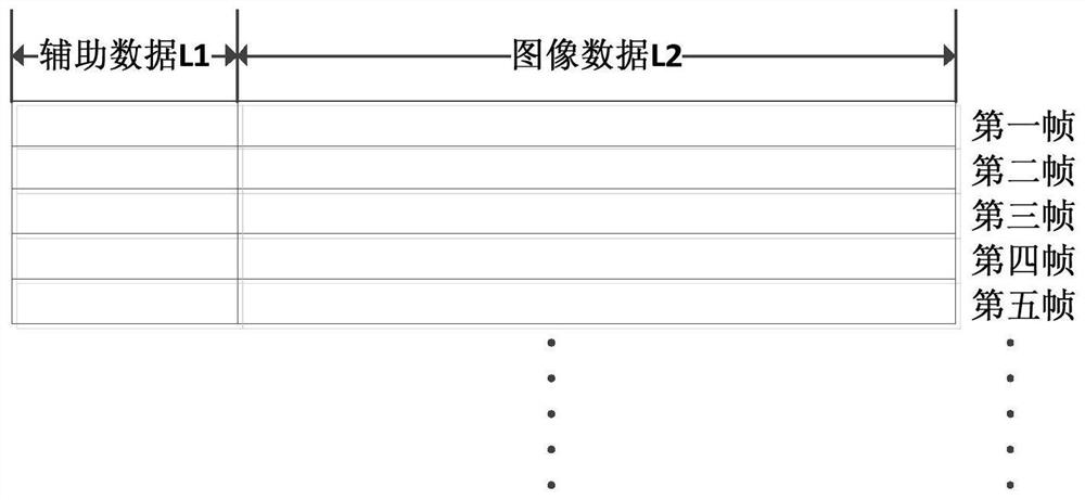
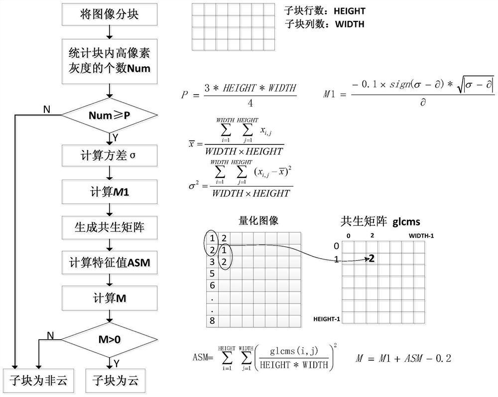
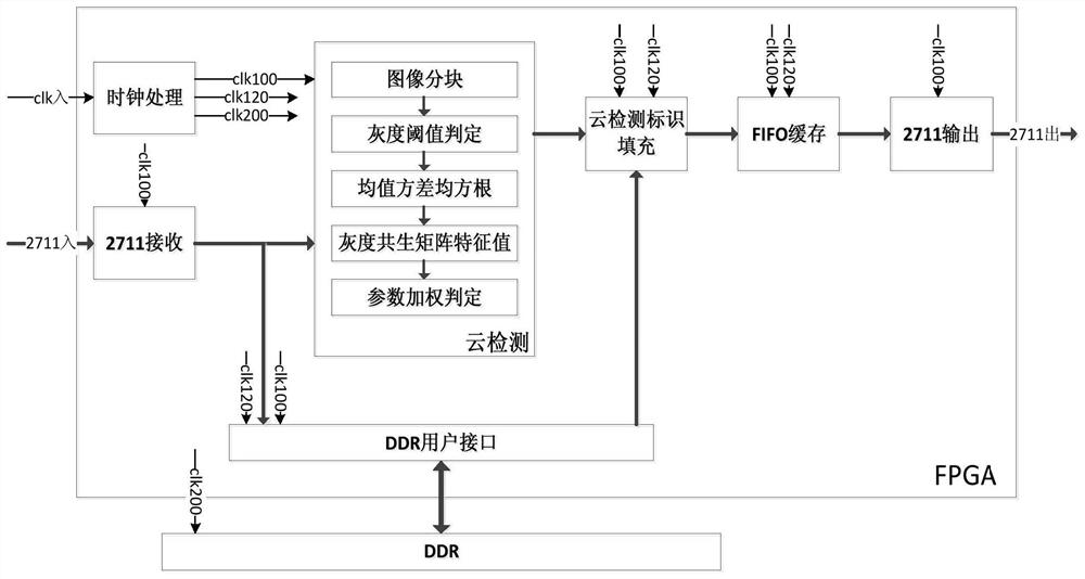
[0049] In the following, a method for filling a cloud detection mark of a satellite image provided by the embodiment of the present application will be described in further detail in conjunction with the accompanying drawings. The specific implementation may include (such as Figure 1-6 shown):

[0050] Step A: The satellite image data frame format consists of two parts, w...


PUM


Abstract

The invention discloses a cloud detection identifier filling method for a satellite image, and belongs to the technical field of electronic and communication system image data processing. An auxiliary data area of a satellite image is utilized, and a reserved position of the auxiliary data area is filled with a detection result in real time. The method has the following advantages that firstly, other data areas do not need to be occupied, and the data transmission bandwidth is saved; secondly, when satellite image data is received on the ground, real-time extraction and analysis are facilitated; and finally, as the cloud identification content is 'FFFF' or '0000', the content not only is convenient for subjectively observing the judgment correctness of the cloud detection algorithm, but also can effectively prevent the interference of channel error codes.

Description

technical field [0001] The invention relates to a cloud detection mark filling method of a satellite image, and belongs to the technical field of image data processing of electronic and communication systems. Background technique [0002] For optical remote sensing satellites, clouds are a serious obstacle to light propagation, which greatly affects the quality of remote sensing information acquisition. Many satellite remote sensing images have "blind areas" covered by clouds, and local object information is lost, which is not conducive to image analysis and understanding, and reduces the utilization rate of data. According to the global cloud cover statistics from July 1983 to June 2008 provided by the International Satellite Cloud Climate Program ISCCP, the global average cloud cover is 66.38%. Real-time and effective cloud detection can reduce the amount of image data in cloud areas. On the one hand, it can relieve the pressure of massive remote sensing satellite data on...

Claims


Application Information

Patent Timeline
Patent Type & Authority Applications(China)
IPC IPC(8): G06T7/00G06T7/136G06T7/45G06T11/40
CPCG06T7/0002G06T7/136G06T7/45G06T11/40G06T2207/10032G06T2207/30192
Inventor 王菊花张建华侯舒维李晓博肖化超张佳鹏
Owner XIAN INSTITUE OF SPACE RADIO TECH
Learn More