

High-resolution heterogenous remote sensing collapsed building detection method
A detection method and building technology, applied in the field of post-earthquake collapsed building detection, can solve the problems of restricted application, labor-consuming manual labeling, unclear model portability, etc.
- Summary
- Abstract
- Description
- Claims
- Application Information
AI Technical Summary
Problems solved by technology
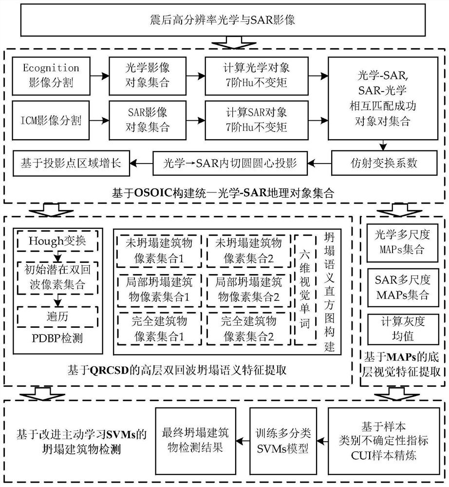
Method used
Image

Examples
Embodiment
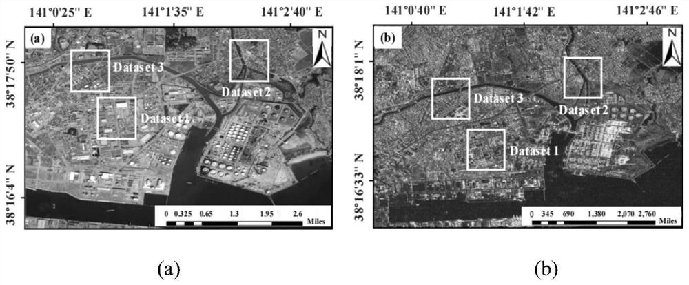
[0083] The study area is located in Sendai, Japan, such as image 3 shown. The earthquake occurred on March 11, 2011, with a magnitude of Mw of 9.0. The epicenter was located in the Pacific Ocean east of Miyagi Prefecture, Japan, with a focal depth of 20 kilometers. Sendai was one of the worst-hit cities by the earthquake. The earthquake and tsunami caused a large number of building damages, including a total of 9,877 collapsed buildings.
[0084] The post-earthquake high-resolution optical image used in the present invention is the IKONOS satellite image in Sendai, Japan, the collection time is March 24, 2011, and the spatial resolution is 1 m. image 3 Shown in (a) in the middle; the post-earthquake high-resolution SAR image is the TerraSAR-X satellite image of Sendai, Japan, collected on March 23, 2011, and the spatial resolution is 3m, as shown in image 3 shown in (b). In the experiment, for the resolution difference between optical and SAR images, the present inventi...
PUM
 Abstract
Description
Claims
Application Information