Apparatus, system, method, and program for wireless GPS surveying

a technology of wireless gps and surveying rovers, applied in wave based measurement systems, navigation instruments, instruments, etc., can solve the problems of limited distance from the surveying base station at which the surveying base station can communicate with the surveying rovers, inaccurate gps data received by the surveying rover,

Inactive Publication Date: 2005-01-13
SCHNEIDER GMBH & CO KG
View PDF2 Cites 25 Cited by
  • Summary
  • Abstract
  • Description
  • Claims
  • Application Information

AI Technical Summary

Benefits of technology

[0008] In a more specific illustrative embodiment, there is provided a method of operating a surveying rover. The method comprises the steps of receiving GPS c

Problems solved by technology

Due to the aforementioned atmospheric conditions and other anomalies, the GPS data received by the surveying rover may be somewhat inaccurate.
However, the survey locations and selected positions in and around the survey locations are limited by the positioning of the surveying base station.
In particular, the distance from the surveying base station at which the surveying base station can commun

Method used


Image

  • Apparatus, system, method, and program for wireless GPS surveying
  • Apparatus, system, method, and program for wireless GPS surveying
  • Apparatus, system, method, and program for wireless GPS surveying

Examples


Embodiment Construction

[0019] While the concepts of the present disclosure are susceptible to various modifications and alternative forms, specific exemplary embodiments thereof have been shown by way of example in the drawings and will herein be described in detail. It should be understood, however, that there is no intent to limit the concepts of the present disclosure to the particular forms disclosed, but on the contrary, the intention is to cover all modifications, equivalents, and alternatives falling within the spirit and scope of the disclosure.

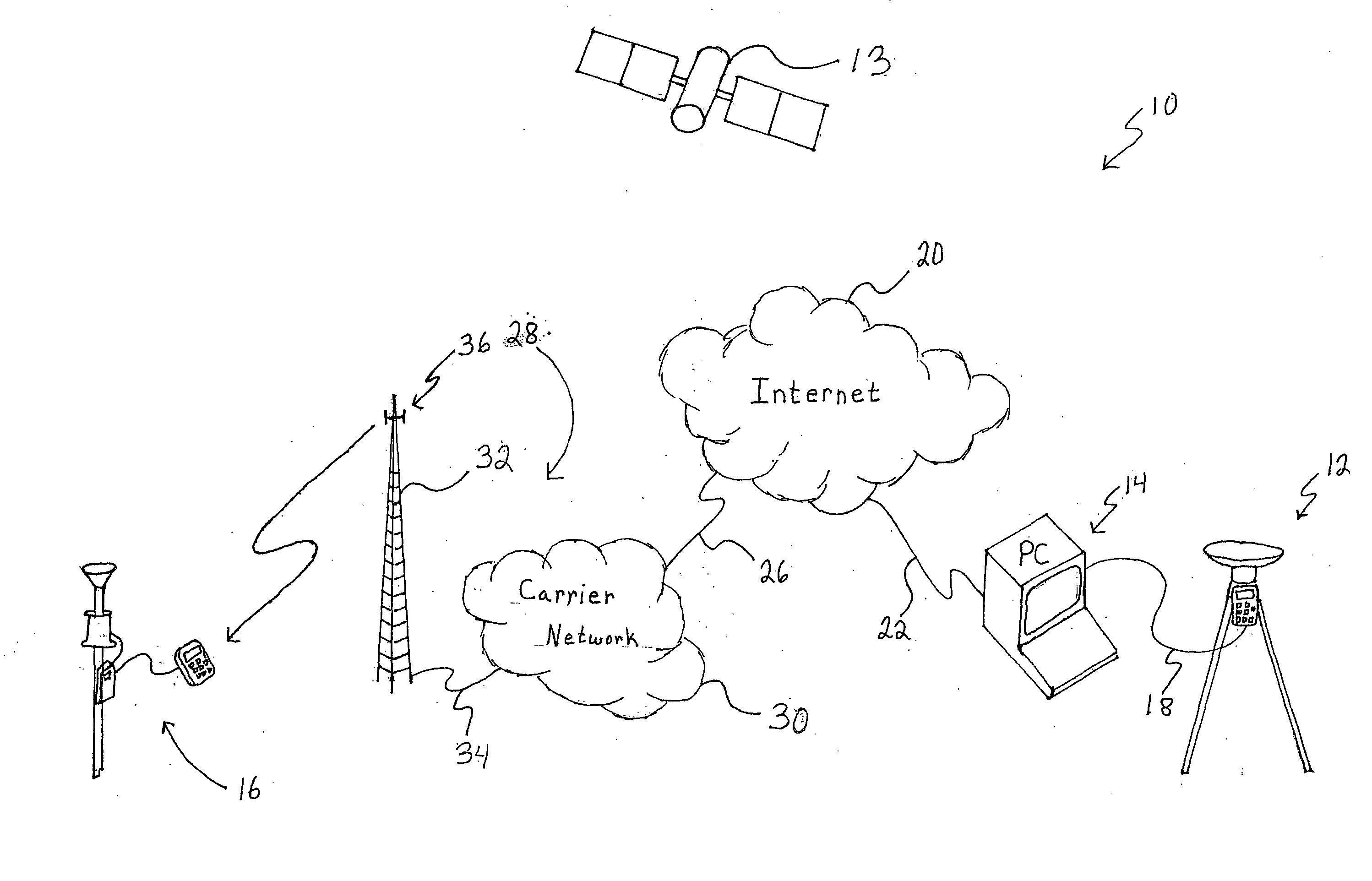
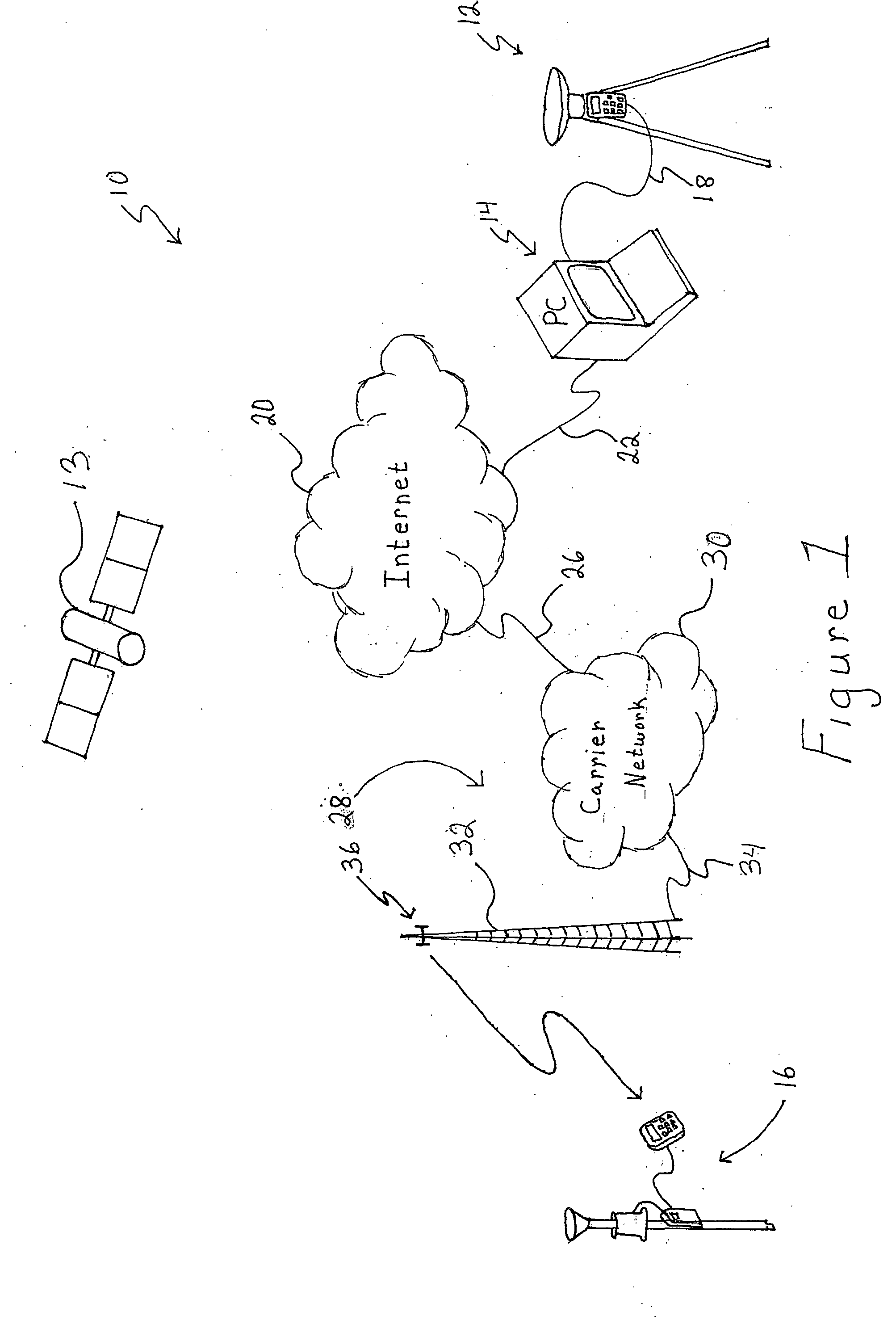
[0020] In one illustrative embodiment, a wireless GPS survey system 10 includes a surveying base station 12, a computer 14, and a surveying rover 16, as shown in FIG. 1. The base station 12 is electrically coupled to the computer 14 via a number of electrical interconnects 18. Illustratively, the interconnects 18 are serial cables which facilitate the transmission of data using a serial transmission. However, in other embodiments, the interconnects 18 may ...


PUM


Abstract

An apparatus, system, method, and program for wireless GPS surveying is disclosed. The system includes a surveying rover which receives GPS correction data from a wireless network. The wireless network includes such wireless networks as a digital wireless network and a circuit switched analog network.

Description

FIELD OF THE DISCLOSURE [0001] The present disclosure relates generally to a GPS surveying system, and more particularly to a GPS surveying system using a wireless network. BACKGROUND OF THE DISCLOSURE [0002] Global Positioning System (hereinafter sometimes GPS) survey systems are used to survey selected locations, for example, plots of land, by gathering topographical measurements and data about the selected location. GPS survey systems utilize GPS data to increase the accuracy of the location surveys. Typical GPS survey systems include a number of elements which communicate with each other during the survey process. For increased mobility and utility, typical GPS survey systems use wireless communications to facilitate the communications between the individual elements. [0003] A typical wireless GPS surveying system includes a stationary element, commonly known as a surveying base station, and a number of mobile remote elements, commonly known as surveying rovers. The surveying ba...

Claims


Application Information

Patent Timeline
IPC IPC(8): G01S19/44G01C15/00G01C21/26G01S5/14G01S19/46G06F1/16
CPCG01S19/07G01C15/00
Inventor RUNKEL, MICHAEL C.KANTNER, JOHN M.
Owner SCHNEIDER GMBH & CO KG
Why Eureka
Try Eureka