Method for organizing map data

a map data and data structure technology, applied in the field of map data organization and storage, can solve the problems of large data size of parcels, adversely affecting the performance of the navigation system, and excessive overhead for storing information about each parcel

Inactive Publication Date: 2005-02-03
HERE GLOBAL BV
View PDF23 Cites 64 Cited by
  • Summary
  • Abstract
  • Description
  • Claims
  • Application Information

AI Technical Summary

Benefits of technology

[0007] To address these and other objectives, the present invention comprises a method of organizing map data on a physical storage medium. The map data represents geographic features located in a geographic region. The method identifies at least one dense area in the geographic region. The map data representing the geographic features within the dense area have a data size exceeding a predetermined maximum size for a predetermined sized geographic area of the region. The metho...

Problems solved by technology

A disadvantage of uniform data size parcels is that when a map display rectangle spans several parcels that are not adjacent on the disk, several seeks are required to fetch the requested data, thereby possibly adversely affecting navigation system performance.
On the other hand, a disadvantage of uniform geographic size parcels is that the data sizes of parcels vary widely from densely...

Method used


Image

  • Method for organizing map data
  • Method for organizing map data
  • Method for organizing map data

Examples


Embodiment Construction

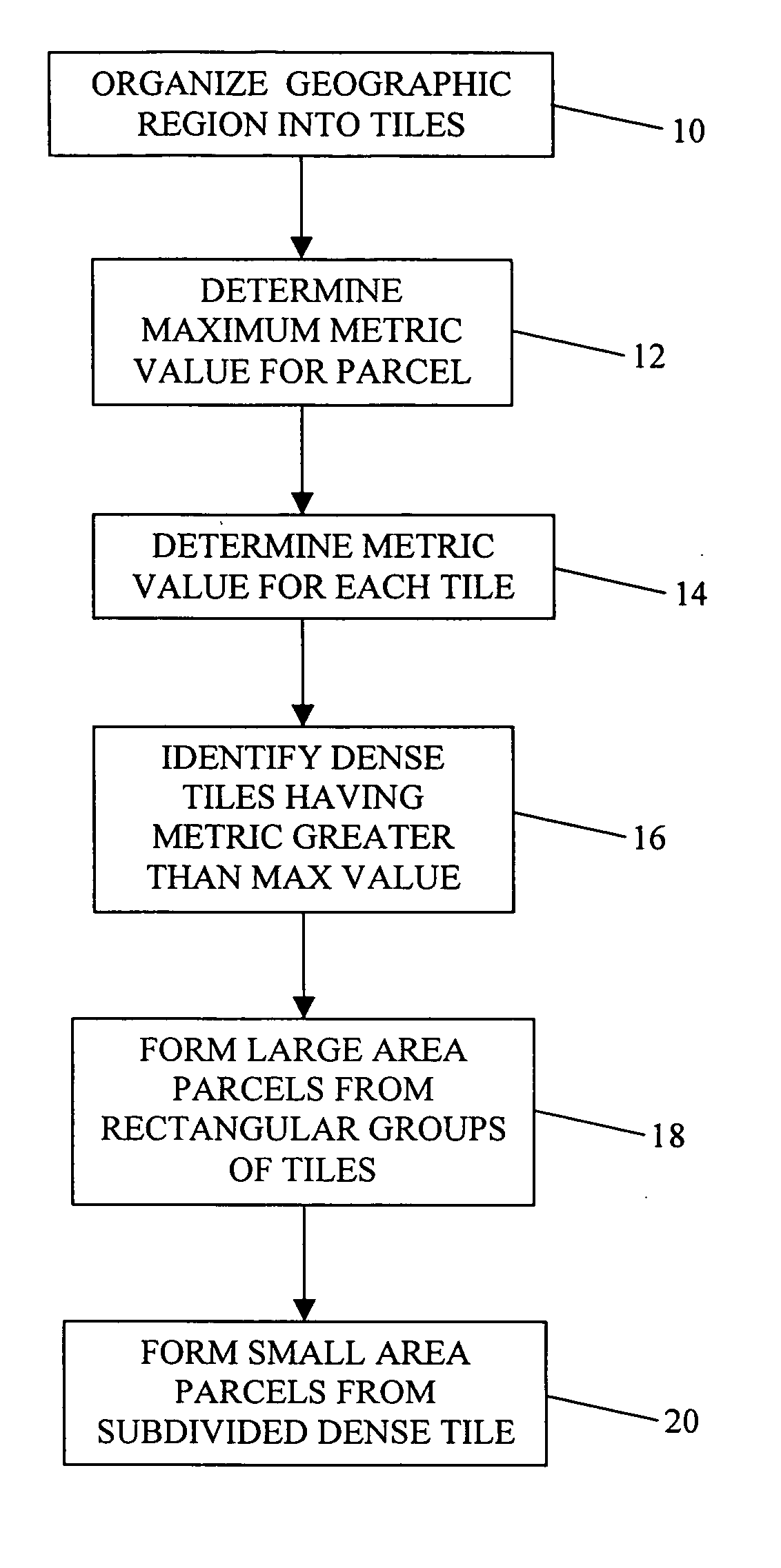
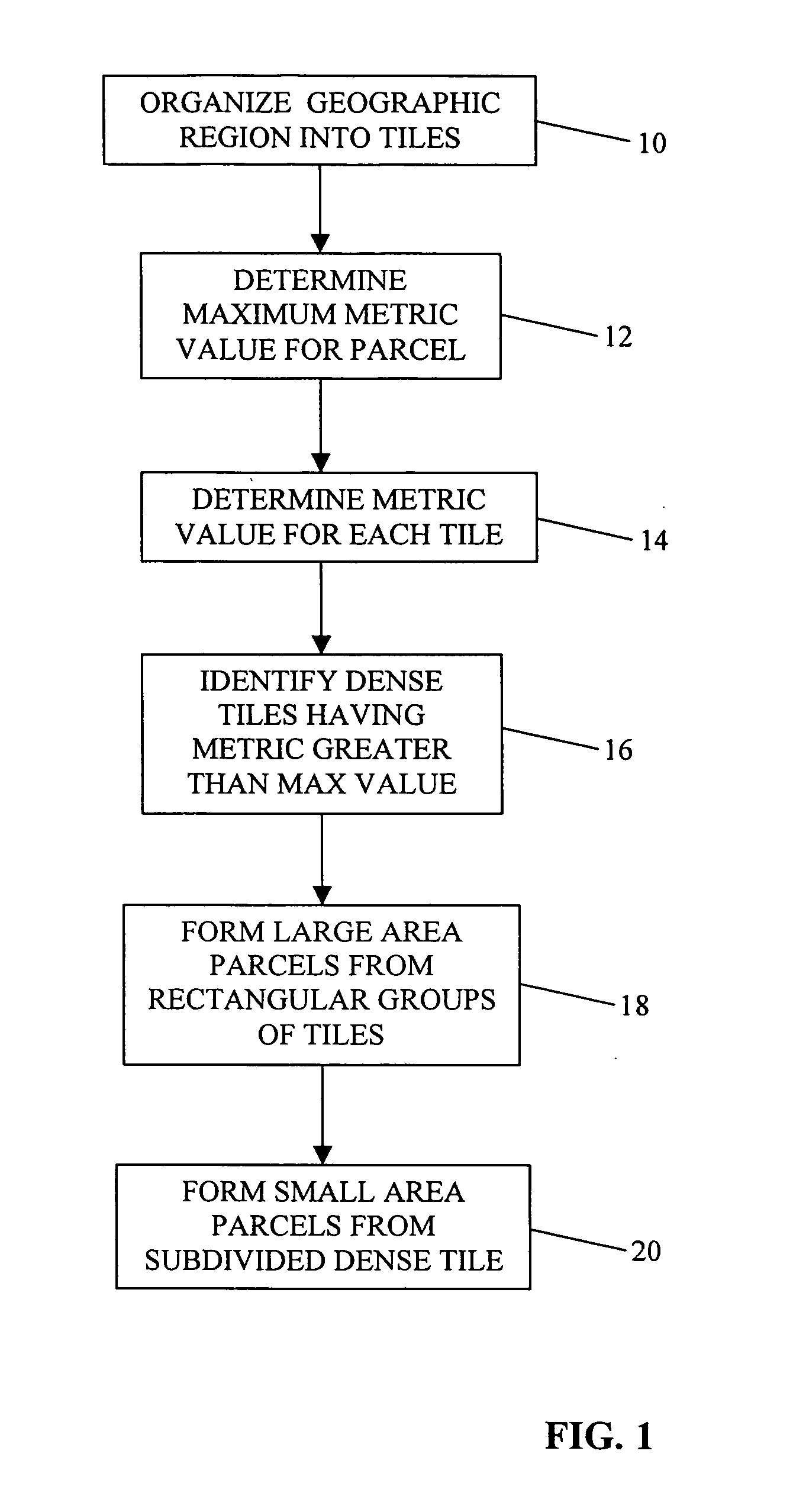
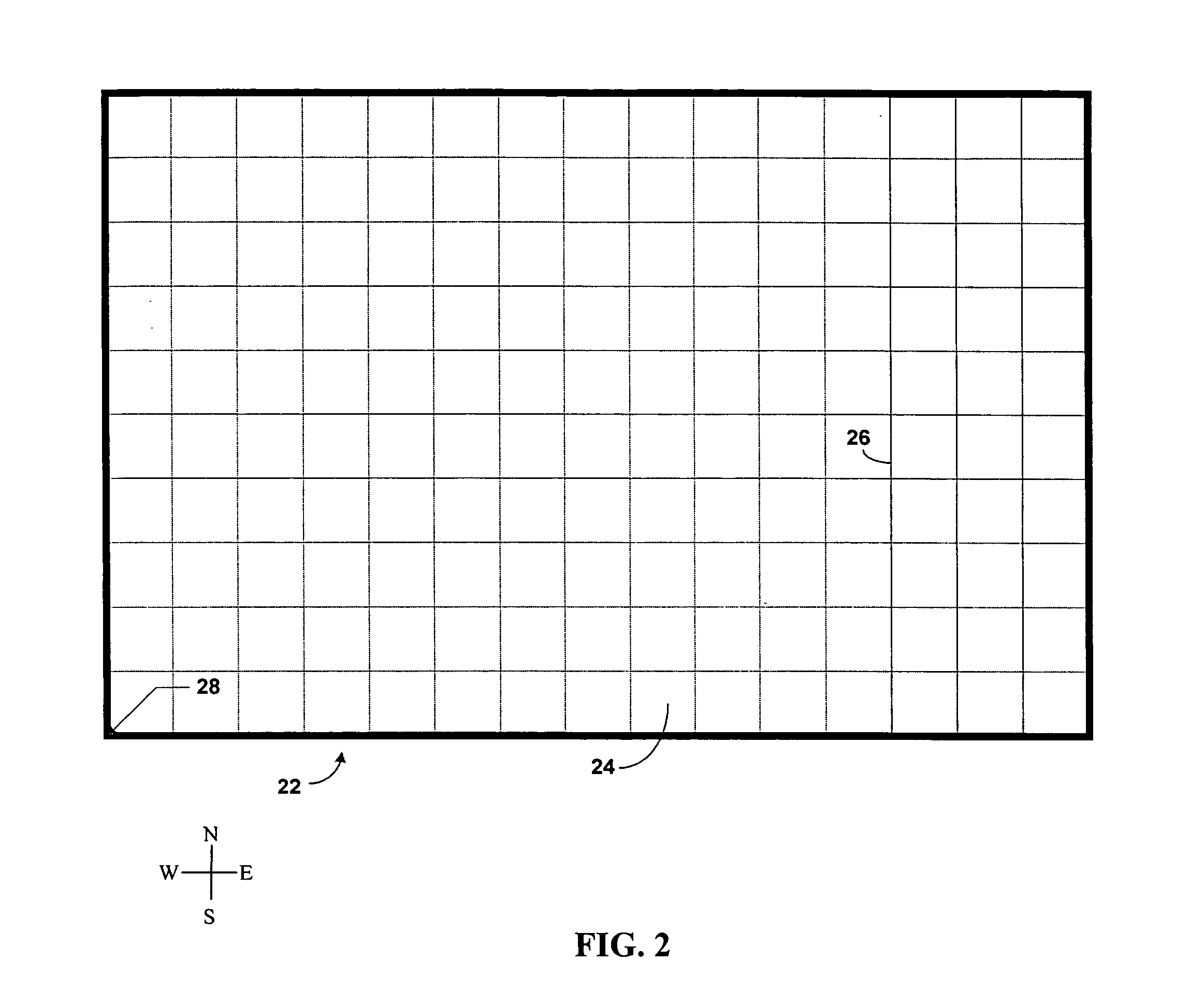
[0014] Parcelization is the process of dividing a map database of a geographic region into spatial parcels. Generally, it is desired to store data representing geographic features, such as roads, spatially based upon the physical proximity of the geographic features that they represent. Data records that are physically (or logically) close together in the map database (and possibly also close together on a storage medium upon which the map data are stored) represent geographic features that are close together physically in the geographic region. To spatially organize data representing geographic features, the data representing the geographic features are organized into parcels. Each parcel of data includes data representing features that are located physically proximate to each other in the geographic region. As described further below, each parcel includes data that represent physical features encompassed within a geographic area of a size, shape and position determined by a parcel...


PUM


Abstract

A method of organizing map data on a physical storage medium is disclosed. The map data represents geographic features located in a geographic region. The method identifies at least one dense area in the geographic region. The map data representing the geographic features within the dense area have a data size exceeding a predetermined maximum size for a predetermined sized geographic area of the region. The method subdivides the map data representing the geographic features within the dense area into parcels so that the portion of map data contained in the parcel is close to a predetermined parcel size. The method subdivides the map data less the map data representing the dense area into parcels so that the portion of map data contained in the parcel is close to the predetermined parcel size. Additionally, the method locates the map data in each parcel together on the physical storage medium.

Description

BACKGROUND OF THE INVENTION [0001] The present invention relates to a method and system for the organization and storage of map data that facilitate use of the map data by navigation application programs such as those in navigation systems. The present invention also relates to a physical storage medium having map data stored thereon having the aforementioned method of organization. [0002] Many navigation systems use map data that are stored on read-only disks (e.g., CD-ROM disks, DVD-ROM disks, etc.) or hard disks. An important factor that affects the performance of some navigation system features, such as map display, is the time required to fetch the map data from the disk. A large portion of the time required to fetch map data is attributable to the seek time of the device (i.e., the time for the read head of the navigation system to move from a current track to the track where the data are located). This factor is important for CD-ROM and DVD-ROM disks but also applies to some ...

Claims


Application Information

Patent Timeline
IPC IPC(8): G09B29/00G01C21/00G01C21/26G01C21/32G06F17/30G06T11/60
CPCY10S707/99943G01C21/32G01C21/3881
Inventor MCDONOUGH, WILLIAM G.
Owner HERE GLOBAL BV
Why Eureka
Try Eureka